

The Vermont Center for Geographic Information is home to all things geospatial in the Green Mountain State.
Montpelier, VT
Joined April 2012
- Tweets1.1K
- Following0
- Followers533
- Likes318





...In before the end of January! Here's what the State of Vermont's GIS groups were up to last year: 2022 Vermont GIS Year in Review: 2022.mapvt.com

Thoughts about Vermont's GIS, we know you have 'em. Let us know via this survey: forms.gle/sMEezBDXM8QGUbrv6
We send shapefiles in thanks😉

New sticker commemorating 30 years of clippin', zippin', & shippin'! Check out what we were up to in 1992: cctv.org/watch-tv/programs/b… Thank you @TownMeetingTV for making this incredible archive available.

Great to see state, federal, and local partners coming together in person to think about the future of GIS in Vermont. Thanks to @VTStateParks for providing the perfect venue at Button Bay State Park!


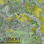
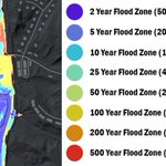
💧💧New Data Release💧💧 We're excited to announce that new lidar derived floodplain data are now available thanks to some amazing work by our partners @uvmvermont #OpenData
vcgi.vermont.gov/data-releas…


Leaf-off✅
No snow ✅
No flooding ✅
No clouds✅
It's that day of the year! Let's go!!! flightaware.com/live/flight/…

VCGI retweeted

After much anticipation, @USGS Landsat 9 products are now available! Download data via EarthExplorer, M2M, and LandsatLook.
🕫 Read the full tech release at ow.ly/vsFM50HRYkE
Landsat is a joint mission of the @USGS and @NASA_Landsat [🧵1/4]

ALT False color image of the Anchorage, Alaska area, as observed by Landsat 9 on November 20, 2021. The image was built using infrared, red, and blue bands of the electromagnetic spectrum. Landsat satellites’ ability to peer beyond visible light make the data acquired with each pass more valuable to the study of Earth's surface changes. Landsat Scene ID LC09_L1TP_069017_20211120_20220123_02_T1
Do you provide #GIS and GIS-related services for Vermonters? Fill out this survey and help those looking for GIS services in #VT: airtable.com/shrImJzJzaUAUKs…

How do you use lidar derived elevation data to create better flood maps? We asked Rebecca Diehl of @UVMGeog @GundInstitute and Kristin Underwood @UVM_CEE youtu.be/fFOxcT6_JB0

A great example of what is possible with historical imagery. Dreaming and scheming of something similar here in VT: Iowa statewide, 1930 digitized and orthorectified historical aerial imagery service. AGO Viewer: bit.ly/3nxBto8 REST Service: bit.ly/3x1xSln
VCGI retweeted

🎉🆕 #WorldCover map 🗺️ at 10 m resolution based on Sentinel-1/2 data is also available in #SentinelHub and #EOBrowser. Only one click away! ➡️ apps.sentinel-hub.com/eo-bro…
👀 Sentinel Hub Public Collections for more details ➡️ collections.sentinel-hub.com…


Yes, we will share the recording later via the #WorldCover website.😀
You can already check Ruben's new blog for info about the #WorldCover map, project requirements, data processing, free and open access of the WorldCover map via the viewer, ... ⬇️
blog.vito.be/remotesensing/r…
Beautiful day here in VT! Surdex has three ✈️ up right now collecting leaf-on imagery across the state. @USDA #NAIP flightaware.com/live/flight/…
Calling all cadastral wranglers: VCGI is hiring a full-time GIS professional to join our parcel program. App due 9/23. Please share widely! job.mapvt.com

VCGI retweeted

World’s Cartographers Continue Living Secret Life Of Luxury On Idyllic, Never Disclosed 8th Continent bit.ly/38CwZnE

Working with partner agencies on making old imagery available digitally reveals how easy it is to become fond of hand-drawn index sheets. Exhibit A and B.


VCGI retweeted

The numbers are in: Lewis is the fastest growing town in Vermont. #2020Census #vtpoli vcgi.vermont.gov/data-releas…