

Weather team providing live weather coverage with degreed meteorologists & storm chasers focused in Kentucky. Business inquiries:[email protected]
Joined April 2025
- Tweets7.7K
- Following235
- Followers1.3K
- Likes2.4K




Zero Meter Chasers retweeted

Happy Saturday everyone! Temperatures overnight got into the middle and lower 30s as many experienced some type of frost/freeze this morning!
Forecast looks absolutely PERFECT today with highs in the mid 50s and light winds during the day!
This will setup our first FREEZE warning as we get into Sunday morning. Widespread temperatures below freezing look likely as we wake up on Sunday morning!
Big game in Knoxville, Tennessee tonight that I KNOW I am watching! Enjoy the day, GO CATS!😼 #KYwx

Zero Meter Chasers retweeted
We saw widespread 1-3” of rain from our mid-week system for many in Kentucky!
Forecast looks BEAUTIFUL today for everyone! Colder weather is coming this weekend with a FREEZE potential on Sunday morning! #KYwx

Zero Meter Chasers retweeted
Radar is showing scattered showers still lingering across the I-75 corridor this afternoon! Rain will clear out by late tonight statewide!
We have seen scattered amounts of 1-3" today across the state! This will help with our ongoing drought conditions!
Satellite is showing cloud breaks in western Kentucky behind the cold front. Could lead to a decent sunset where we get clouds fading out!
Beautiful Thursday forecast with COLDER weather expected this weekend! #KYwx


Zero Meter Chasers retweeted

🪦 to our red headed step child Mesoscale Model, the #NAM
Our boy @SCweather_wx said it’s best:

Zero Meter Chasers retweeted
Heavy rain starts in western Kentucky late tonight and moves through the state tomorrow!
We could have a strong storm or 2 but widespread severe is not expected!
1-3” of rainfall expected through tomorrow night! #KYwx

Zero Meter Chasers retweeted
Widespread rain will return to Kentucky late on Tuesday night and last through Wednesday!
Latest model data has storms approaching western Kentucky late Tuesday night and advancing throughout the state on Wednesday!
Data has 1-3" of rainfall from this wave in general with localized higher amounts. Severe weather is NOT expected with this round!
Much needed rainfall for many! #KYwx
Zero Meter Chasers retweeted
For the older generation, do YOU remember this one? An early season snowstorm ❄️*thumped much of KY with over a Half-Foot for many. Even an Isolated one Foot portions measured around E’Town/Hardin Co area. Image via @spann

Zero Meter Chasers retweeted
The Storm Prediction Center has upgraded today's severe risk to an enhanced risk (level 3/5) in portions of Oklahoma and Kansas. This includes a 10% cig-1 tornado risk!
Latest model data is showing more discrete cells along the dry line! StormNet also has very high tornado probabilities from 6-9 PM.
Active day ahead! #OKwx #KSwx


Zero Meter Chasers retweeted
“Early Look” 👀 next Week:
It appears that our shot of some strong, (maybe Severe) ⛈️ chcs look to come on TUESDAY PM. A classic “High Shear/Low CAPE” event is poss. Mid-Low level winds will be cranking with little ⛈️ 🧃 to work with. Gusty 💨 look like Main Hazard ⚠️ for now.


Zero Meter Chasers retweeted
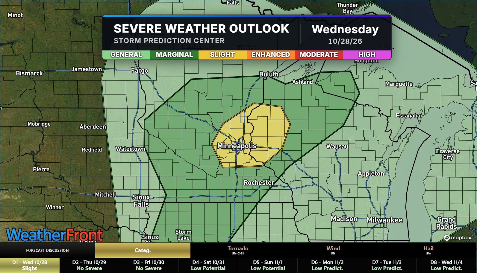
Data is starting to come in agreement with a strong storm early next week and severe weather is looking more likely in the central US on next Monday, November 2nd.
SPC issued a Day 4 15% risk for this threat targeting Oklahoma and Kansas. Latest from SPC:
"The main severe threat should develop during the afternoon along the cold front. Effective deep-layer shear will be near 50 kt, with sufficient low-level turning with height to support both supercells and linear structures late."
Watching this VERY closely next couple of days! #OKwx #KSwx


Zero Meter Chasers retweeted
Good news:✅
The weekend is trending drier! Halloween now looks overcast and DRY for most in Kentucky.
Sunday does have a small rain chance but data has trended significantly less in the last 48 hours.
Our next rain chance will be middle of next week with the cutoff low moving across the US. I still think model data is struggling with this setup… It will be a pattern changer!
Forecast video on all of this tomorrow morning! 🫡#KYwx



Zero Meter Chasers retweeted

Gnarly SunDog, with the aid of unique clouds this evening! - Eastern Hart Co. KY
@I65WxSils @0meterChasers @2kHoukWx @Main_Event_Wx @Kentuckyweather @ChrisAllenSkywx @wxornotBG @WKUweather


Zero Meter Chasers retweeted
Widespread rainfall looks likely next week!
The latest EURO ensembles are showing possibility for multiple inches of rainfall through next Friday!
Our first rain chance will likely come late Saturday into early on Sunday.
More rain chances are likely next week as well! More updates to come as we get closer! #KYwx

Zero Meter Chasers retweeted
Rinse, cycle and REPEAT! Chilly morning temperatures as you wake up this morning!
We will warm into the lower 70s in the afternoon today. Another PERFECT weather day!
Keeping a close eye on our drought status as we have not seen measurable rain in over SEVEN days! Some drought conditions are showing up in Central Kentucky.
Enjoy this weather while it lasts! Looks like an active pattern is taking shape as we begin November! Ready to fire up the blogs/streams soon! #KYwx


Zero Meter Chasers retweeted
Low level Jet come late Next Monday Evening via EURO AI Ensemble right over I-65 Corridor. Little 🌬️
Watching trends with this signal.


Zero Meter Chasers retweeted

A special weather statement has been issued for Jeffersontown KY, Lyndon KY and Middletown KY until 2:30 PM EDT

ALT This graphic displays a special weather statement plotted on a map. The statement is in effect until 2:30 PM EDT. The statement includes Jeffersontown KY, Lyndon KY and Middletown KY. A STRONG THUNDERSTORM WILL IMPACT SOUTHEASTERN JEFFERSON COUNTY UNTIL 230 PM EDT. The threats associated with this storm are wind gusts up to 30 MPH and no hail is expected. Seek shelter in a sturdy structure until the storm passes.
Zero Meter Chasers retweeted
Radar is showing our MCV on radar in southern Illinois with CAPE building into the area!
This will track toward Kentucky and as CAPE builds this afternoon, we will get widespread storms later today
Timing for storms along the I-65 corridor looks to be 2PM - 6PM #KYwx!

Zero Meter Chasers retweeted
Once we get through storms today and tomorrow, things REALLY change this weekend. Latest model data is showing temps in the high 30s/low 40s👀
Colder weather will only last a few days as we continue the rollercoaster weather ride in October! That looks to continue through the end of the month! #KYwx
