

Meteorologist, @NEWSCENTERMaine | Former Chief Meteorologist, @kiii3news | Certified by the National Weather Association | Avid Golfer | @UTSA & @msstate Alum
Portland, ME
Joined March 2009
- Tweets17.5K
- Following167
- Followers4.4K
- Likes759




Thursday will have a cooler feel to it with highs in the middle to lower 40s and 30s (north). East to northeast breeze will freshen up a bit at 10-15 mph in the afternoon. A few showers also in play in SW Maine. More sun north and east.

1
138
First (wet) flakes of the season for coastal Maine will be possible pre-dawn, Friday (NOV 13). Minor accumulation on grassy areas/higher terrain will be possible. This is a little before the climatological average


82
Wet snow will be in play for Maine Friday morning as a coastal storm moves through the Gulf of Maine. Not expecting travel issues at this time, but some minor accumulation on grassy areas & higher terrain is plausible.


99
The energy associated with what will eventually be a storm exiting the mid-Atlantic coast on Thursday is about 3,000 miles from Maine. If Maine is to see impacts from it, it would be Friday (Nov. 13).

98
A stray shower is possible Tuesday afternoon, but the best shot at a passing shower will be Tuesday evening as a clipper works through Maine; snow in the highlands/Aroostook County, but not much accum. It's gone by daybreak, Wednesday.

2
1
131
A storm exiting the mid-Atlantic coast later this week (NOV 12) could have implications for Maine Friday and Saturday. As there typically are at this range, there are two general ideas for the eventual outcome.

1
97
The other possibility is that the low bends north as it gets into the Atlantic as it feels the influence of a region of upper level low pressure in Quebec. This would tug it north. This scenario brings snow and rain into the mix for Maine Friday and Saturday (NOV 13/14).
1
30
Cooler and damp this weekend in Maine (NOV 7/8); more in line with November standards for the state. It won't be a continuous rain either day. Both days will feature a general drying trend from SW to NE.

1
1
145
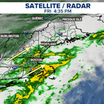
NOV 6, 4:35p | Rainy night ahead! Showers and maybe even a few rumbles of thunder will run up the coast and through Maine tonight. Some of this will contain pockets of heavy rain. Focus will be near the coast.
Unsettled & cooler weather will continue this weekend.

104
Maine's weather will turn more unsettled and cooler into the weekend.
FRI: A stationary boundary rests near the coast and rounds of rain will be running along it. That puts coastal Maine in line for passing showers, while locations away from the coast remain dry and mild.

1
106
SAT: A coastal low works in, bringing more of Maine into the rain equation. It won't rain all day, but there will be passing showers floating around. It'll also be cooler (low 50s).
SUN: Lingering showers in the AM, exiting in the aftn. Again, high temps stay in the low 50s.


1
36

Drought persists across Maine. Going back to September of 2025, precipitation deficits are running over a foot in many locations. Some spots are lacking around 2 ft. since last September.

116
A weather system currently over the Great Lakes will send a group of showers through Maine from west to east Thursday afternoon between 12p and 6p. A few tenths of an inch on the table. High temperatures still manage the 60s and low 70s.


107

Won't have to many (if any) more of these kind of days before the Maine golf season succumbs to the Winter cold. Enjoy if you can get out!

2
2
184
Middle to lower 70s move in to much of Maine Wednesday, November 4. That's about 20 degrees above average for the time of year and near record territory in Portland and Bangor.


108

