

NWS EWX #VOST partner & NOAA Weather-Ready Nation Ambassador™. Along with @NWSSanAntonio, we inform, educate & provide general/urgent weather info. #SATWX
- Tweets20.9K
- Following53
- Followers6.8K
- Likes6.6K




ALT A National Weather Service Austin/San Antonio map of forecast low temperatures for South-Central Texas Tuesday evening, October 27, into Wednesday morning, October 28. Low temperatures are forecast to be in the low to mid 60s across the region. Skies will become cloudier overnight. Conditions tonight are damp, but stay rain-free. Winds will be light and below 8 mph for most areas. Title: Tonight: Becoming Cloudier Overnight.

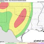
ALT A National Weather Service graphic showing risk areas for heavy rain capable of causing flash flooding Thursday, October 29, through Friday morning, October 30, for South-Central Texas. A Level 2 of 4 risk of excessive rainfall leading to flash flooding is shown for areas along the Rio Grande and Southern Edwards Plateau, with a lower risk for areas farther east. Heavy rain may cause isolated instances of flash flooding. Stay weather aware and up-to-date with the forecast.


ALT The graphic shows today's forecast with mostly cloudy skies are forecast for earlier in the day with skies improving from west to east for partly cloudy. There is a 20 to 60 percent chance of showers and storms across portions of the Coastal Plains and areas between I-35 and I-37 south of the San Antonio metro area. Highs in the upper 70s to mid 80s.

ALT A National Weather Service Austin/San Antonio map of forecast low temperatures for South-Central Texas Monday evening, October 26, into Tuesday morning, October 27. Low temperatures will be in the low to mid 60s for most of the region, with a few spots in the southern Edwards Plateau dipping just below 60F. Mostly cloudy skies are forecast. There is a 10 to 30 percent chance for light showers over the southern Edwards Plateau and Coastal Plains. Conditions will be dry and mostly cloudy for the rest of South-Central Texas. Winds will be light and below 8 mph for most areas. Title: Tonight: Mostly Cloudy with a Few Light Showers.

ALT Infographic showing rain chances through Saturday, October 31, which chances as high as 90 percent. The highest chances are for Thursday into Friday, especially for areas near the Rio Grande and Southern Edwards Plateau (including Del Rio, Rocksprings, Brackettville, and nearby areas). Heavy rain and some flooding are possible for the rainiest locations. Check the forecast for updates through the week. Title: Rain Chances Rising This Week.

ALT A forecast graphic from the National Weather Service Austin/San Antonio updated Friday, October 23, 2026, at 2:04 PM, titled "Tonight: Cool; Mostly Cloudy Skies in the West". Bulleted key points on the left note clear to partly cloudy skies in the east, mostly cloudy skies in the west, lows in the mid-50s to mid-60s, and light to moderate southeasterly winds. On the right, a map displays regional forecast low temperatures, including 56°F in Llano, 58°F in Fredericksburg and Georgetown, 59°F in Austin, 64°F in San Antonio, and 67°F in Eagle Pass.

ALT National Weather Service seven-day forecast table for South Central Texas covering October 23 through October 29, 2026. High temperatures remain warm in the 80s through the weekend before turning milder, in the 70s, by Tuesday and Wednesday of next week. Overnight lows consistently stay in the 50s and 60s. Rain chances are near zero through the weekend, then increase to between 10% and 50% across the region early next week, peaking on Tuesday the 27th.

ALT A weather forecast infographic from the National Weather Service Austin/San Antonio for the night of Wednesday October 22nd to early morning of Thursday October 23rd. On the left of the graphic is a list of temperature ranges: Coastal Plains: 57 to 59. I-35 Corridor: 57 to 60 Hill Country: 53 to 56. Southern Edwards Plateau: 55 to 58. Rio Grande Plains: 63 to 66.

ALT National Weather Service forecast graphic for the Austin and San Antonio area for Thursday, October 22, 2026. The forecast calls for mostly sunny and warm conditions with light east to southeast winds. High temperatures across South Central Texas are projected to be in the 80s, generally ranging from 80°F to 88°F.

ALT A National Weather Service 7-day forecast graphic for south-central Texas, updated on October 21, 2026, showing warm temperatures followed by a milder weekend and low rain chances next week.

ALT National Weather Service South-Central Texas forecast for tonight, Monday, October 19 into Tuesday, October 20, titled "Tonight: Mostly clear and not as cool." Temperature ranges listed on the left side of the graphic are as follows: Coastal Plains: 57 to 59. I-35 Corridor: 56 to 60. Hill Country: 50 to 54. Southern Edwards Plateau: 53 to 57. Rio Grande Plains: 58 to 63.

ALT Forecast graphic for tonight Oct 16/17. A text box on the left describes the forecast for partly cloudy skies this evening. Winds will be from the north at 15-25 mph with gusts up to 40 mph during the evening. Wind speeds will drop to 10-20 mph with gusts up 30 mph overnight. Temperatures will be cooler with lows in the mid 40s to low 50s. A map on the right shows forecast low temperatures with an icon depicting partly cloudy skies with breezy winds.

ALT A Flood Watch graphic. Text box on the left outlines the details of the watch. In effect 1 pm Thursday through 7 AM Friday. Rainfall of 1-3 inches with up to six inches. The right side shows a map of the watch for Val Verde County.

ALT A Wind Advisory graphic. The left side has a text box outlining the advisory. In effect from Friday from 4 AM til 7 PM. All of South-Central Texas. North winds 25-30 mph with gusts up 50 mph. Secure loose objects. Driving may be difficult. The right side is a map showing the advisory for the entire area.

ALT National Weather Service graphic for Austin/San Antonio updated Tuesday, October 13, 2026, at 3:20 PM. Header: Tonight: Another Very Mild & Humid Night Under Mostly Cloudy Skies. Main Content: Forecast Lows: 70°F to 78°F. Bullet Points: Very mild and humid overnight. Mostly cloudy skies with light to moderate southeast winds. Windiest over the southern Edwards Plateau and western Hill Country. Visual Background & Footer: The image on the left shows a wide landscape under dark, wavy, mostly cloudy skies with a white vehicle on a road below.

ALT National Weather Service Austin/San Antonio forecast graphic for tonight: "Very Warm & Humid With Shower/Storm Chances Ending" (Updated Mon Oct 12, 2026 at 3:30 PM). The image shows cloudy skies next to forecast low temperatures between 70°F to 78°F. Key bullet points include: Very mild and humid overnight, Mostly to partly cloudy skies with light to moderate southeast winds, Most shower/storm activity should end shortly after sunset.

ALT The graphic shows the weather forecast for the next 7 days including highs, lows, and rain chances. Expecting a dry and warm weekend, however, rain chances return on Monday mainly east of Interstate 35, but keeping late in the week.

ALT A National Weather Service graphic for Austin/San Antonio titled "Tonight: Clear and Warmer This Evening," updated Friday, Oct 09, 2026 at 1:49 PM. The background features a nighttime skyline of Austin's illuminated city buildings reflecting across a body of water. On the left side, a dark box displays "Tonight's Lows" by region: Coastal Plains: 62–67°F, I-35 corridor: 61–67°F, Hill Country: 58–63°F, Southern Edwards Plateau: 59–65°F, Rio Grande Plains: 63–70°F.

ALT A National Weather Service Austin/San Antonio graphic highlighting forecast low temperatures for South-Central Texas October 9. Tonight will be mostly clear across South-Central Texas. Low temperatures will be above normal ranging from the mid 60s to the low 70s. Winds will be less than 10 mph mainly from the north through northeast.

ALT A National Weather Service Austin/San Antonio graphic highlighting forecast low temperatures for South-Central Texas October 8. Low temperatures range from the upper 50s to the upper 60s. Winds will be from the northeast through east at less than 10 mph. Skies will be mostly clear.
