Get accurate, fun weather updates with Brzzy! Download the app now! 🌦️ #BrzzyWeather

Joined May 2023
New Brzzy update coming soon, check out our new website👉Brzzy.co
2
4
3,161
Josephine Picks Up Speed. 65 mph, racing northeast at 13. Peaks near 81 Friday. Watch the surf from high ground today.
17
Orionids, peak night. Moon set 3:12. Dark until dawn. Up to 18 an hour. Step out at 4:25, face southeast. Seen one yet?
1
1
52
Moenkopi Wash, Arizona. Life-threatening flash flooding overnight. The wash near Tuba City is at 33.5 feet, flood stage 27. Do not cross flooded roads.
36
Heber, Arizona. Reported tornado damage Wednesday night. Homes damaged, power out, at least one injured. NWS has not confirmed a tornado. Avoid damaged areas.
2
3
286
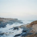
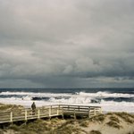
Coastal flooding continues at high tide through the week. Life-threatening surf and rip currents along the East Coast. Stay off the beach at high tide.
8
Josephine Holds At 65. 988 mb, moving north-northeast at 6 mph off the Mid-Atlantic coast. Watch the surf from high ground.
1
17
The 11 pm advisory trims the peak to 75 mph Thursday evening. Then Josephine turns extratropical and powerful, moving northeast away from the coast.
1
12
Josephine is official. 65 mph, 265 miles south of Nantucket. Flooding at high tide. Watch the surf from high ground.
34
Arizona's first tornado watch in 16 years. Northern Arizona until 6pm MST.
1
1
98
Coconino, Yavapai, Mohave and Navajo counties. Hail up to 2.5 inches. Winds 60 to 70 mph.
1
30
Strongest storms build this afternoon along the Mogollon Rim. If a warning fires, get inside and away from windows.
9
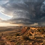
A rare Level 3 storm risk over Arizona today. Supercells, big hail, a tornado or two by afternoon. Have a way to get warnings. Who is watching the sky?
1
84
Batanes just went to Signal No. 2. Rosal's first step up the warning ladder.
1
30
Still 215 km/h, gusts to 265. Now 845 km east of Northern Luzon, closing at 25 km/h.
1
15
Seas hold at 8 meters. Closest pass Thursday into Friday. No landfall expected. Stay in port.
11
Rosal escalated. 8-meter seas off Batanes tonight. Two stories of water.
1
43
The storm holds at 215 km/h. Closest pass is Thursday into Friday, and it will not make landfall. The sea is the threat.
1
14
Weather Advisory No. 3 adds heavy rain on the northern coast. Small boats are done for the week.
15