

Radar & hail/severe storm meteorologist formerly at @SAWeatherServic | Views my own | RT's & likes not endorsements https://xitter.gq/t.co/Gqhq0XtnTE
Joined October 2012
- Tweets9.8K
- Following536
- Followers1.2K
- Likes4.6K




Pinned Tweet
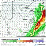
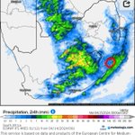
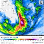
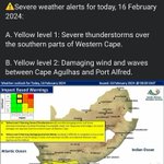
Today's severe #weather (#heavyrain, #flooding & #hail) in the #Cape provinces marks the first memorable severe weather day of the 2019/20 Spring/Summer season in #SouthAfrica.
Those who follow severe weather events in SA may find these #radar coverage maps of interest.


Craig Powell retweeted

Timelapse of the Kankakee-Knox Supercell that produced numerous intense to violent tornadoes
Craig Powell retweeted

Check out this incredible bright green clear slot or moat of sinking air wrapping around the wall cloud as this supercell was primed to drop a #tornado.
This is what you want to look for when trying to pinpoint tornadogenesis.
Craig Powell retweeted

NOT A TORNADO, but This is WILD!!!!
☁️ 🚫🌪️ It was a scud cloud (Scattered Cumulus Under Deck) or a pocket of condensation under the main cloud overcast.
No circulation as we can see when zoomed in, but the best imposter I've seen by a cloud pretending... WOW!!!!
📍 Lewistown in Frederick County MD
⏰ Monday Afternoon May 5 2025
🎥 Thank you Danielle Catanzaro Kinnamont for sharing.
Craig Powell retweeted

@CPowellWX Why do they call it "forecasting" while they wait for the shit to go down before "updating " the forecast. Initial warnings were for Kzn and Eastern Mpumalanga. The storm over Pta has been going for nearly 45 now....10 min ago???


Craig Powell retweeted

This is by far the most insane example of a hook echo I have ever seen in #SouthAfrica and I spent years looking at #radar data related to #supercell.s & other severe #weather while at #SAWS, and it has a debris ball to boot!!😳
#tongaat #tornado
Image: SAWS media release.

Craig Powell retweeted
Yes & no.
The equipment is there in the form of Gematronik S-band Doppler radars & has been for a while (quoted tweet) - similar to that used in the US for tornado detection, prior to their most recent upgrades & they came with software that can do it.
xitter.gq/CPowellWX/status/17987…

Craig Powell retweeted
It takes a lot of effort and equipment to predict the forming and path of a tornado. Given the rarity in SA, there is just not enough experience at SAWS, and no incentive for private chasers to take up the job like they do in the USA.
Craig Powell retweeted

Media release: 12 June 2024.
oThongathi tornado ratied EF3 on the Enhanced Fujita scale
#saws
#southafricanweather
#weatheroutlook – at Centurion, South Africa


Craig Powell retweeted
Media release: 12 June 2024. (1 to 4)
oThongathi tornado ratied EF3 on the Enhanced Fujita scale
#saws
#southafricanweather
#weatheroutlook – at Centurion, South Africa


Thread discussing the recent severe #weather (#tornado.es [#Tongaat/#Utrecht] and #flooding [#Margate]) in #KZN and the weather #warning system.
Absolute garbage!! SAWS acquired and erected 10 S-band Doppler radars (R240mil) during 2009/2010 (of very similar quality to those used in the US) capable of detecting movements/motion within thunderstorms. I would know, I worked with the data from them everyday for years.


The radar was also on when Margate got slammed but extremely heavy rain and night time flooding without a warning. So something is clearly amiss with the current warning system, more so for thunderstorm-related severe weather than that from cold fronts.