Daniel Stoelb (@DanielStoelb) header
Daniel Stoelb (@DanielStoelb) profile picture

#GIS program coordinator for @OregonOEM. GIS professional since 2006. As you know, a picture is worth a thousand words - imagine how many words are on a map!

Joined February 2015
Photo by Daniel Stoelb (@DanielStoelb)Photo by Daniel Stoelb (@DanielStoelb)Photo by Daniel Stoelb (@DanielStoelb)Photo by Daniel Stoelb (@DanielStoelb)Photo by Daniel Stoelb (@DanielStoelb)Photo by Daniel Stoelb (@DanielStoelb)Photo by Daniel Stoelb (@DanielStoelb)Photo by Daniel Stoelb (@DanielStoelb)Photo by Daniel Stoelb (@DanielStoelb)Photo by Daniel Stoelb (@DanielStoelb)
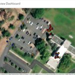
So happy to get our latest #GIS solution to track #SAR incident data for Oregon. A big thanks to our State SAR coordinator & community to help us build & design a useful solution! Excited to see this moving forward! osarid-geo.hub.arcgis.com/ @GISPublicSafety @EsriSLGov @OregonOEM
1
97
Daniel Stoelb retweeted
Today is #GISDay! OEM uses GIS technology for tracking hazards and incidents to help our partners and the public stay informed. Visit our GIS Hub to see maps and data tools available: https://xitter.gq/t.co/BkMu4WzVYN Learn about GIS in Oregon emergency management: prepfit-geo.hub.arcgis.com
1
4
Happy to be featured on our @OregonOEM weekly news article to celebrate the upcoming #GISDay on Wednesday this week. Here's the article: content.govdelivery.com/acco… #EMGTwitter @gisday @GISPublicSafety @EsriSLGov @ArcGISHub @ArcGISStoryMaps
1
3
Daniel Stoelb retweeted
💨🌧️🌊 Track weather hazards using the OEM Hazard Situation Overview dashboard with tabs for weather and flood forecast: https://xitter.gq/t.co/FbeSJC3Clz 🚧 Use Tripcheck.com for road hazards and closures. 🚨 Receive local emergency alerts: oralert.gov #orwx
3
12
Daniel Stoelb retweeted
☀️🌩️🚩 Heat and Fire Weather are forecast to impact the state later this week. 📸 View weather alerts on OEM's Hazard Situation Overview Dashboard using the "Weather" tab: https://xitter.gq/t.co/FbeSJCkFnz 📱 Or use the mobile-friendly RAPTOR map: https://xitter.gq/t.co/9VH6cJ9Tu0 #ORwx #ORFire
2
5
Daniel Stoelb retweeted
🔥 View current fire data and evacuation maps using the OEM Fires Dashboard: https://xitter.gq/t.co/AdpvPAttvh 🗺️ The dashboard tracks data from local, state & federal partners. ☁️ For smoke impacts, visit the @ORSmokeInfo blog: oregonsmoke.org 📷 Screen capture from Aug. 4, 2022.
1
8
1
21
I have invoked the Emergency Conflagration Act to make more state resources available to the fire crews on the front lines in Wasco County at the Miller Road/Dodge Fire.
19
15
156
Daniel Stoelb retweeted
Follow Wasco County Sheriff's Office for evacuation information for the Dodge/Miller - Juniper Flat wildfire: facebook.com/WascoCountySher… Sign up for Wasco County emergency alerts: https://xitter.gq/t.co/xwglwWAoHN View current wildfires on the @OregonOEM dashboard: https://xitter.gq/t.co/gDCVuEZwka
1
7
10
We have just recently completed the #GIS #AAR for this year. This process incorporated asking our #GISforEM community to answer questions regarding the data they used during events over the last year, what was created, and specific lessons learned. 🧵 1/3
1
1
1
6
Additionally, we added a new element specifically to ask about details for the FIT themes and what datasets were used specifically. These resulted in an analysis for what data were used, issues they encountered with the data, and recommendations for new datasets to include. 2/3
1
Great presentation from @FEMA_Deanne regarding #GIS for #emergencymanagement. Happy to continue sharing critical data during disasters for the whole community. Interested in hearing more? Check it out here: oregon-oem-geo.hub.arcgis.co… #EsriUC @OregonOEM @GISPublicSafety @EsriSLGov
1
4
Today I received a plaque celebrating 10 years of service to Oregon Emergency Management and the State of Oregon. Hard to believe that it has been that long! A retrospective thread: 2014 Wildfires 2015 Wildfires 2015 Umpqua Community College Active Shooter 2015 POTUS Visit 1/5
1
9
Things have changed so much in the realm of #EMGIS and I'm so proud of the work that I've been able to accomplish during this short period of time. A big shout out everyone who's worked in the past w/me on all of these: the numerous exercises, AARs, and initiatives. 4/5
1
2
We have such a great community here in OR and I'm happy to continue to serve, making the data we have relevant, timely, & informative for the whole community. Thank you for an awesome 10 yrs and I look forward to the future! @OregonOEM @EsriDRP @ArcGISApps @ArcGISStoryMaps 5/5
3
So happy to be able to have exercised our statewide #damageassessment utility yesterday over in the Dalles. Interested in learning more? See our #hub site here: oregon-damage-assessment-pro… @OregonOEM @EsriDRP @ArcGISApps @ArcGISSurvey123 @ArcGISQC @ArcGISHub
5
Daniel Stoelb retweeted
Isolated strong wind gusts capable of producing tree damage will be possible this afternoon across NW OR & SW WA. The highest threat will be in the Willamette Valley. If threatening weather approaches, avoid taking shelter under a tree even if in a vehicle #pdxtst #orwx #wawx
5
46
16
99