Madison County EMA (@HMCEMA) header
Madison County EMA (@HMCEMA) profile picture

Official account for Huntsville-Madison County EMA. This page is not monitored 24 hours a day. All emergencies should be reported by dialing 911.

Huntsville, Alabama
Joined January 2010
Photo by Madison County EMA (@HMCEMA)Photo by Madison County EMA (@HMCEMA)Photo by Madison County EMA (@HMCEMA)Photo by Madison County EMA (@HMCEMA)Photo by Madison County EMA (@HMCEMA)Photo by Madison County EMA (@HMCEMA)Photo by Madison County EMA (@HMCEMA)Photo by Madison County EMA (@HMCEMA)Photo by Madison County EMA (@HMCEMA)Photo by Madison County EMA (@HMCEMA)
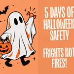
Don’t be scared—be prepared! Happy Halloween from Huntsville-Madison County EMA! 👻
140
Inspect Treats Before Eating. 🍬 Check all candy and treats before children eat them. Discard anything unwrapped, damaged, or suspicious, and be mindful of food allergies and choking hazards for younger children.
1
1
214
Keep Halloween Decorations Fire-Safe. 🕯️ Keep candles, jack-o'-lanterns with real flames, and other heat sources away from costumes and decorations. Use battery-operated lights when possible and keep walkways and exits clear.
193
Keep Trick-or-Treaters Together. 👨‍👩‍👧‍👦 Young children should always have a responsible adult with them. Older kids should travel in groups, stick to familiar routes, and agree on a check-in time.
1
228
🚒🚑🚔 Happy National First Responders Day! Today, we recognize and celebrate the brave men and women who answer the call when our communities need them most. From firefighters and law enforcement officers to EMS personnel, 911 dispatchers, and other emergency response professionals, your dedication, courage, and commitment to protecting others make a lasting difference every day. From all of us at Huntsville-Madison County EMA, thank you for your service, your sacrifices, and your continued commitment to keeping our community safe. We are proud to work alongside you! 💙❤️
1
343
Walk Safely and Use Crosswalks. 🚸 Use sidewalks whenever possible, cross streets at corners and crosswalks, and look both ways before crossing. Avoid darting between parked cars and put phones away while walking.
236
Be Bright and Be Seen! 🔦 Choose bright or reflective costumes, carry flashlights or glow sticks, and make sure masks don't block vision. Help drivers see you after dark!
258
Halloween is taking over John Hunt Park once again, with the @HSVPolice and Huntsville Parks & Recreation team up for an evening of trick-or-treating, games, entertainment and a haunted house on Friday, Oct. 23, from 6-9 p.m. at the Jaycee Building, 2200 Jaycee Way. Admission is free and open to all ages! The event will feature: 📷Trick-or-treat trail 📷Bounce houses 📷Family-friendly entertainment and carnival games 📷Food trucks with items for purchase 📷Haunted House, opening at 6 p.m. Looking for more details? Get the full event information here: bit.ly/4ynmgYs
1
1
3
342
🍂 Dry, seasonal weather is expected to continue throughout the week! Afternoon highs will reach the mid to upper 70s, with cooler overnight lows in the mid to upper 40s. Enjoy the fall weather!
1
283
A Beautiful Stretch of Fall Weather Ahead 🍂 Dry conditions will continue through midweek, bringing plenty of sunshine during the day and clear skies at night. Temperatures will gradually warm toward the end of the workweek, with highs climbing back into the mid to upper 70s and overnight lows returning to the mid to upper 40s. Enjoy the sunshine and those crisp fall nights! 🌤️
1
1
297
If you’re traveling in the area Saturday morning, plan for delays and use alternate routes. Roads will reopen after the parade concludes and the route is cleared! Additionally, be prepared for traffic delays and congestion around @aamuedu throughout the remainder of the day. The homecoming game is scheduled to kick off at 2:05 p.m.
Meridian Street will close Saturday, Oct. 17, beginning around 7:45 a.m. for Alabama A&M University's Homecoming Parade. Get the full traffic advisory: bit.ly/4ilKDjH
723
Today in honor of Breast Cancer Awareness Day, we raise awareness, honor survivors, remember those we’ve lost, and stand with everyone affected by breast cancer. Early detection matters, and regular screenings can save lives! 💗 REMINDER: Saturday morning (October 17, 2026), downtown Huntsville will turn pink for the 23rd Annual Liz Hurley Ribbon Run! As our community comes together to support breast cancer awareness, please be mindful of runners and walkers, allow extra travel time, and watch for traffic changes and temporary road closures in the downtown area.
300
Madison County EMA retweeted
[6 AM] Just like the dried flowers in our scrapbook graphic, things are going to stay completely dry across northern Alabama and southern middle Tennessee this week! Expect plenty of sunshine along with a steady warm-up through Thursday! #HUNwx
4
7
1,573
10/10/2026: 10:49 AM The Flood Watch for Madison County has been cancelled. The High Wind Warning is still in effect as the remnants of the storm continue to pass through.
1
448
10/9/2026: Here is an update on the impacts we are tracking from Hurricane Isaias. Stay weather aware and have multiple ways to receive alerts. 🌧️ The expected rainfall totals have decreased to 1-3 inches with isolated areas receiving 4-6 inches of rain. The Flood Watch remains in effect from 1 AM Saturday until 7 AM Sunday. Heavy rain may lead to flooding of low-lying areas and roads. Stay weather aware and never drive through flood waters! Turn Around Don't Drown. ⚠️ Madison County has been upgraded to a High Wind Warning from 1 AM Saturday until 7 AM Sunday. We are expecting sustained winds up to 25 MPH with gusts up to 60 MPH. We may have some trees down and power outages due to the winds. Be sure to secure any loose items around your home that could blow away. 🌪️ The tornado threat remains low, but this is Alabama and a pop-up is always possible. ⏲️ Our most likely timing will be from 12 AM Saturday until 12 PM Saturday, but we could see lingering impacts into Sunday morning. See the latest National Weather Service Huntsville briefing here: weather.gov/media/hun/DSSBui…
1
526
10/8/2026: The National Weather Service has issued a Flood Watch and High Wind Watch for this weekend due to Hurricane Isaias. 🌊 The Flood Watch is in effect from late Friday night until Sunday morning. We expect between 2-4" of rain with 5-7" of rain possible in isolated areas over the weekend. We may see ponding on roads and flooding in low-lying areas. Remember to avoid water of unknown depths and seek higher ground if necessary. Turn Around Don't Drown. 🌩️ The High Wind Watch is in effect from Saturday Morning until Sunday Morning. We expect to have sustained winds up to 25 MPH and gusts up to 50 MPH. We may have some trees down and power outages due to the winds. Be sure to secure any loose items around your home that could blow away. 🌪️ The tornado threat for the weekend is trending low, but a pop-up is always possible. Remember to have an emergency kit that can sustain you and your family for 72 hours and have multiple ways of receiving warnings.
407
Madison County EMA retweeted
Hurricane Isaias is forecast to make landfall near the AL/FL coastal area Friday night. There is a medium chance of impactful gusty winds, a low risk of flooding, and a low risk of a tornado or two in NC/NE AL on Saturday into Saturday night. #HUNwx
9
18
4,492
The Huntsville - Madison County E.M.A. will be conducting a test of the Outdoor Warning Siren system today at 12:00 PM. This will only be a regular monthly test and no emergency exists. The siren system is designed for outdoor warning. We recommend a NOAA Weather Alert Radio for use inside your home as well as cellular apps to alert you. Remember that any one method can fail! Having more than one method increases the chances that you will receive a weather warning in time to act. Review where you would take shelter in the event of a warning.
1
2
381
Madison County EMA retweeted
Very warm weather is expected Friday w/highs in the u80s-l90s. Then, a slow moving front will bring showers and thunderstorms this weekend with locally heavy rainfall & a low risk of flash flooding. The rainfall will keep highs in the middle 70s to around 80. #HUNWx
3
7
1,572
After a warm end to the week, shower & thunderstorm chances increase Friday evening and continue through the weekend. Heavy rain could bring a low flash flood risk. Clouds & rain will keep highs in the mid-70s to lower 80s. Stay weather aware! 🌧️
1
432