

Meteorologist, Storm Chaser, Photo/Videographer, Hooper, Traveler, and Sports Enthusiast featured on The Weather Channel show Storm Riders.
Kansas, USA
Joined March 2012
- Tweets7.2K
- Following978
- Followers20.6K
- Likes5.4K


Pinned Tweet
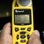
I had to go out and test the winds in the eyewall of Irma!!! xitter.cf/SimonStormRider/status…

Juston Drake retweeted

As of 0200Z, 4 StickNets have clocked 3-second gusts over 100 mph in #Isaias! Platforms 217, 218, 325 & 326 all hit triple digits, and 9 total topped 84 mph. @NWSMobile @NWSTallahassee @NHC_Atlantic #flwx #alwx


Juston Drake retweeted

The sun has risen on #Champi and its now-cleared out eye. As usual hard to stop looking at the low-level clouds swirling around in the eye
Juston Drake retweeted

No modern El Niño event remotely compares to how far east the *mean* Indo-Pacific Warm Pool (IPWP) currently is in the Equatorial Pacific
Remarkably, the mean IPWP is currently shifted ~15 degrees east of 1997-98, the modern gold standard for an “east-based” El Niño event


Juston Drake retweeted

🌀Hurricane Isaias Damage Analysis (1/4)
NWS Mobile continues to investigate an extreme corridor of damaging winds WEST of Isaias' center. This radar/velocity loop shows intense winds, with deeper blues/greens indicating higher wind speeds, possibly associated with a "sting jet"
Juston Drake retweeted

Chase Archive Pro is LIVE!
As a reminder, first 20 signups get a founding member discount, and we are just getting started with Pro features.


Juston Drake retweeted
Being climate dynamicist at heart, this is the kind of AI application to meteorology I’ve been yearning to see
Many S2S dynamical model biases are well known/generally predictable
Probabilistic bias correction (PBC) is imho a game changer for S2S/week-to-week weather forecasts

In @Nature this week, our new research shows how machine learning can improve weather forecasts two to six weeks out, a timeframe that's historically been very difficult to predict.
It's exciting to see the potential of this work to help us better prepare for extreme weather, manage natural resources, and make more informed decisions in agriculture.
There's a broader lesson here... the future may not just be about ever-more-capable models, but about building intelligent verification systems around them: systems that learn where models are systematically wrong, reason about cause and effect, and continuously calibrate predictions against reality.
Read more: microsoft.com/en-us/research…

Juston Drake retweeted

🇮🇸 The explosive extratropical intensification and landfall of an exceptionally deep, ~925 MBAR autumn storm in Iceland today.
Heavy Icelandic rain, Hurricane-force wind gusts, and the onyx-colored waves of the icy North Atlantic have battered the island.
Juston Drake retweeted

#ISAIAS was my 88th #hurricane core penetration. It wasn't the prettiest specimen—it was kind of a freak show, honestly—but it had some spicy moments, & I got some real purdy shots thanks to dramatic views & great lighting. Now deciding which lucky cyclone will be No. 89.❤️


Juston Drake retweeted

THEORY THREAD | What happened in Pensacola, Florida during Hurricane #Isaias.
The strongest winds in a tropical cyclone is typically seen in the NE Quadrant of the cyclone. However, Isaias strongest winds near landfall occurred in the NW & SW quadrants. So what happened?

Juston Drake retweeted
Preliminary data continues to be assessed at NWS Mobile, seeing a distinct corridor of enhanced winds (80–110+ mph) WEST of where Hurricane Isaias made landfall. Data review and quality control will continue, with a final post-storm assessment expected in the coming days.

ALT Preliminary highest wind reports

ALT Preliminary precipitation reports
Juston Drake retweeted

This was one of the wildest things I ever experienced on tropical coverage.

At our station in Choctaw Beach, the temperature rose dramatically as the strongest winds moved in from Isaias. @JimCantore mentioned this in his live shot last night

Juston Drake retweeted

Storm surge rising in Destin, Florida
October 9, 2026
Hurricane Isaias
W/ @JustonStrmRider

Juston Drake retweeted

Pressure remaining steady or decreasing a tad and the wind field a bit more symmetric per the last pass. Isaias is defiantly refusing to weaken and will likely come ashore as a low-end Category 3.

Juston Drake retweeted

Still impressive flight-level winds (~140 mph at 10,000 ft) in the latest @NOAA_HurrHunter pass through Isaias. No signs of an eyewall replacement cycle or core weakening yet. Still early in the mission but pressures at least steady. We'll see what the center drop says.


Juston Drake retweeted

With Tropical Storm Isaias continuing to take shape, I revamped the deterministic model viewer on PolarWx with more customization options, in addition to significant website usability improvements for mobile devices:
polarwx.com/tropical/#al0920…

Juston Drake retweeted

The track is probably gonna end up being west of all of these, but a few analogs I like for #92L for structure and intensity in the Gulf are Josephine (1996), Earl (1998), Gordon (2000), and Nestor (2019). All four were east-weighted due to shear, but still produced significant impacts to the east of the center.
This is definitely one where you can't led your guard down even if the center doesn't directly go over you. I would expect some pretty significant surge, flooding, and tornado impacts over places like the Florida Big Bend based on the current guidance.


