NASA’s favorite (habitable) planet. 🌎💚 Studying Earth from ground to orbit.
- Tweets25K
- Following86
- Followers3.7M
- Likes3K







ALT A U.S. Drought Monitor map of Texas depicts drought intensity across the state. Severe, extreme, and exceptional drought are shown in various shades of red and orange and cover large portions of the state. The area around Lubbock falls within the severe category. Extreme and exceptional drought is present in counties to the immediate northeast. Credit: NASA

ALT NASA satellite image of the Lubbock region in Texas on September 9, 2026. The area appears dry and brown. Only some fields are green and most of the lakes appear white and dried out. Credit: NASA


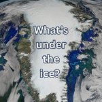
ALT Aerial view of Thwaites Glacier in Antarctica, showing a vast expanse of white ice ending in a steep ice cliff above dark blue ocean water. Broken ice surrounds the glacier’s edge. Credit: NASA


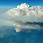
ALT Aerial photograph of a fire-generated cloud. Near the ground, dark brown smoke shows the location of the Widemouth 2 fire in Utah. The smoke rises high into the atmosphere and spreads out. Above the smoke layer are puffy white clouds, including a puff of very tall clouds. Credit: INSPYRE / Bernadett Weinzierl

ALT Photograph of NASA’s ER-2 aircraft on the runway. In the foreground, a person holds two orange lights to signal to the plane. The sunset is orange and pink in the background. Credit: NASA / Milan Loiacono

ALT A photograph shows a truck and two people in yellow firefighting shirts on the side of a road. In the distance is a wildfire and the sky is filled with smoke. Credit: NASA / Milan Loiacono


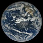
ALT Full-disk satellite view of Earth. The Americas are visible on the right. Four tropical cyclones swirl above the blue waters of the Pacific Ocean. From left to right: Nolo, Odalys, Polo, and Rachel. The Intertropical Convergence Zone appears as a band of puffy white clouds near the equator. The storms are all near this area. Credit: NASA


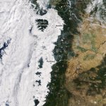
ALT Satellite image of low-lying clouds covering western Washington and Oregon on September 19, 2026. The clouds are puffy and white. They obscure most of the landscape between the Pacific coast and the foothills of the Cascade Range. Parts of the Olympic Mountains and Oregon Coast Range are visible above the clouds. Credit: NASA