NC's Weather Now - retweeted
🚨 Updated tornado summary for October 11th, 2026.
We have confirmed 10 tornadoes occurred between 10:14 AM and 1:47 PM and caused nearly 21 miles of significant damage. However, and most importantly, these tornadoes did not result in any fatalities. #NCwx

ALT Updated summary from the October 11th, 2026 tornado outbreak. This information is up to date as of 2 PM on November 12th, 2026. We have now confirmed 10 tornadoes touched down in central North Carolina between 10:14 AM and 1:47 PM on October 11th, 2026. Making October 11, 2026, the day with the most confirmed tornadoes in central NC history, but most importantly, only 1 injury and no fatalities occurred on this historic day. Three EF-0's, five EF-1's, and two EF-2's.
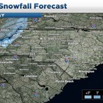
Forecast for this upcoming NW flow snow event:
Expect parts of the smoky mountains to get around 3-5" of snow, with a dusting-3" along the NC-TN border with areas like Boone to get up to a dusting, Asheville area will likely stay dry but a few flurries are possible.
#ncWX
4
179
Expect a decent cooldown for late next week, with potentially a widespread freeze event for much of the Piedmont, some NW flow snow in the mountains is also possible.
#ncwx
NC's Weather Now - retweeted
How can any of you make any assumptions about the long range? Like all this talk on "A cooldown is coming but it'll be brief then it'll warm up again"
Wow! Very creative! I mean that is so easy to say. The timeframe coming up that is bringing a shot of cold air with Winter weather chances was showing above average temperatures on the EPS last Saturday. Now we have the coldest air of the season on the way.
Let's just keep things out in front of us. No reason to just pencil off huge timeframes way out of ahead of us. Like you got people saying December is toast... How do you know? You got a time machine?
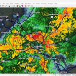
Might be seeing some small hail with the wake county storm
#ncwx
1
94
NC's Weather Now - retweeted
Nice clickbait. 2009-10 is not a good analog for this winter
There’s a pretty huge difference in sensible impacts (especially on the East Coast) when your ridge is over Greenland-Baffin Bay vs the Hudson Bay w/ a huge Gulf of Alaska trough flooding the continent with mild air.
NC's Weather Now - retweeted
Hail in strong thunderstorm this morning in Brown Summit taken by Kim Lathrop.
Our ongoing drought is beginning to worsen for much of central and eastern NC, although we can expect a MUCH wetter pattern with constant storm systems by the time we get to the end of this month all the way into December, hopefully reversing the effects of our recent dry
#ncwx
#ncwx
Expecting a unseasonably warm and cloudy day with highs in the 70s and a few showers, will have better rain chances for Tonight and early Friday, before clearing out by the evening.
2
84
NC's Weather Now - retweeted
NCDOT have begun removing sections of damaged pavement on NC 12. NC12 from the Basnight Bridge to Rodanthe is still experiencing continuous flooding, and standing water, and there is 1,100 feet of damaged pavement. The area is closed to the public.
NC's Weather Now - retweeted
Non-tropical Invest #93L has a 40% chance of becoming a Subtropical Storm in the North Atlantic this week.
The system lacks robust convection around the center, and is still frontal, making it non-tropical. However, this could change over the next couple of days, as the NHC notes, and could briefly become a strong Subtropical Storm.
This system will continue to meander parallel to the East Coast over the next couple of days, bringing some gusty winds to coastal areas, before moving quickly to the NE later this week.
NC's Weather Now - retweeted
⚠️A state of emergency has been issued for Hatteras Island and a mandatory evacuation order for visitors on Hatteras Island takes effect at 8 p.m. on Friday, October 16. Info at darenc.gov/storm. Long duration Nor'easter impacts becoming increasingly likely. #ncwx
NC's Weather Now - retweeted
🚨❗️Attention Dare County Residents and Visitors- Special Attention Hatteras Island: Mandatory Evacuation Order for Visitors in Rodanthe, Waves, Salvo, Avon, Buxton, Frisco and Hatteras Village!
#ReadyNC #ncwx
A mandatory evacuation for all visitors on Hatteras Island takes effect at 8 p.m. tonight (October 16). A state of emergency has been issued for Hatteras Island.
Latest updates: DareNC.gov/Storm.
NC's Weather Now - retweeted
NEW: Hatteras Island is not messing around with this upcoming storm.
Visitors have to leave, and aren’t welcome until this storm clears sometime next week.
High surf and possible coastal flooding start this weekend and could linger several days.
A mandatory evacuation for all visitors on Hatteras Island takes effect at 8 p.m. tonight (October 16). A state of emergency has been issued for Hatteras Island.
Latest updates: DareNC.gov/Storm.
#ncwx
Expecting a coastal low to form offshore along a stalled cold front on Saturday and linger into the middle of next week.
Wind, high surf, flooding and beach erosion is possible, what will make the impacts more significant is the fact that it will be a long lasting event.
3
124
NC's Weather Now - retweeted
Drought is slowly fading across the Carolinas. D4 is now gone in NC. Large portion of the western Carolinas now in normal conditions.