

Official Twitter account for the National Weather Service California Nevada River Forecast Center or CNRFC, https://xitter.cf/t.co/wpdBnfYjSp.
- Tweets1.5K
- Following132
- Followers7.2K
- Likes56







ALT Graphic showing water temperature impact thresholds. Water temperatures below 40 degrees: Extremely Dangerous, water temperatures 50 to 60 degrees: Very Dangerous, water temperatures 60 to 70 degrees: Dangerous, and with water temperatures below 77 degrees, breathing begins to become affected. Data courtesy of the National Center for Cold Water Safety.

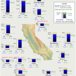
ALT Map showing reservoir conditions across California, including % total capacity, and % historical average.

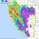
ALT Map of California and Nevada showing gridded precipitation totals over the past 7 days ending at 5 AM PDT on March 17. Widespread precip was observed during this period.

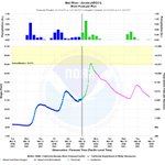
ALT Hydrograph showing the Mad R at Arcata surpassing the Action stage around Midnight.

ALT Hydrograph showing the Smith River at Dr Fine Bridge forecast to reach its Action stage around Noon.

ALT Ensemble river forecast showing the Smith River at Dr Fine Bridge and its chances of exceeding "Action Stage", which is 61%.

ALT Ensemble river forecast showing the Cosumnes River at Michigan Bar and its chances of exceeding "Action Stage", which is 57%.

ALT Map showing the expected precipitation amounts through Tuesday morning. Best totals over northern CA and the upper Klamath River basin with 1" to 3", except 4" to 7.5" for the Shasta Lake drainage, crest of southern OR Cascades, and Smith/lower Klamath River basins.

ALT Graphs showing status of the California snowpack, now ~90% of avg.

ALT Map showing gridded precipitation for the past 72 hours. Widespread across CA and portions of NV.

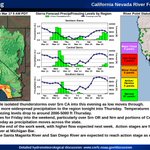
ALT California Nevada Forecast Center Daily briefing. Graphic on left showers forecast precipitation amounts for Tuesday 5 am through Monday 5 am. Around 3-6 inches of precip over the Nrn CA Coast and Shasta Basin and along the Sierra and 1-2 inches along the Central and Srn CA coast and into Srn CA mtns and Sac Valley. The middle graphic shows Sierra Forecast precip amounts and Freezing levels for the Northern Sierra, Central and Southern Sierra with freezing levels dropping to around 2000 to 4000ft by Thursday. The graphic on the right shows the forecast river point status with 97 points normal and 5 points reaching action/ monitor stage.

ALT Forecast precipitation amounts for Tuesday 5am to Friday 5 am. 1 to 2 inches along the coast and 2-4 inches along the Sierra.

ALT Forecast precipitation amounts for Friday 5 am to Monday 5 am. 1 to 3 along the NW CA coast and Shasta Basin and Nrn Sierra and up to half an inch along Central CA coast and a tenth of an inch or less for Srn CA coast .


ALT Chart showing Northern California snowpack for 24/25.

ALT Chart showing Central California snowpack for 24/25.

ALT Chart showing Southern California snowpack for 24/25.

ALT Graphic with the forecast Precipitation amounts for Saturday 4am through Tuesday at 4am. Highest amounts around half an inch to an inch over NW CA coast and along the Sierra and higher terrain of Northern and Central NV.

ALT Graphic with the forecast precipitation amounts for Tuesday 4 am through Friday 4 am. Highest amounts around 1-1.5 inches along the Sierra.

ALT Graphic with the Maximum temperatures forecast for Wednesday and graphic showing departure from normal up to 20 degrees above normal.

ALT Graphic with the Maximum temperatures forecast for Thursday and graphic showing departure from normal up to 20 degrees above normal.

ALT Graphic with quantitative precipitation forecast amounts for Saturday 4 am to Tuesday 4am. Highest amounts up to around an inch over the Shasta Basin and along the Sierra.

ALT Graphic with observed 7 day precipitation amounts for Sat February 1 2025 at 4 am to Saturday February 8 at 4 am. Highest amounts are 13-26 inches over the Nrn Sierra and 9-20 inches over Shasta Basin. Little to no precip fell over SE CA and SE NV.

ALT Graphic of the Ensemble River Forecast at mainstem river forecast points showing at least a 10% chance of exceeding action/monitor stage at Santa Margarita River at Ysidora and San Diego River at Fashion Valley in the next five days.

ALT Forecast precipitation amounts for California and Nevada through 4 am Tuesday. Highest amounts 1-3 inches over the transverse mtns (highest over the San Gabriel and San Bernardino Mtns) and 0.75-1.5 inches over Srn CA coast and generally 0.5-1 inch over Southern Sierra.

ALT Graphic of Forecast precipitation amounts for California and Nevada 4 am Tuesday through through 4 am Friday. Highest amounts 0.25-0.5 inches over the NW CA coast and up to a tenth of an inch for the Central CA coast and interior Nrn CA and Srn CA.

ALT Map of California and Nevada showing percent of normal precipitation. Northern CA shows the best with some areas 150 to 200 percent of normal. Southern CA and southern NV are doing the worst with some areas in single digits percent of normal.

ALT Map of forecast precipitation for Monday 4am through Thursday 4 am over Srn OR, Nrn CA, and portions of Central CA and Nrn NV. Precip amounts of 1-2 inches for the Smith Basin and Srn OR Cascades and 0.5- 1 inch for the Shasta Basin and N Bay Area and around half an inch or less elsewhere.


ALT Graphic of the CNRFC Daily briefing with a plot of the forecast precip from 4 am today to 4 am Dec 21 showing precip over Srn Or, Nrn CA and portions of Central CA and Nrn NV with the highest amounts along the Nrn CA coast and Shasta Basin with 1-3 inches of precip. Plot of forecast precip amounts and freezing levels for the Northern, Central, and Southern Sierra. Freezing levels down to around 5000 ft in the Northern Sierra on Monday. River Forecast Point map showing 7 forecast points at or above action/monitor stage.

ALT Map of 48 hour observed precipitation over California and Nevada showing highest amounts of 3-6 inches with local amounts around 8 inches along the Northern CA coast and Shasta Basin and 3-6 inches over the Nrn Sierra and 1-4 inches in the Sac Valley.


ALT Map of forecast precipitation amounts across CA and NV. Best totals over northern CA, mainly in the range of 4-7" for the higher terrain and 1-3" for lower elevations. Lesser amounts expected for central CA.

ALT Total Precipitable Water showing the Atmospheric River impacting northern CA.


