

PennCo Fire provides support to twenty volunteer fire departments for Pennington County citizens not residing in Rapid City.
- Tweets5.3K
- Following194
- Followers1.3K
- Likes2.5K









ALT A graphic saying the Driver Exam Stations in Aberdeen, Brookings, Huron, Mitchell, Pierre, Pine Ridge, Rapid City, Sioux Falls, Spearfish, Wagner, Watertown, and Yankton close at noon on November 5, 2026.


ALT Picture of the forecast showing rain and thunderstorms with high temperatures into the 60’s before clearing on Monday.

ALT A National Weather Service Rapid City graphic showing a Red Flag Warning Friday from 11 AM to 7 PM MDT for parts of southwestern South Dakota and northeastern Wyoming. The map highlights affected areas in pink, with details noting gusty northwest winds up to 35 mph, humidity as low as 12–18 percent, and ongoing drought creating critical fire weather conditions. Safety reminders include avoiding outdoor burning, fireworks, driving over dry grass, and discarding cigarettes.

ALT Image on the right shows the Black Hills from a distance during a sunrise. On the left is a forecast through Saturday.


ALT Chrome clad motorcycle National Weather Service logo in one corner and a sun icon in the other corner. Expect hot weather through the weekend with a bit of smoke for some. High temperatures will generally be in the 90s on the plains with some 80s for the Black Hills. Thunderstorm chances will be limited. Isolated thunderstorms may occur through this evening over south-central South Dakota. Active thunderstorms may occur early Saturday morning over south-central South Dakota. Isolated thunderstorms may occur east of the Black Hills late Sunday.

ALT Severe weather outlook map for late Friday night and early Saturday morning. Isolated severe thunderstorms with large hail and frequent lightning may occur from about 300 AM MT / 400 AM CT to 800 AM MT / 900 AM CT Saturday morning. Monitor the weather and have a plan of action if severe weather is imminent.

ALT A summary of upcoming weather conditions, noting intermittent smoke, a chance for isolated showers or thunderstorms tonight, and a shift to very warm and hot temperatures from Thursday through the weekend.

ALT A National Weather Service forecast graphic titled "Cooler Weather Ahead," displayed over a scenic mountain and pine forest landscape. The five-day outlook shows Monday with highs of 78 to 93°F featuring afternoon thunderstorms and a fire danger icon. Tuesday is cooler at 66 to 76°F with afternoon thunderstorms. Wednesday brings partly cloudy skies and highs of 74 to 84°F. Thursday is sunny with temperatures rising to 80 to 90°F, and Friday is sunny and hot, ranging from 87 to 97°F.

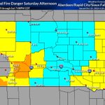
ALT A National Weather Service Red Flag Warning graphic detailing extreme fire danger in effect from 11 AM to 8 PM MDT Monday. A regional map highlights affected areas in bright pink, including the Black Hills, northern and eastern Foothills, west Central Plains, and parts of Weston County. Critical weather conditions listed include northwest winds of 20 to 30 mph with gusts up to 45 mph, relative humidity between 18 and 25 percent, and ongoing drought. Three safety icons at the bottom advise: "Don’t burn outdoors," "Don’t drive over dry grass," and "Don’t throw cigarettes out of a vehicle."

ALT Map shows pink shaded areas that are under the Red Flag Warning.

ALT National Weather Service forecast graphic titled "Hot Today" displaying maximum Sunday temperatures across western South Dakota and adjacent areas. The heat map shows widespread highs between 91°F and 108°F, featuring peak temperatures in locations such as Rapid City at 104°F, Philip at 106°F, and Red Shirt at 108°F. On the right, a five-day forecast panel shows sunny and windy conditions today (95°F to 109°F) and Monday (80°F to 95°F), cooler temperatures with a chance of thunderstorms on Tuesday (68°F to 78°F) and Wednesday (75°F to 85°F), and sunny skies returning Thursday (82°F to 92°F).

ALT National Weather Service Heat Advisory graphic for portions of the western and central South Dakota plains, valid from 10:00 AM to 8:00 PM MDT on Sunday, August 2nd. The image warns of high temperatures over 100°F and heat index values reaching 103°F to 105°F. A map on the right highlights the orange-shaded Heat Advisory area, including towns like Rapid City, Philip, Hot Springs, and Pine Ridge. Four safety precautions are illustrated at the bottom left: avoid working during the heat of the day, wear light-colored clothing, stay in air-conditioned spaces, and drink plenty of water.

ALT Monthly climate report for Downtown Rapid City showing July 2026 as one of the warmest on record, with mean temperatures near historic highs and below‑average precipitation, plus a table comparing the last ten years of July climate data.

ALT Monthly climate report for Rapid City Regional Airport showing July 2026 as one of the warmest on record, with high mean temperatures, a record warm minimum, below‑average precipitation, and a table comparing the past ten years of July climate data.


ALT Red Flag Warning graphic that says a western South Dakota is under a red flag warning from noon to midnight on July 25, 2026.

ALT A map of South Dakota counties under a red flag warning on July 25, 2026.


ALT Maps of high temperatures for today and Thursday. Expect mild temperatures today and Thursday. HOT temperatures return Friday through the weekend. A 2nd round of showers and thunderstorms will arrive tonight and Thursday.

ALT Map of the probability of 0.25” of rain tonight and Thursday. Here is a look at the probability of 0.25” of rain or more tonight and Thursday. Given the amount of moisture in the air, locally heavy rainfall is possible for some, especially southwest of the light green line on this graphic. Given the nature of summertime showers and thunderstorms, not all folks will get beneficial rainfall, but some might hit the jackpot.

ALT A horizontal bar chart titled "Chance of Precipitation Greater Than 0.25 in" with the subtitle "Tonight and Thursday," illustrating the probability of receiving more than a quarter-inch of precipitation across several specific locations: Gillette: 70% Lemmon: 0% Martin: 55% Philip: 30% Pine Ridge: 70% Rapid City: 60% Spearfish: 50% Winner: 40%
