
@nbc6 meteorologist since 2005. @OhioU grad. @univmiami instructor. 26 years of late nights, early mornings.
Miami/Fort Lauderdale
Joined April 2011
- Tweets31K
- Following499
- Followers11.2K
- Likes18.1K


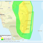


"Turn Around, Don't Drown" is over 20 years old... a successful, catchy campaign from @nws that surely has proven a deterrent to behaviors, decision making around flooded roadways.
But it's still hard to reach the "I know these roads" and "my car can handle it" crowd.
With already high tides expected...add a persistent (gusty) ocean breeze with passing showers to the mix and you have a worst-case scenario for the King Tide peak.
**Coastal Flood Warning is in effect until Wednesday evening for coastal Broward/Miami-Dade**
#TideMaxxing
Passing downpours, gusty winds and several high tide cycles through mid-week... October ends with the hope of more sun and quieter weather to begin November.

High impact tides coming tonight --> Tuesday as the full moon works in tandem with passing downpours and strong ocean breezes. A coastal flood warning goes into effect overnight.

I am (not) shocked.
Data getting spread like seeds in a field.
nbcnews.com/tech/tech-news/m…

Ryan Phillips - NBC6 retweeted

Just be honest, you're sharing that exciting weather model map because you want engagement or to say you called it, not to actually inform people.
In Omaha, @USRepMikeFlood speaks about his discovery of reduced balloon launches, pushed for @NWS to be essential personnel and pulled out of #DOGE reduction in force. #nwa26

Heavy rainfall threat increasing for Saturday afternoon, evening...leading into Sunday.
The slight risk (yellow) points towards a low-end risk of exceeding rainfall amounts that could produce flooding... something we'll be watching this weekend.


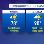
Monday will mark the 9th day in a row with afternoon highs at 90° or greater! A weak front sliding through the area may trigger a shower, but will deliver slightly lower humidity by day's end.

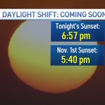
Yikes -- three weeks until we settle into our "winter" ways.
Some will probably be happy to get some daylight in the morning hours, yea?

Between Elgin and Mobile - excellent radar capture for landfall tonight.
This includes monitoring of wind, hydro and svr/tor threat.
In 2017 when @NHC_Surge started pumping out products, it was a new frontier in tropical forecasting, messaging.
Here in 2026, the value is (probably) taken for granted.
The team locked in on the first forecast for #Isaías and hasn't looked back.
Not an easy forecast, folks.
The advancement of AI modeling is a compliment to overall impact messaging - it is not the new, singular path to hurricane forecasting.
Every element of data collection, model evaluation & human guidance is essential to construct a useable forecast.
AI tools aid the process.

As an enterprise rooted in weather communication - sharing organized, actionable assessment and logical preparation to consumers (viewers) IS the name of the game.
Every model run, sat image loses value...
critical messaging rises to the top.
Fanatical X accounts are buggin'!
Now: Tropical Depression Nine forms in Gulf, forecast to be the Atlantic season's first hurricane as it heads to the northern Gulf coast. @nbc6


8pm Monday --> Stepping closer to a tropical depression developing in the Gulf over the next few days... @nbc6
