

Weather + Climate | Look Up 🚀 | Florida State PhD + Michigan Go Blue! | Cat 6 🐈 | SI @weathertrader | Maps at @ForecastEagle + https://xitter.cf/t.co/RZoMToAx1q
Atlanta, GA
Joined September 2008
- Tweets30.8K
- Following5.9K
- Followers154K
- Likes74.1K





Pinned Tweet
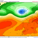
Great Britain and mainland Europe to be hit by "3 bomb cyclones" in a row each with hurricane force winds, heavy rain, and potential for disruption.
The North Atlantic storm track + jet stream is configured for storms to form every 2-days, rapidly intensify, and landfall.
5874 tornado warnings so far in 2026 across the Lower 48 issued by National Weather Service
Arizona adding a few this week -- rare!
weather.city/alerts-archive

Ryan Maue retweeted

Josephine formed yesterday but will be another Atlantic "shortie" as it quickly morphs into a powerful extratropical storm today into Friday. It'll also do little to pick the season off the mat, which continues to be one of the least active on record. ⬇️
michaelrlowry.substack.com/p…


Ryan Maue retweeted

Phoenix, San Diego and Las Vegas haven’t had rain on a single Halloween in 30 years. Portland, Oregon: 19 of 30
Our Trick-or-Treat Forecast is live: 30 years of Halloweens at 100 cities now, and the 6-9PM forecast for yours from next Wednesday. Early lean: warmer than normal for the East, South and Midwest, cooler for the Northwest.

Vance is nearly a hurricane ... at low latitude only 9°N so plenty of room to run
The cloud pattern passes the "eye test" and we should have a Major Hurricane in the next 48-hours, or sooner.
Next storm is Winnie🐻


The second major bomb cyclone has been named by the Met Office --> Boelo
UK global model shows 944 mb central pressure to pass right through Scotland.
Hurricane force wind gusts over potentially large area this weekend.
Maps: forecastbritain.com/britain/…


Ryan Maue retweeted
Great Britain and mainland Europe to be hit by "3 bomb cyclones" in a row each with hurricane force winds, heavy rain, and potential for disruption.
The North Atlantic storm track + jet stream is configured for storms to form every 2-days, rapidly intensify, and landfall.
The first "bomb cyclone" for early Friday will bottom out around 977 mb but be a mobile "diabatic Rossby wave" driven system, so compact and potential for "sting jet" when bent-back warm front superposes with upper-level jet stream beneath/around tropopause fold.
The next 2 bombs are more typical "Icelandic Lows" in the 940s or 950s mb ... fairly intense but more typical/frequent heading into winter.


I don't think we should name purely Subtropical Storms, and NHC didn't until 2002 instead giving them a number designation. However, many subtropical systems eventually turn tropical, so it's often a moot point. Except with Josephine is going to transition into an extratropical system soon (at hurricane intensity).
All these definitions can cause confusion!


Super Typhoon Champi now up to 160-knots maximum sustained winds. That's almost 185 mph
Category 5 intensity for tropical cyclones
Nearly EF5 on tornado scale except Champi's eye is 35 miles wide.
Moving at 15-knots -- so vacuuming up boatloads of climate fuel from ocean


