

Currently a robotics engineer working on robot perception in challenging and hazardous environments.
Hobart, Tasmania
Joined July 2018
- Tweets197
- Following234
- Followers249
- Likes2K



Sean Krisanski retweeted

OpenAI just dropped a prototype of 3D DALLE (called “Point-E”) 👀. It isn’t as good as Google’s DreamFusion, but blazing fast! Like ~600x faster to generate 😮. 2D DALLE has already turned the creative world upside down. How will 3D DALLE disrupt games, VR, metaverse, …? 🤯

Sean Krisanski retweeted

After more than five years of work: our new publication on how to almost double woodland carbon overnight; or, when models work a bit too well.
Full paper: bit.ly/3uXiG8D
[1/10]

Sean Krisanski retweeted

Check out our new paper on @biorxivpreprint
TLS2trees: a scalable tree segmentation pipeline for TLS data
biorxiv.org/content/10.1101/…
Sean Krisanski retweeted

🚨🌲🎉NEW PAPER ALERT🎉🌲🚨
@MethodsEcolEvol: "Developing nondestructive species-specific #tree #allometry with terrestrial #laser scanning"
A new #opensource #Rstats method of measuring #forest #carbon and improving #tree allometry in #3D using #lidar.
bit.ly/3V2UAnW
Great approach to canopy sampling!

See from the pilot's perspective how the @NTBG sampled the Euphorbia eleanoriae on this 2,000 ft high peak. This represents the first time this plant population has ever been sampled. youtube.com/watch?v=skhNlmlO…
Sean Krisanski retweeted

Our Remote Sensing Consultant, Sam West recently spoke alongside Jan Rombouts from OneFortyOne at #ForestTech 2022. Catch up on how #MLS #LiDAR from @emesent Hovermap are having an impact on the future of #forest #inventory. player.vimeo.com/video/68452…

Sean Krisanski retweeted
Keynote: #ForestTech 2021/22 Conference #Technology on Steroids #remotesensing #forests #GIS #Inventory #LiDAR #Drones #Satellites #Starlink #VR Past Present Future. What tech changed how we operate in #forestry sector and what this means for the #future. tinyurl.com/yhu6mrae

Sean Krisanski retweeted

Very proud to announce the release of our new stable version: CloudCompare v2.12.0 "Kyiv"!
cloudcompare.org/
See the release notes here: tinyurl.com/3d74kvzy

Sean Krisanski retweeted

The procedural tree 🌳 generator is fully functional and is actually quite useful for research 😉 adamerickson.xyz/deps/gltf_p…
Sean Krisanski retweeted

📜new paper out 📜
Terrestrial laser scanning (TLS) is more and more used to measure tree volume in 3D. But how accurately can we model small branches?
➡️OA doi.org/10.14214/sf.10550
with @kungphil, Pasi Raumonen @Hans1Verbeeck @sruthiMoorthy, Bert Gielen,

New paper is out! "Design and Testing of a Novel Unoccupied Aircraft System for the Collection of Forest Canopy Samples" mdpi.com/1999-4907/13/2/153/…
youtu.be/iM0RSLVlETY
#forest #canopy #samples #drone #UAS #UAV #adaptive #landing #gear #3Dprinting #ROS @Forests_MDPI


Excited to finally share the major output of my PhD with the world! This is a Python package which accepts high-resolution forest point clouds as input and fully automatically (and without parameter tuning) turns them into detailed measurements. youtu.be/rej5Bu57AqM
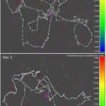
Fixed an error in the CCI at breast height calculation, added this to the tree_data.csv output, and have added an explanation of CCI to the README. Circumferential Completeness Index (CCI) is just a measure of how complete the coverage is for a particular diameter measurement.

Sean Krisanski retweeted

Really impressed with this #Python #TLS #MLS #ULS #LiDAR toolset developed by @SKrisanski @arcforestvalue @interpine_nz available at github.com/SKrisanski/FSCT. Just gave it a run on some tropical savanna TLS - very neat approach. Many thanks to all involved!

