

Info for the San Luis Valley about emergencies and preparedness, from the Regional Emergency Coordination Committee. This page is not monitored 24/7.
- Tweets1.9K
- Following72
- Followers1K
- Likes204
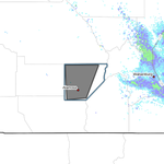





ALT This graphic displays a special weather statement plotted on a map. The statement is in effect until 2:00 PM MDT. The statement includes Capulin CO. A STRONG THUNDERSTORM WILL IMPACT SOUTHEASTERN RIO GRANDE AND CENTRAL CONEJOS COUNTIES THROUGH 200 PM MDT. The threats associated with this storm are wind gusts up to 50 MPH and half inch sized hail. Seek shelter in a sturdy structure until the storm passes.

ALT Tropical moisture will move into the area today, bringing periods of showers & t-storms to the entire region from this afternoon into Thu. Locally heavy rainfall/flash flooding is possible over the San Juan Mtns today into Tue, and over the srn Sangres, srn I-25 corridor and far sern plains on Tue/Wed. Storm total rainfall of 3-4 inches will be possible over southern portions of the region, mainly south of Highway 50, with amounts in the 1 to 2 inche range farther north.

ALT This graphic displays a special weather statement plotted on a map. The statement is in effect until 1:00 PM MDT. The statement includes Conejos County, CO. A STRONG THUNDERSTORM WILL IMPACT SOUTHWESTERN RIO GRANDE AND WESTERN CONEJOS COUNTIES THROUGH 100 PM MDT. The threats associated with this storm are wind gusts up to 50 MPH and half inch sized hail. Seek shelter in a sturdy structure until the storm passes.

ALT This graphic displays a special weather statement plotted on a map. The statement is in effect until 4:30 PM MDT. The statement includes Alamosa CO, San Luis CO and Fort Garland CO. A STRONG THUNDERSTORM WILL IMPACT SOUTHERN ALAMOSA and CENTRAL COSTILLA AND EAST CENTRAL CONEJOS COUNTIES THROUGH 430 PM MDT. The threats associated with this storm are wind gusts up to 50 MPH and no hail is expected. Seek shelter in a sturdy structure until the storm passes.

ALT This graphic displays a dust storm warning plotted on a map. The warning is in effect until 4:45 PM MDT. The warning includes US-160, US-285 near Alamosa, CO. This warning is for Alamosa County in southeastern Colorado, West central Huerfano County in southeastern Colorado, Costilla County in south central Colorado, Southeastern Saguache County in central Colorado and Eastern Conejos County in south central Colorado. Near zero visibility in blowing dust expected. These conditions are resulting in Dangerous life threatening travel. There are 24,877 people in this warning along with highways US-160, US-285.

ALT This graphic displays a special weather statement plotted on a map. The statement is in effect until 3:45 PM MDT. The statement includes Alamosa CO, San Luis CO and Fort Garland CO. STRONG THUNDERSTORMS WILL IMPACT CENTRAL ALAMOSA, WESTERN HUERFANO and CENTRAL COSTILLA AND NORTHEASTERN CONEJOS COUNTIES THROUGH 345 PM MDT. The threats associated with this storm are wind gusts up to 55 MPH and pea sized hail. Seek shelter in a sturdy structure until the storm passes.

ALT Red Flag Warnings will continue over the mountains/valleys and I-25 corridor again today, running until midnight tonight. Relative humidity values will be exceptionally low, many places under 5%. Winds will be slightly less than the past few days, but still gusty out of the sw 20-30 mph. Avoid anything that could spark a fire.

ALT Hot, dry & windy conditions will persist today & Friday, with relative humidity falling below 5 percent in spots both days. These conditions will make it very easy for fires to start & spread quickly. Some improvement in conditions is expected for the weekend, with winds weakening & moisture gradually returning.

ALT A Red Flag Warning is in effect for Today & Wed, & a Fire Weather Watch has been issued for Thu. Expect hot temperatures & S-SW winds gusting 25 to 45 mph each afternoon, while humidity falls to less than 12 percent. Avoid anything that could spark a wildfire!

ALT No change in the weather pattern is forecast for Mon/Tue as hot/dry/windy weather & critical fire weather conditions persist across srn CO. The greatest danger will be over the Sangres/srn I-25 corridor on Mon, as winds gusting over 50 mph may develop early in the morning & persist into the afternoon. Take care to avoid fire starts. #cowx

ALT Dry, windy and hot weather will persist across southern CO Sunday and Monday, with critical fire weather conditions continuing. A Red Flag Warning is in effect for the mountains/interior valleys and southern I-25 corridor for Sunday, with a fire weather watch for much of the same area on Monday. Conditions will be especially dangerous over the mountains and interior valleys, where many locations have seen little or no rainfall the past several weeks. Take care to avoid fire starts!

ALT Dry, windy and hot weather will spread across southern CO over the weekend, bringing a return of critical fire weather conditions. Red Flag Warnings are in effect for much of the mountains and interior valleys for Saturday, with a fire weather watch for the same area on Sunday. Along the I-25 corridor and across the southeast plains, no watches and warnings are in effect, but spotty areas of high fire danger are likely, especially in locations which haven't received much rainfall this past week. Take care to avoid fire starts.

ALT The image shows a map of the warning location in the south central Colorado valleys. There is text explaining how to stay safe during this event.

ALT The image shows a map of the hazard area with text explaining the details of the hazard information.

ALT The image shows the map and details of the Red Flag Warning for tomorrow.

ALT The image shows the map and details of the Red Flag Warning for today and tomorrow.

ALT The image shows two maps. One shows the high temperatures predicted for the day, the other shows the area covered under the Red Flag Warning for SE CO.

ALT Fire Danger will be high in and near the mountains today. Use extra caution to avoid fire starts as gusty winds and dry conditions will result in rapid fire spread. Critical Fire Weather conditions will return across the central and southwest mountains on Thursday while the plains experiences a cool down. A map shows a Red Flag Warning in effect for all of the mountains, valleys and southern I-25 corridor from Pueblo County through Western Las Animas County. Another map shows a Fire Weather Watch posed for Thursday afternoon and evening for the southwest and central mountains.

ALT Fire Danger will be HIGH across the mountains and adjacent plains the next couple days. Record to near record heat will combine with gusty winds, low humidity, and dry vegetation to create conditions favorable for rapid fire spread. Please maintain heightened awareness and avoid activities which could start a wildfire! A map shows a Red Flag Warning in effect from 1 PM to 9 PM today across the southwest mountains, San Luis Valley, and Chaffee, Lake and Fremont Counties. Another map shows a Fire Weather Watch is in effect for Wednesday afternoon and evening for all of the southern CO mountains, valleys and Pueblo, Huerfano and western Las Animas Counties.