

https://xitter.cf/t.co/VBtvaqC6tC helps home buyers, realtors, and investors explore, compare, and rank U.S. ZIP codes with over 500 attributes.
Georgia, USA
Joined May 2026
- Tweets24
- Following36
- Followers2
- Likes7




Biggest SkaldMaps update yet 🎉
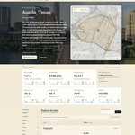
🗺️ Every US ZIP code (33,000+) now has its own free profile page. No login ✨
Redesigned app: Explore, Rate & Compare 💸 One simple plan
Try yours for free: skaldmaps.com/zip/78704/

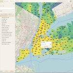
We shipped some UI updates to SkaldMaps: You can now manage your entire workflow from a single screen!
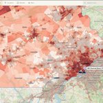
Here's my hypothetical #cabin search in the #NC mountains. 👀
Go try it: skaldmaps.com/
#RealEstate #GIS


Today's #Map: #Birmingham, #Alabama 's pre-1960 housing share shows the city's industrial past. Highlighted: The wonderful Saw's BBQ in #Homewood, AL (made with skaldmaps.com)

In the spirit of #America250: While we don't have pre-1753 housing stock, here's pre 1960 housing share in #Philadelphia.
Highlighted is 520 Chestnut St, also known as Independence Hall, where the Declaration of Independence and the Constitution were signed, built in 1753. 🇺🇸

SkaldMaps is trending on @peerpush_com !
We are your friendly local
location intelligence and real estate rating engine.
peerpush.com/p/skaldmaps

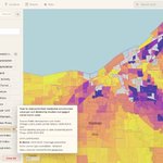
SkaldMaps recently added new housing market and permit-based investment signals. 🎉
For instance, "New Build Value / Home Value" gives you the YtD permitted residential construction value per unit divided by median mortgaged owner home value...

...as a proxy for new permitted housing being expensive or cheap for a local market.
Here's an example for market momentum in the #Cleveland, #Ohio area.
#RealEstateInvestments #LocationIntelligence

SkaldMaps tract data for serious deep dives just got an update: Tract and county views can use amenities, annual weather, and voting estimates! This used to be exclusive to the ZIP level. Here's a proximity map to the nearest @dunkindonuts in #Alabama - I spy a donut dessert.

Today's #Map: #Florida 's #Miami urban area is heavily constrained by protected land and the Miami-Dade Urban Development Boundary (made with skaldmaps.com)


New feature on skaldmaps.com: Try any US #ZIP code and try out pre-filled #RealEstate model and explore #LocationIntelligence without an account.


SkaldMaps now shows you a confidence indicator on how accurate the attribute you're viewing for a particular geography is: Find our how we do it on the brand new 🎉#blog 🎉: skaldmaps.com/blog/2026/06/b…
#GIS #DataQuality


SkaldMaps now shows you a confidence indicator on how accurate the attribute you're viewing for a particular geography is: Find our how we do it on the brand new 🎉#blog 🎉: skaldmaps.com/blog/2026/06/b…
#GIS #DataQuality
