

India's public data, already reconciled. We turn questions about India into evidence you can map, compare and cite. Explore maps on https://xitter.cf/t.co/1dWdFjWHXh
India
Joined April 2026
- Tweets296
- Following188
- Followers335
- Likes32




Spatial India retweeted

Census 2011 says 31% of India is Urban, while World Bank and UN estimate it to be 55% and 63% respectively. So, why does India underestimate its urban population?
@SpatialIndia argues that the fault lies with the Census’s two-box urban/rural classification criteria and calls for a third category for areas in transition.
jungindien.in/blog/dehat-by-…

Spatial India retweeted

In Swades (2004), an engineer from NASA brings electricity to his village.
Some 20 years ago, electricity reaching a village was the sort of achievement that deserved to be celebrated in cinemas.
Launched in 2017, Saubhagya scheme would electrify 2.86 crore households by 2022, including Leisang in Manipur which is counted as the last inhabited census village.
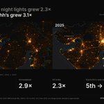
In this satellite image created by @SpatialIndia you can see the growth of bright lights in the farming districts of Eastern UP and Bihar between 2012 to 2024.
Rural India is urbanising rapidly modernising but is the Indian Census equipped to see it?
@JungIndien’s latest essay in collaboration with @SpatialIndia examines the rules behind Census classification, and why India needs a third category for places between villages and towns.
Read here: jungindien.in/blog/dehat-by-…
Spatial India retweeted
The gas sits off the Mahanadi delta. In the delta districts, about 7 in 10 homes still cooked without clean fuel: Bhadrak 23% on clean fuel, Kendrapara 28%, Jagatsinghpur 31%.
Odisha overall is 35%, 4th lowest state. Local supply and city gas could move these numbers fast.
Mapped on @SpatialIndia using NFHS-5.

Spatial India retweeted
Great to see this shipped for district and block administrations. A public version of the same idea runs on @SpatialIndia 15 official sources and 90+ indicators on the same 800+ districts, with the Gati Shakti highway and rail networks as an overlay so infrastructure and outcomes read in one frame.
Spatial India retweeted
The timing alone settles it. India's working-age population starts shrinking in the 2040s, so a population bill would land exactly when the country needs more workers.
And the real driver is already visible across 776 districts: the more women finish 10 years of school, the fewer marry before 18.
That is the whole mechanism, and it needed no law.


Spatial India retweeted
Is Pune really worth sitting at 96th percentile here? 🧵
We pulled up #Pune on @SpatialIndia across 85+ open data indicators. It scores 69/100 on development, with insurance coverage at 14% (11th percentile nationally) and 38 infant deaths per 1,000 births (89th percentile nationally).

Spatial India retweeted
Pulled Raigad up on @SpatialIndia before the master plan lands: 175% credit growth in five years (P96 nationally), 74% of farm holdings under a hectare.
The before-picture of a planned city is public data — it just needs to be visible.

Spatial India retweeted
Biryani is the headline. Iron is the policy.
We visualized child anaemia in every TN district — ages 6–59 months, haemoglobin under 11 g/dL — and the state is nowhere near uniform. Central TN around the Karur–Trichy belt runs darkest. The Coimbatore belt and Kanyakumari, lightest.
Worth a look at which district needs this iron-intervention policy the most. Explore the data live on @SpatialIndia

Spatial India retweeted
India has 4.5 crore+ pending cases in district courts alone. Some districts have 60%+ cases older than 5 years. The backlog isn't just a number — it's people dying while waiting for their turn.
Now layer gender on top: in most districts, women file fewer than 10% of pending cases. The system is slow for everyone — but women barely even make it to the queue.
We mapped court cases indicators across 800+ districts on @SpatialIndia . This data is already public. It just needs to be visible enough that no one can look away.


Spatial India retweeted
District-level population data already shows why this is far more complex than a single policy can handle — and why this committee is overdue.
Murshidabad (Bangladesh border) has a population density of 1,334 per sq km. Jaisalmer (Pakistan border) — 17 per sq km. That's a 78x difference between two border districts. Monitoring "demographic shifts" in one means something entirely different than in the other.
The eastern border tells the real story. Dhubri went from 74% to nearly 80% Muslim population between 2001–2011. Darrang jumped to 64%. In West Bengal, Murshidabad, Malda, and North 24 Parganas all saw Muslim populations cross one-third to two-thirds — with the state's Hindu share dropping from 78.5% in 1951 to 70% by 2011.
Meanwhile Assam's Muslim population grew 286% between 1961–2011, nearly 1.5x the national average of 194%. Nine out of 27 Assam districts had Muslim majorities by 2011, up from six out of 23 in 2001.
The 4,000+ km India-Bangladesh border — much of it unfenced, marshy, or riverine — makes enforcement fundamentally harder than the western border. You can see the population pressure difference clearly on the map: the entire eastern edge of India is deep pink (high density), while the western border fades to near-empty blue.
Good to see data-driven policy finally getting the institutional backing it needs. Explore population, demographics, and 70+ other district-level indicators on @SpatialIndia

Spatial India retweeted
Before the highway: zoom into Odisha's coast. Khordha glows. The districts between? Much darker. A coastal highway connecting Rameshwar to Paradeep could change that.
See it yourself — district-level data on spatialindia.com
Spatial India retweeted
We built the most powerful way to explore India's district-level data.
Now live! 🇮🇳🚀 #IndiaData