

🌐 Global weather updates, stats and stories. 🌐 Tracks and delivers updates on tropical cyclones worldwide.
Jamaica
Joined February 2024
- Tweets2.7K
- Following67
- Followers562
- Likes810






Weather Stats retweeted

Today in hurricane history, 21 years ago on August 11, 2004, Hurricane Charley passed Jamaica’s south coast as a Category 1 storm, bringing strong winds and torrential rainfall, causing one fatality, and racking up $4.1 million USD in damages. Do you remember this hurricane?
Weather Stats retweeted

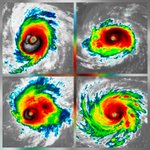
A microwave scan of #Erick showed it was on the way to forming a cyan ring, a sign of coming RI. I would imagine it has done so by now. Lends credence to the stronger end of the envelope.
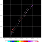
You can now see both the microwave plots and new EPS track data right on the storms page! Much easier to keep track of forecast or structure changes


Weather Stats retweeted
JAMAICA 24-HOUR FORECAST
Sunday Night...Showers and thunderstorms mainly across northeastern and southern parishes.
Monday Morning & Afternoon…Widespread showers and thunderstorms spreading across the island. Strong Gusty Winds expected, up to tropical storm force.
Weather Stats retweeted
Bulletin #1 has been issued, placing Jamaica under a Tropical Storm Warning as at 5:00pm.

Weather Stats retweeted
A Severe Weather Alert is now in effect for Jamaica as the area of low pressure over the southern Caribbean is forecast to further develop and move closer to the island.

Weather Stats retweeted
ATTENTION! Heavy rainfall from a developing system is expected across much of Jamaica starting Monday, November 04, 2024. Even without a named storm, this may disrupt travel, work & school, with possible flash flooding. Stay safe and avoid flooded roads-turn around, don’t drown.
Weather Stats retweeted

I think the strength and size of this storm is going to take a lot of people by surprise. Jamaica and Cuba really need to be on high alert. The western Carribean waters have a lot of relatively untapped heat that goes deep down, so if this storm finds a friendly atmospheric setup, the sky could be the limit while it's down there in the Carribean.


Weather Stats retweeted
Until tropical cyclone genesis forecasting and intensity forecasting become more accurate for potential storms like this one, instead of trying to forecast a specific intensity, like "a 65 mph tropical storm" when something gets close to landfall a few days out, I think a lot more emphasis should be given to inform the general public about the "outlier" possibilities that exist, such as the possibility that this could potentially be a major hurricane when it gets close to or over Jamaica. It takes all the right ingredients falling into place for some of the these worst-case scenarios to come to fruition, so we usually don't explicitly call for worst-case, but I feel like it's important for the public to be aware of the full scope of possibilities. And this goes both ways- if we know that the worst-case scenario for a given potential landfall location is only a minimal hurricane, then if the public feels like meteorologists have the reputation of being fully honest with them in the past, then the public will calmly go about needed preparations without panicking. But when the public feels like they are constantly being surprised by how bad the intensity forecasts are, they will naturally be very worried about even weaker potential storms that pose little threat. And people will also tend to start relying on their own judgement more than actual forecasts. So that's why it is so important for meteorologists and media to convey the full scope of possibilities for any given scenario and helping the public to understand their respective risk factor.

I think it's time for us Jamaicans to take the GFS a bit more seriously now considering how we are much closer in time.....and man the trend is just not our friend, unfortunately. #wxtwitter #Tropicswx


Weather Stats retweeted
As we move towards the end of October, which is traditionally Jamaica's wettest month, we continue to monitor the unstable conditions over the western Caribbean. We have another month to go before the 2024 Hurricane Season draws to a close, so please remain on the alert.

Weather Stats retweeted
Today in earthquake history, 1 year ago on October 30, 2023, one of the strongest earthquakes on record in Jamaica, a moderate magnitude of 5.6, struck in Hope Bay, Portland, causing damage, panic and the closure of most businesses & schools. Do you remember this earthquake?
Weather Stats retweeted

On this date in 2012, Hurricane Sandy achieved her initial peak intensity as a Category 3 before crashing down on the eastern tip of Cuba like a massive rogue wave of 115 mph, October-chilled winds. The storm that she subsequently metamorphosed into in the open Atlantic would be a hybrid Hurricane of unfathomably immense proportions.
(Sat-image credit: CIMSS)
Weather Stats retweeted

Patty is looking for a coco bread

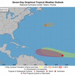
The Caribbean is a spot to watch for tropical mischief towards the end of October.
This is a climatologically favored area this time of the year and models are starting to sniff something out. Next name on the list is #PATTY.
#TropicalUpdate 🌀🌀🌀

Weather Stats retweeted

I will always be convinced that 1988's Hurricane Gilbert was in the wrong basin.
The storm's sheer size and majestic presentation remained unparalleled in the Atlantic Basin's history.

Weather Stats retweeted
Here's an incredible infrared satellite image of the CDO of 1998's Hurricane Mitch.
The uniformness and symmetry of the CDO, as well as the perfect circle-shaped eye are dead indicators of Category 5 intensity.
This is atmospheric perfection at its finest.


Weather Stats retweeted
On this day in 1988, Hurricane Gilbert dealt a direct and catastrophic hit to #Jamaica. Making landfall near Kingston as an extremely menacing Category 3, Gilbert’s siege of 30+ in. of rain, 19 ft. of storm surge, and 125 mph sustained winds disastrously ravaged the island, claiming the lives of 49 people.
(Sat-image credit: CIMSS)
Weather Stats retweeted
A size comparison between two famous Category 5 hurricanes.
1988’s Hurricane Gilbert is on the left and 1992’s Hurricane Andrew is on the right.
Tropical cyclones come in all shapes and sizes.


Weather Stats retweeted
Hurricane Dean (2007) compared to Hurricane Beryl as they raked #Jamaica’s southern coastline. Both storms had Cat 4 winds of 140+ mph when they brushed the island with their stinging cyclonic tentacles.
(Sat-image credit: CIMSS)