

welcome to the official StormTrackingHQ twitter account this twitter account will only tweet about models, SPC risk, Watches issued by NWS
Joined June 2023
- Tweets5.4K
- Following147
- Followers427
- Likes39






Severe Weather MDs 0742 has been issued for parts of #Louisiana, #Arkansas and #Texas
Concerning: Severe Potential Watch Unlikely
Watch Probability: 20%
#Tornado: ≤ 90 mph
#Wind: ≤ 60 mph
Valid until 1:15 pm CST Today
#wxtwitter #wxX #wx #severewx #severe #severeweather #MarginalRisk #DixieAlley #lawx #LAwx #txwx #TXwx #arwx #ARwx #Shreveport #Natchitoches #ElDoradoAR

#TornadoWarning 022 has been issued for #Shreveport LA, Bossier City LA and Red Chute LA until 12:45 pm CST #wxtwitter #wxX #wx #severewx #severe #severeweather #MarginalRisk #DixieAlley #lawx #LAwx
#Tornado
Radar indicated
#Hail
Pea sized possible
Population
260,862
Schools
99
Hospitals
17

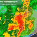
#SevereThunderstormWarning 082 has been issued for #Shreveport LA, Bossier City LA and Greenwood LA until 12:00 pm CST #wxtwitter #wxX #wx #severewx #severe #severeweather #MarginalRisk #DixieAlley #lawx #LAwx #txwx #TXwx
#Wind
Up to 60 MPH
#Hail
Pea sized possible
Population
320,928
Schools
104
Hospitals
21

Severe Weather MDs 0741 has been issued for parts of #Oklahoma and #Texas
Concerning: Tornado Watch #699, #700, #701
#Tornado: 85-110 mph
#Wind: ≤ 60 mph
Valid until 10:45 pm CST Today
#wxtwitter #wxX #wx #severewx #severe #severeweather #SlightRisk #TornadoAlley #okcwx #dfwwx #okwx #OKwx #txwx #TXwx #Durant #McAlester #Muskogee #Ardmore #Ada #GainesvilleTX #Sherman

#TornadoWatch 0701 has been issued for parts of #Kansas, #Oklahoma, #Missouri and #Arkansas until 3:00 am CST #wxtwitter #wxX #wx #severewx #severe #severeweather #SlightRisk #Tornado #TornadoAlley #DixieAlley #dfwwx #arwx #ARwx #okwx #OKwx #kswx #KSwx #mowx #MOwx #Ada #Tusla #BrokenArrow #Owasso #Durant #FayettevilleAR #Muskogee #MiamiOK #Pittsburg #Joplin #IndependenceKS #Bartlesville #FortSmith #McAlester
Probability Hazards
#Tornadoes
40/20%
#Wind
50/20%
#Hail
10/<2%
Combined Severe Hail/Wind
70%
Tornadoes
A couple #tornadoes possible
Hail
Isolated #hail up to quarter size possible
Wind
Scattered gusts up to 70 MPH possible
Population
2,745,530
Schools
1,165
Hospitals
107

Severe Weather MDs 0739 has been issued for parts of #Oklahoma
Concerning: Tornado Watch #699
#Tornado: 100-125 mph
#Wind: 55-70 mph
#Hail: ≤ 1.25 in.
Valid until 8:00 pm CST Today
#wxtwitter #wxX #wx #severewx #severe #severeweather #EnhancedRisk #TornadoAlley #okcwx #okwx #OKwx #Norman #OklahomaCity #Stillwater

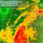
#SevereThunderstormWarning 081 has been issued for #Wichita KS, Derby KS and Haysville KS until 7:15 pm CST #wxtwitter #wxX #wx #severewx #severe #severeweather #EnhancedRisk #TornadoAlley #kswx #KSwx
#Wind
Up to 70 MPH
#Hail
Pea sized possible
Population
511,627
Schools
138
Hospitals
13

#FlashFloodWarning 037 has been issued for Boca Raton FL, Deerfield Beach FL and Lighthouse Point FL until 8:00 pm EST #wxtwitter #wxX #wx #flashflood #flood #flwx #FLwx
Safety Information
Move immediately to higher ground
Avoid walking or driving through flood waters
Population
326,798
Schools
38
Hospitals
3

Severe Weather MDs 0737 has been issued for parts of #Oklahoma and #Texas
Concerning: Tornado Watch #699
#Tornado: 100-125 mph
#Wind: 55-70 mph
#Hail: 1.00-1.75 in.
Valid until 7:30 pm CST Today
#wxtwitter #wxX #wx #severewx #severe #severeweather #EnhancedRisk #TornadoAlley #ntxwx #dfwwx #txwx #TXwx #okwx #OKwx #WichitaFalls

#TornadoWatch 0700 has been issued for parts of #Texas until 11:00 pm CST #wxtwitter #wxX #wx #severewx #severe #severeweather #EnhancedRisk #Tornado #TornadoAlley #ntxwx #dfwwx #abiwx #SanAngelo #Brownwood #GrahamTX #Abilene #MineralWells #GainesvilleTX #Sweetwater #Weatherford #Stephenville
Probability Hazards
#Tornadoes
40/20%
#Wind
40/30%
#Hail
40/30%
Combined Severe Hail/Wind
70%
Tornadoes
A couple #tornadoes possible
Hail
Scattered #hail up to two inch size possible
Wind
Scattered gusts up to 75 MPH possible
Population
840,403
Schools
494
Hospitals
38

Severe Weather MDs 0736 has been issued for parts of #Texas
Concerning: Severe Potential Watch Likely
Watch Probability: 80%
#Wind: 65-80 mph
#Hail: 1.50-2.50 in.
#Tornado: 85-110 mph
Valid until 6:00 pm CST Today
#wxtwitter #wxX #wx #severewx #severe #severeweather #EnhancedRisk #TornadoAlley #ntxwx #dfwwx #abiwx #txwx #TXwx #Abilene #GrahamTX #Brownwood #Sweetwater #Haskell

Severe Weather MDs 0734 has been issued for parts of #Oklahoma and #Kansas
Concerning: Tornado Watch #699
#Tornado: 100-125 mph
#Wind: 65-80 mph
#Hail : 1.00-1.75 in.
Valid until 5:45 pm CST Today
#wxtwitter #wxX #wx #severewx #severe #severeweather #EnhancedRisk #TornadoAlley #okcwx #okwx #OKwx #kswx #KSwx #PoncaCity #Stillwater #ArkansasCity #Enid

Severe Weather MDs 0733 has been issued for parts of #Texas
Concerning: Severe Potential Watch Possible
Watch Probability: 60%
#Tornado: 100-125 mph
#Wind: 65-80 mph
#Hail: 1.00-1.75 in.
Valid until 4:00 pm CST Today
#wxtwitter #wxX #wx #severewx #severe #severeweather #EnhancedRisk #TornadoAlley #ntxwx #abiwx #dfwwx #txwx #TXwx #Dallas #FortWorth #Denton #MineralWells #GrahamTX #Haskell #Abilene #Weatherford #Brownwood #Stephenville #SanAngelo

#TornadoWatch 0699 has been issued for parts of #Texas, #Oklahoma and #Kansas until 10:00 pm CST #wxtwitter #wxX #wx #severewx #severe #severeweather #EnhancedRisk #Tornado #TornadoAlley #ntxwx #okcwx #okwx #OKwx #txwx #TXwx #kswx #KSwx #WichitaFalls #Vernon #Altus #Hutchinson #Wichita #Woodward #PoncaCity #Stillwater #OklahomaCity #Norman #Enid #Lawton #ElkCity #ArkansasCity #McPherson #Salina #GreatBend #HaysKS #RussellKS #Ardmore
Probability Hazards
#Tornadoes
50/30%
#Wind
50/40%
#Hail
40/30%
Combined Severe Hail/Wind
90%
Tornadoes
A couple strong #tornadoes possible
Hail
Scattered #hail up to two inch size possible
Wind
Scattered gusts up to 75 MPH possible
Population
3,311,529
Schools
1,504
Hospitals
152

Severe Weather MDs 0732 has been issued for parts of #Kansas, #Texas and #Oklahoma
Concerning: Severe Potential Watch Likely
Watch Probability: 80%
#Tornado: 120-145 mph
#Wind: 65-80 mph
#Hail: 1.00-1.75 in.
Valid until 3:00 pm CST Today
#wxtwitter #wxX #wx #severewx #severe #severeweather #EnhancedRisk #TornadoAlley #ntxwx #okcwx #okwx #OKwx #kswx #KSwx #txwx #TXwx #OklahomaCity #Norman #Wichita #Hutchinson #McPherson #PoncaCity #Enid #Stillwater #ArkansasCity #ElkCity #Altus #Woodward #Vernon #WichitaFalls

#TornadoWatch 0698 has been issued for #Texas, #NewMexico and #Oklahoma until 2:00 am CST #wxtwitter #wxX #wx #severewx #severe #severeweather #SlightRisk #Tornado #TornadoAlley #phwx #nmwx #NMwx #okwx #OKwx #txwx #TXwx #Tucumcari #Dalhart #GuymonOK #Amarillo #Hereford #Borger #Clovis #RoswellNM
Probability Hazards
#Tornadoes
30/20%
#Wind
50/10%
#Hail
<5/<5%
Combined Severe Hail/Wind
60%
Tornadoes
A couple #tornadoes possible
Hail
Isolated #hail up to half inch size possible
Wind
Scattered gusts up to 70 MPH possible
Population
551,055
Schools
316
Hospitals
28

#SevereThunderstormWatch 0697 has been issued for parts of #NewMexico until 9:00 pm MST #wxtwitter #wxX #wx #severewx #severe #severeweather #SlightRisk #TornadoAlley #nmwx #NMwx #SantaFe #SantaRosa #Ruidoso #LasVegasNM
Probability Hazards
#Tornadoes
20/<2%
#Wind
30/30%
#Hail
<5/<5%
Combined Severe Hail/Wind
50%
Tornadoes
A couple #tornadoes possible
Hail
Isolated #hail up to half inch size possible
Wind
Isolated gusts up to 75 MPH possible
Population
247,730
Schools
144
Hospitals
9

Severe Weather MDs 0731 has been issued for parts of #NewMexico
Concerning: Severe Potential Watch Possible
Watch Probability: 40%
#Tornado: 85-110 mph
#Wind: 55-70 mph
#Hail: ≤ 1.25 in.
Valid until 4:15 pm MST Today
#wxtwitter #wxX #wx #severewx #severe #severeweather #SlightRisk #TornadoAlley #nmwx #NMwx #Albuquerque #TruthorConsequences #SantaFe #LasVegasNM

#SevereThunderstormWatch 0694 has been issued for parts of #NewMexico and #Texas until 9:00 pm MDT #wxtwitter #wxX #wx #severewx #severe #severeweather #SlightRisk #TornadoAlley #nmwx #NMwx #txwx #TXwx #SliverCity #Albuquerque #LasVegasNM #TruthorConsequences #Ruidoso #SantaFe #SantaRosa #RoswellNM #Deming #LasCruces #ElPaso #Alamogordo
Probability Hazards
#Tornadoes
10/<2%
#Wind
40/20%
#Hail
50/40%
Combined Severe Hail/Wind
80%
Hail
Scattered #hail up to Apple size possible
Wind
Scattered gusts up to 70 MPH possible
#Lightning
Frequent #lightning possible
Population
2,753,094
Schools
1,064
Hospitals
63

Severe Weather MDs 0730 has been issued for parts of #Texas and #NewMexico
Concerning: Severe Potential Watch Likely
Watch Probability: 80%
#Hail: 1.50-2.50 in.
#Wind: 55-70 mph
#Tornado: ≤ 90 mph
Valid until 1:15 pm MDT Today
#wxtwitter #wxX #wx #severewx #severe #severewather #SlightRisk #TornadoAlley #nmwx #NMwx #txwx #TXwx #SliverCity #Albuquerque #LasVegasNM #TruthorConsequences #Ruidoso #SantaFe #SantaRosa #RoswellNM #Deming #LasCruces #ElPaso #Alamogordo
