

Disseminating information on natural hazards for Trinidad and Tobago and Lesser Antilles
Trinidad and Tobago
Joined April 2014
- Tweets17.8K
- Following397
- Followers22.5K
- Likes1.1K


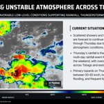


5:50 PM - Street flooding ongoing on the Eastern Main Road, Guaico, in the vicinity of Blue Mountain following a strong thunderstorm across northeastern Trinidad.
Between 25 and 55 mm of rainfall fell across the area over the past 2 hours.
Expect traffic delays.
Forecast: ttweathercenter.com/forecast…
5:15 PM - A strong thunderstorm continues to intensify as it moves northwest across north-central Trinidad, producing heavy to violent rainfall across northeastern and north-central Trinidad, along with frequent lightning.
Gusty winds, frequent lightning, and short-lived street flooding are the primary hazards, favoring Trinidad.
Forecast: ttweathercenter.com/forecast…

As forecast, scattered showers and thunderstorms are affecting Trinidad and Tobago, with locally strong storms moving across northern and central Trinidad and the Gulf of Paria, bringing frequent lightning, locally heavy rainfall, and wind gusts up to 50 km/h.
Over the past hour, over 450 lightning flashes have been detected across T&T, with the highest on-shore counts across east-central Trinidad and northeastern Trinidad.
Thunderstorm activity and rainfall will continue and gradually diminish into the night.
Gusty winds, frequent lightning, and short-lived street flooding are the primary hazards, favoring Trinidad.
Forecast: ttweathercenter.com/forecast…

Over the past hour, scattered thunderstorms have produced frequent lightning across Trinidad, south and west of Tobago, and over the Columbus Channel, Gulf of Paria, and Caribbean Sea.
Thunderstorms are moving across Trinidad presently, producing frequent lightning.
See flashes in your area: ttweathercenter.com/live-lig…

4:05 PM - Scattered showers and thunderstorms are affecting both islands this afternoon, with locally heavy rainfall affecting northeastern, central, west-central, and southwestern Trinidad.
Primary hazards: Gusty winds (>50 km/h), locally heavy rainfall producing short-lived street flooding, and lightning.
Unsettled weather is forecast to continue into the night, gradually settling near midnight, with early morning showers and isolated thunderstorms expected.
Details: ttweathercenter.com/forecast…

7:45 PM - Scattered showers, isolated thunderstorms, and cloudy skies are forecast to continue affecting T&T overnight tonight through Thursday.
Unsettled weather is forecast to continue into the weekend, bringing locally heavy rainfall favoring eastern areas of Trinidad and across Tobago.
Forecast for your area: ttweathercenter.com/forecast…
What's the weather like in your area?

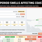
With sunny skies this weekend, a beach trip will be tempting. Exercise caution from this afternoon (~4 PM) through Tuesday as long-period swells move in, primarily affecting north-facing coastlines of both islands.
These swells will produce occasional large, battering waves in nearshore areas, particularly across Tobago’s north coast from tonight, Trinidad’s north coast from tomorrow, and north-facing coasts of the Gulf of Paria by Sunday afternoon. There will also be an elevated risk of rip currents.
Details: ttweathercenter.com/seas-for…

12:45 AM - Scattered showers and thunderstorms are beginning to affect eastern Trinidad and Tobago as increasingly favorable upper-level conditions develop across the region, enhancing shower/thunderstorm development.
Variably cloudy conditions are forecast today across T&T, with isolated to scattered showers and locally strong thunderstorms, particularly east of T&T.
Main hazards: Frequent lightning, gusty winds, and heavy rainfall in thunderstorm activity, with street/flash flooding likely in downpours. Overall, higher rainfall is forecast across eastern areas.
Forecast: ttweathercenter.com/forecast…

2:30 PM - Isolated thunderstorms and scattered showers/rain bring cooler afternoon conditions across Trinidad, while hot, sunny conditions continue across Tobago.
With an isolated afternoon thunderstorm, Piarco's 2:00 PM temperature hit 23.7°C, lower than this morning's minimum of 24.6°C!
Between 25 and 50 mm of rainfall has been recorded across west-central, central, and east-central Trinidad as locally heavy rainfall continues to affect the island.
Forecast: ttweathercenter.com/forecast

1:56 PM - A major M8.0 (preliminary, subject to change) earthquake has struck south of Panama, with hazardous tsunami waves forecast for the Pacific coastlines of:
· PANAMA
· COLOMBIA
· COSTA RICA
· ECUADOR
· PERU
· NICARAGUA
· GUATEMALA
· EL SALVADOR
· MEXICO
There is NO tsunami threat to T&T and the Lesser Antilles.
Details on the earthquake via the USGS: earthquake.usgs.gov/earthqua…
Details on the tsunami threat via the PTWC: tsunami.gov/

9:55 PM - The Eastern Main Road-Churchill Roosevelt Highway Link Road (northbound, heading into Morvant) in the vicinity of Maritime Plaza, Barataria is impassable due to a large fallen tree, bringing down utility lines. Seek alternate routes.
Scattered showers and thunderstorms are affecting Trinidad as a tropical wave moves across the region.
Forecast: ttweathercenter.com/forecast…
10:30 PM - Heavy rainfall is affecting the eastern half of Trinidad, seen here in Sangre Grande, as repeated rounds of heavy showers and thunderstorms move from the southeast to northwest across the same areas. Street/flash flooding is likely across the eastern half of Trinidad overnight.
Forecast: ttweathercenter.com/forecast…
10:15 PM - Over the past hour, more than 500 lightning flashes have been detected, primarily off Trinidad's southeastern coast, visible across much of central and southern Trinidad.
Heavy rainfall is also affecting southern and eastern areas as these slow-moving showers and thunderstorms move onshore, with light to moderate rainfall elsewhere across Trinidad and across eastern Tobago.
Forecast: ttweathercenter.com/forecast…

7:20 PM - Isolated thunderstorms south of Trinidad are slowly drifting northwest toward the island's south coast. Elsewhere, mostly cloudy skies continue.
Overnight, isolated thunderstorms and showers are forecast to move generally from southeast to northwest across both islands.
Main hazards: Heavy downpours may produce street/flash flooding, with gusty winds and lightning in thunderstorms.
Forecast: ttweathercenter.com/forecast…

The Adverse Weather Alert has been discontinued for the western half of Trinidad after heavy afternoon showers and thunderstorms caused flooding across west-central Trinidad.
While less impactful weather is forecast, isolated showers and thunderstorms are still forecast overnight for T&T.
Details: ttweathercenter.com/2026/10/…

3:20 PM Oct 5, 2026 - Flooding ongoing on at St. John’s Road off Orange Field Road, Carapichaima. Avoid venturing into flood waters. Expect traffic delays.
Adverse Weather Alert in effect for the western half of Trinidad until 5:00 PM today: ttweathercenter.com/2026/10/…
2:00 PM Oct 5, 2026 - Flooding ongoing on Orange Field Road, Carapichaima in the vicinity of Carlson Chemicals. Avoid venturing into flood waters. Expect traffic delays.
Adverse Weather Alert in effect for the western half of Trinidad until 5:00 PM today: ttweathercenter.com/2026/10/…
1:50 PM - Street flooding ongoing on Cedar Hill Road, Cedar Hill, Claxton Bay near Soledad Road. Avoid venturing into flood waters. Expect traffic delays.
Adverse Weather Alert in effect for the western half of Trinidad until 5:00 PM today: ttweathercenter.com/2026/10/…