

Manager of Meteorology Operations at Xcel Energy - focused on wildfire mitigation while powering society.
Denver, CO
Joined March 2012
- Tweets18.1K
- Following1.5K
- Followers15.9K
- Likes17.3K



Taylor Trogdon retweeted

On August 20 every year, Dr. Bill Gray would ring a bell denoting the start of the climatologically most active portion of the Atlantic #hurricane season. Historically, about 2/3 of all Atlantic hurricane activity occurs between August 20 - October 10.

Taylor Trogdon retweeted

– Atualização da Avaliação de Danos –
O tornado violento que atingiu Piraí do Sul, Paraná, Brasil, em 8 de agosto, foi classificado como um tornado F4, com ventos estimados em pelo menos 380 km/h (236 mph), segundo o PREVOTS (Brasil). O tornado percorreu uma trajetória de 26,1 km (16,2 milhas) e atingiu uma largura máxima de 750 m (820 jardas).
A classificação F4 baseou-se principalmente nos danos extremos à vegetação e ao solo ao longo de partes da trajetória. Isso incluiu a remoção completa de galhos e folhagem de árvores nativas de tronco rígido, o descascamento de mais de 60% dos troncos e um padrão característico de abrasão (efeito de lixamento) em suas superfícies. O tornado também arrancou grandes áreas de pastagem a profundidades de 10 a 30 cm, com áreas individuais medindo aproximadamente 127 a 188 m². Determinou-se que esses indicadores de danos excepcionalmente intensos eram compatíveis com ventos de pelo menos 380 km/h (236 mph).
Este é o segundo tornado violento (F/EF4+) de 2026, excluindo-se o tornado de Kushva, na Rússia, ocorrido em 22 de junho — classificado como IF3 pelo ESWD, embora um avaliador local lhe tenha atribuído a classificação F4.


Taylor Trogdon retweeted

Why is it ‘cancelled’ in the U.K. but ‘canceled’ in the U.S.?
Because we gave them that L in 1776.
Taylor Trogdon retweeted

Sorry for radio silence, nonstop, filming tornadoes with my jaw on the floor in North Central Illinois.

Taylor Trogdon retweeted

Radar: 3:47 PM 5/5/26
Precipitation is increasing in coverage this afternoon with rain switching to snow in many locations across the urban corridor including at our office in Boulder. Thunder snow is occurring in the mountains as shown by the lightning symbols. #cowx


Taylor Trogdon retweeted

**ALL-TIME RECORD**
Providence is up to 32.8" and counting, surpassing the Blizzard of '78. Records date to 1904. Still snowing. #wbz

Taylor Trogdon retweeted

Please join me in celebrating our 156th birthday. The National Weather Service was created by a joint resolution of Congress on February 9, 1870. From a telegraph to issuing our first Advisory from the cloud yesterday, our public safety/national security mission stands strong to safeguard lives, property, and the economy. I’m humbled to lead this 24/7 team that goes above and beyond every day.
Taylor Trogdon retweeted
@NWSSPC meteorologists issued 26 winter mesoscale discussions (MDs) in the past 48 hrs. The most winter MDs for any 2 day period in our database (2008-present).
Previous record:
20 (Feb 21-22, 2011)
Nearly 8000 winter storm reports issued by @NWS offices during the same period.


Taylor Trogdon retweeted

👀🤝

Look at this box that we just got... it's from one of the only remaining undefeated teams in college football!
The Missouri Tigers have such great colors, an awesome mascot, and one of my favorite running backs in the country!!
Thank you Coach Drinkwitz and @MizzouFootball!!
Taylor Trogdon retweeted

Last night, the 53rd Weather Reconnaissance Squadron flew into the eye of Hurricane Erin—and captured imagery of the breathtaking stadium effect.
These missions provide critical data to the NHC to improve forecasts, helping keep communities safe before the storm makes landfall.#readynow #weatherready
Taylor Trogdon retweeted

NEW: The NWS receives permission to hire up to 450 meteorologists/hydrologists/radar technicians after DOGE-related cuts. Agency also given a public safety exemption from federal hiring freeze. (1/2)
Taylor Trogdon retweeted

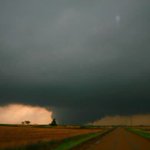
A new hazardous #weather warning system proved its mettle in March during #tornado outbreaks which produced over 115 confirmed tornadoes resulting in $6.25 billion in damage.
Learn about the Hazard Services Convective developed by @noaagsl: research.noaa.gov/new-hazard…

ALT Dark clouds swirl together at the top of the frame and a tornado cone begins to form below the clouds above a cornfield. Flat farmland extends as far as the eye can see; on the horizon, the sun is showing through lighter clouds.
Taylor Trogdon retweeted
This is only the 3rd time since at least 2006 (when we can easily query our records), and likely only the 3rd time in SPC history based on available data, that a High Risk has been issued on Day 2.
The 2 previous times were:
4/14/2012
4/7/2006

12:32pm CDT #SPC Day2 Outlook High Risk: in central/southern parts of MS/AL spc.noaa.gov/products/outloo…

Taylor Trogdon retweeted

Something that gets overlooked on these fire days... Places like OKC, Wichita, Lubbock and other cities could have a single structure fire that could turn into a catastrophic urban conflagration.

Taylor Trogdon retweeted

In 1991, the first webcam was deployed at a Cambridge University computer lab. Its sole purpose is to monitor a particular coffee maker so that lab users could avoid wasted trips to an empty coffee pot.

Taylor Trogdon retweeted

Another very serious fire weather event coming for SoCal. Something that sticks out to me: even though winds will be a little weaker (not much) than 1/7 event, RH’s are going to be exceptionally dry come Mon night and Tue morning, much drier than that event. 2-5% values likely

Taylor Trogdon retweeted

The @NWSSaltLakeCity office — home to both the Weather Forecast Office and the Colorado Basin River Forecast Center — does a great job keeping Utah prepared for whatever Mother Nature has in store.
While I was hoping for a white Christmas, current models suggest more active winter weather between Christmas and New Year’s. We encourage Utahns to prepare and stay safe by visiting weather.gov/safety/winter.


Taylor Trogdon retweeted

December 10-11, 2021:
The worst December outbreak in US history impacted the Midwest and Mid-South. 24 of the 71 confirmed twisters were significant (EF2+). Several dominant multi-state supercells were responsible for intense tornado families. 92 people were killed.
#wxhistory


Taylor Trogdon retweeted

Here's the NHC cone progression for Hurricane #Milton.
The first center-line forecast was about 12 miles from the actual landfall point, and stayed relatively consistent through most of the advisories.
We can also see Milton's incredible and historic RI phase in the Southern Gulf.
The NHC absolutely nailed the track of Milton into Florida.
#flwx #tropics #weather