

The official account for current information for the Tamarack Fire near Markleeville, CA.
Markleeville, CA
Joined July 2021
- Tweets163
- Following6
- Followers1.4K
- Likes2
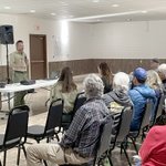


#CarsonRD hosted a public meeting near #Markleeville, CA, to discuss the Tamarack Restoration Project. The project is in the initial planning stage and will address the restoration needs of the area burned by the #TamarackFire in 2021. READ MORE... fs.usda.gov/detail/htnf/news…

2
The #CarsonRD wants to remind visitors to be aware of their surroundings, stay out of closed campgrounds, and follow warning signs when recreating in the area burned by the 2021 #TamarackFire near #Markleeville, CA. READ MORE... fs.usda.gov/detail/htnf/news…

#TamarackFire on the #CarsonRD near #Markleeville, #California has been declared controlled. The fire reached this milestone after steady precipitation over the weekend provided much needed moisture to the fire area. fs.usda.gov/detail/htnf/news…

5
Tamarack Fire Information retweeted

Know Before You Go: @NWS (weather.gov/forecastmaps); Ranger District for current info for the area (https://xitter.gq/t.co/exjZhJAI9z); Forest road & trail conditions (https://xitter.gq/t.co/ov2IPgOJNx); and #Nevada & eastern #California roads (dot.nv.gov/travel-info or dot.ca.gov/travel).

A flood watch is in effect for parts of California and Nevada, including Douglas County. For more info go to douglascountynv.gov/news/wha…
The risk of flood is especially high in areas in or around burn scars Learn more in our guide below.
#FloodAfterFire
livingwithfire.com/wp-conten…

ALT Nevada Flood After Fire Guide cover image, with subtext "A Post-Fire Resource for Nevada Communities"
Tamarack Fire Information retweeted
Reminder heavy precipitation creates a risk of flooding and debris flows especially in steep canyons and burn scars without warning. Never attempt to drive or hike through an area that has been flooded or a debris flow has occurred.


Here are FREQUENTLY ASKED QUESTIONS regarding limited recreation opportunities on the #BridgeportRD and #CarsonRD over #LaborDay weekend.... fs.usda.gov/Internet/FSE_DOC…


4
Tamarack Fire Information retweeted
All California lands managed by #BridgeportRD & #CarsonRD are only open to day use unless camping in concession-operated campground or staying in a resort or recreation residences on #NFS lands, except closed areas. #PCT & #TahoeRim Trails are also closed. fs.usda.gov/detail/htnf/news…

Tamarack Fire Information retweeted
Due to the #CaldorFire, all areas, campgrounds, trails, and roads on the #CarsonRD from south of U.S. Route 50 to the southern district boundary and from the western district boundary to the Nevada State line. For more info... fs.usda.gov/detail/htnf/news…

Tamarack Fire Information retweeted

We made the difficult decision to temporarily close all National Forests in CA in order to better provide public & firefighter safety due to extreme fire conditions. This will be effective on Aug. 31 at 11:59 p.m. through Sept. 17 at 11:59 p.m. MORE: go.usa.gov/xMqCs

The Tamarack Fire is 82% contained and 18% confined. To see what this means, go to inciweb.nwcg.gov/incident/ar…
#TamarackFire finishing up repair and Hazardous Tree Mitigation. Sierra Front IMT transferring command to Type 4 Incident Commander 8/23/2021 at 6am.

#TamarackFire will complete Hazardous Tree Mitigation and suppression repair this weekend.

#TamarackFire completes Hazardous Tree Mitigation in Pleasant Valley. Daily temps returning to seasonal average. SFIMT transitioning to Type 4 team Monday Aug. 23rd.

3
#TamarackFire continues to see cooler tamps and clearer skies today. Personnel numbers drop as work is completed.

HWY 395 is open through Douglas county and #TamarackFire burn area. For more HWY 395 closure info. visit;
roads.dot.ca.gov/
nvroads.com/
#TamarackFire sees cooler temps in the region. Smoke and haze continue.

#TamarackFire is NOT producing the smoke in the Carson Valley or the surrounding area. The smoke is coming from the #caldorfire in Grizzly Flats Ca. For more information on the Caldor Fire visit;
inciweb.nwcg.gov/incident/78…
#Tamarackfire will see RED FLAG conditions and smoke from the #caldorfire throughout the region today.

HWY 395 is OPEN through the #TamarackFire area. 395 closed Doyle to the Lassen turn off north of Susanville due to the #DixieFire. Smoke coming into the #TamarackFire area is from the #CaldorFire.
Information can be found at;
inciweb.nwcg.gov/incident/76…
inciweb.nwcg.gov/incident/78…
#TamarackFire A Fire Weather Watch has been put in place through Tuesday evening in the region for high temps., low humidity and gusty winds.
