

This is an archived account and is not being updated. For the latest updates follow @USGS.
- Tweets2K
- Following115
- Followers4.8K
- Likes337


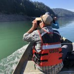





ALT A hydrologic technician conducts a routine visit to Crater Lake near Crater Lake, Oregon. (Photo: Tom Craig, USGS Oregon Water Science Center)


ALT Educational poster from the Water Science School that illustrates where water is in a desert environment, how it moves, and different ways water is used both naturally and through human interaction.


ALT An adult dragonfly at Lake Clark National Park & Preserve (Alaska) in 2015.

ALT View from the SE rim of McDermitt caldera, Nevada and Oregon, showing rhyolite lavas overlain by thin outflow McDermitt Tuff in the south wall of the caldera. The low area that makes up most of the photo is intracaldera tuffaceous sediment. This is Thacker Pass, the site of largest and highest-grade lithium deposits in the region. Photo by Chris Henry, Nevada Bureau of Mines and Geology. Photo by Chris Henry, Nevada Bureau of Mines and Geology.


ALT A wildfire at night with a wall of fire in the background behind the silhouette of a wildland firefighter.



ALT A deer stands in a shallow body of water under a lush rain forest with moss covered trees.


ALT On a dark blue background, we see a turquoise illustrated river. Text on the image reads, “New Baseflow Forecast Tool. Find out how much water will be available if there is no rain. Download forecasts for thousands of locations across the US at usgs.gov/baseflow. Join us for a demo of the tool at our webinar on Thursday May 9th, 2 PM EDT.” We see a small screenshot of the Tool. The white USGS logo is in the bottom left.

ALT Image of the globe highlighting the U.S - with text "There's no place like our Home - Happy Earth Day".

ALT Text reads: Cataloochee Creek near Cataloochee, North Carolina (03460000). Photo collage: From left to right. Top row: Photo of the creek flows through a forest full of fall foliage. Photo of the gage next to a creek in fall foliage. Photo of flowers near the creek. Bottom row: Photo of the gage next to the creek with bare trees. Photo of the gage with snow. A sign with information about the gage can be seen. Photo of the gage with trees with green foliage surrounding.


ALT The gage house by Cataloochee Creek in the woods.

ALT The bridge on Cataloochee Creek in the woods.

ALT The gage house by Cataloochee Creek in the woods from the bridge.