

Official Twitter account of the Dept. of Earth Science at Utah Valley University. We do geology, geography, & environmental science!
Orem, Utah
Joined October 2019
- Tweets86
- Following26
- Followers48
- Likes45


UVU Earth Science retweeted

Coring the the Great Salt Lake is underway... Day 1 was a success. We hope to constrain the age of movement on faults and explore shaking proxies, ie sediment remibilzation adjacent to the scarp, using the 2020 Magna earthquake as a calibration.


UVU Earth Science retweeted

What lies beneath the Great Salt Lake? Great to finally have Chirp data rolling in on this lake paleoseismology project with @DBrothersSC and @neotectonics. Profile shows debris flow/landslide near Antelope Island buried by lake sediments.


UVU Earth Science retweeted

#ChamplainTowersSouth tilt time series shows a peculiar pattern. South vs north was tilting at a rate of 17.8 microrad/yr and there was a turning point in 2018, any guesses on what could cause the tilt and turning point? @virginia_tech @Sentinel1a

UVU Earth Science retweeted
Good haul on day 1 of coring GSL seds! Last photo is “brine shrimp fecal pellet mud” buried by sand sourced from a lake bottom fault scarp.


UVU Earth Science retweeted

First official day as Faculty Senate President at @UVU . Excited to work for faculty needs and to keep us moving forward.


UVU Earth Science retweeted
WE ARE #1 FOR EARNINGS RIGHT OUT OF COLLEGE WHEN COMPARED TO OTHER UNIVERSITIES IN THE STATE!!!
uvu.edu/news/2021/03/2021_03…

UVU Earth Science retweeted

It's #FreeMapMonday! Retweet and follow us for a chance to win the map of Canyonlands NP, UT!
#USGSStore (U.S. residents only)

UVU Earth Science retweeted

Latest update to the @USGSTNM 3D Elevation Program #lidar data collection in OT: 12 datasets, inc coverage of red rock country in S UT (e.g., Grand Staircase-Escalante NM). Here's the confluence of Buckskin Gulch (left - "longest slot canyon in the 🌎") w/ the Paria River Canyon


UVU Earth Science retweeted
Also in this batch of #3DEP data is a large #lidar dataset covering west-central Colorado (area around Gunnison). Below: a portion of the Black Canyon of the Gunnison River gorge in @BlackCanyonNPS (left) and the Crested Butte area, inc @skicrestedbutte.


UVU Earth Science retweeted
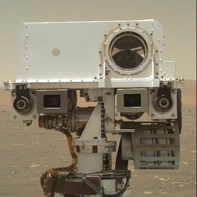
Your front-row seat to my Mars landing is here. Watch how we did it.
#CountdownToMars
UVU Earth Science retweeted

It's been such an exciting week with Perseverance's successful landing on Mars! For anyone curious about what working in mission operations for Mars rovers is like, check out our interview with @tanyaofmars here:
rocket-women.com/2017/07/mee…
#rocketwomen #Perseverance #womeninSTEM

UVU Earth Science retweeted

A “Radically Different” World Map? mappingasprocess.net/blog/20… #mappingasprocess

UVU Earth Science retweeted

High to Extreme avalanche danger in northern Utah. Avoid all avalanche terrain.

UVU Earth Science retweeted

Map of historical seismicity for today's M7.1 earthquake near Honshu & cross-section with projected mechanisms. M9.1 Tohoku quake is directly up-dip. Based on orientation of mechanism compared to seismicity, this quake may have occurred within subducting slab, not on interface.


UVU Earth Science retweeted

50 years ago this week, one of the faults bounding L.A. ruptured in a M6.6 quake. The mountains lurched ~2 m up over the valley, teaching us some big lessons about how faults literally intersect society. It’s #FaultFriday and we’re talking about the Sierra Madre fault! 🧵

ALT Oblique map of LA Basin
UVU Earth Science retweeted

It's been a while that I haven't posted. So here is an old fat slab subduction model. This is likely a process occuring in Central Andes 35 Ma ago. #Geodynamics #Subduction #ASPECT
UVU Earth Science retweeted

#FridayFun: What did the legend Robin Williams have to say about #earthquakes in #California?! #Standup #RobinWilliams
