

Official Twitter account for the University of Wisconsin-Madison's Arthur H. Robinson Map Library, the #1 source for maps and GIS data on campus
Madison, WI
Joined April 2013
- Tweets144
- Following77
- Followers391
- Likes42






Robinson Map Library retweeted

Jaime is kicking off #DayOfTheBadger in the Robinson Map Library with a warm cup of coffee. Be sure to tag @UWMadisonGeog with pictures of you celebrating #DayOfTheBadger

Robinson Map Library retweeted
Tomorrow is #DayOfTheBadger! Learn more at: geography.wisc.edu/madgeogne…

Robinson Map Library retweeted
Sydney Davison repping #DayOfTheBadger while helping repair an old map in the map library. Who else has a cow shirt they want to show off? #DayOfTheBadger
dayofthebadger.org/campaigns…

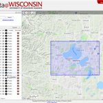
Just added 300 new aerial photo records to #geodatawi for 2020 NAIP and 2018-2020 WROC imagery for Wisconsin counties geodata.wisc.edu/?f%5Bdct_is…
We just launched a new series of 'how to' videos - featuring tips on finding data, maps & imagery in the #geodatawi geoportal: geodata.wisc.edu/pages/video…
Robinson Map Library retweeted
Shout out to @jymemart, Map & Geospatial Data Librarian @UWRobinsonMap, for continuing to support research and learning by scanning aerial photos from the library online request form - for remote library users. Visit online for map and data needs: geography.wisc.edu/maplibrar…

819 new Wisconsin geospatial datasets added to geodata.wisc.edu/ this summer - including 2020 county foundational layers, NG-911, and 2018 NAIP
Robinson Map Library retweeted

Check out our great interview with Dan Seidensticker, GIS Specialist from Greater Madison MPO. bit.ly/3ffLGOC Interview conducted by @jymemart @UWRobinsonMap #GIS #Madison

New 2020 Wisconsin county geospatial data is currently being added to the UW Geoportal - 358 layers and counting:
geodata.wisc.edu/
Highlight on Wisconsin coastal data layers in the new GeoData 2.0 Geoportal geodata.wisc.edu/

We're excited to share the new and improved Wisconsin Geoportal - geodata.wisc.edu/ We focused on new ways to develop collections, which means access to MORE data & maps from agencies & organizations across WI - including the geospatial archive at the Robinson Map Library
Big News! For the first time since it's initial launch in 2014, ALL geospatial data (over 2,500 datasets!) in the GeoData@Wisconsin portal are PUBLIC and freely downloadable by anyone. No restrictions on access is a WIN for data consumers everywhere! geodata.wisc.edu/opengeoport…

Looking for GIS data? The B1G Geoportal has a sleek new look! Now it's even easier to find data & scanned maps from all participating institutions: geo.btaa.org/

The WI Idea in action! Read about our awesome project with Grant County: geography.wisc.edu/madgeogne…

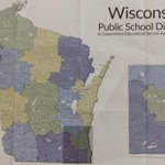
Excited to add this to our collection today! Updated WI public school districts map, courtesy of our wonderful DPI. Thanks to @ohthatswitte for providing us with a copy!

Challenge accepted from @NYPLMaps
-7 days, 7 b&w photos of library life
-No humans, no explanations
-Challenge someone new every day!
For day 1 we challenge @AGSLib
#LibraryLife

So many maps! We're ready for the #UWScienceExpeditions campus open house tonight 6:30-9:00pm!

This Friday! Visit the Map Library and historic Science Hall on April 6th during #UWScienceExpeditions

Almost 9,000 GIS datasets and scanned maps are now discoverable from the Big Ten Geoportal! Check it out: geo.btaa.org/
WHS This Day in WI History: Dec 1, 1884 - "Fire destroyed Science Hall on the UW-Madison campus. As a result, engineering students were forced to use the cramped space of the former dormitory, North Hall, for the next four semesters." wisconsinhistory.org/Records…