

Husband and father, neogeographer, hacker and hiker, mobile software engineer, curious, never stop exploring
Zürich, Switzerland
Joined December 2008
- Tweets5.4K
- Following973
- Followers1.1K
- Likes716
Pinned Tweet
Checkout 🇨🇭SwissTrains for iOS, now available in the AppStore: appsto.re/ch/HNHGab.i
Vasile Coțovanu retweeted

or.... you can use my unslop-ui skill and get as close as possible to a real designer-made UI!
npx skills add felipebasurto/unslop-ui -g


whole #php2shell looks like a calculated PR stunt to me. paper websites are too polished, we have patchtheplanet.org movement, srsly? FBI, Reuters. Anyway PHP has been "dead" for 20 years anyway :o)
1
1
327

QGIS is here to stay but this tool is just insane, ridiculously fast and running even in your browser web.rustgis.app/

RustGIS v0.3.0 is here!
RustGIS is a fast, free and open-source GIS in pure Rust for mapping, analyzing and sharing geospatial data. It runs natively on Windows, macOS and Linux, and in your web browser. Your data stays on your machine unless you send it to an AI model you choose, and every action is a command you can script.
This release puts the world's open data a search away, draws maps on the GPU, and brings RustGIS to Python and Jupyter. It is our biggest release yet: 150 pull requests from 16 contributors, 15 of them contributing for the first time. Thank you to everyone who helped!
What's new in v0.3.0
- Open data, built in: search STAC catalogs, Planetary Computer, Overture Maps, Source Cooperative, OpenStreetMap, geoBoundaries, data.gov and other open-data portals, and browse S3 buckets.
- Cloud-native by address: GeoParquet, FlatGeobuf and cloud-optimised GeoTIFFs open by their web address and are read in place, only the parts you need.
- More formats and services: live PostGIS tables, DXF, LiDAR (LAS, LAZ, COPC), MBTiles, Zarr, WCS, OGC API Tiles and many more, plus an SQL pane powered by DuckDB Spatial.
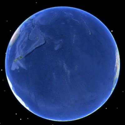
- A faster map: GPU rendering (beta), smooth zoom and pan, and a globe with your map draped over it under the stars.
- Python and Jupyter: pip install rustgis to run the engine in Python and open the app in a notebook with rustgis.Map.
- Process plugins: plugins that run as programs, with their own Python environments, in the background with progress and Cancel.
- AI Assistant: sign in with ChatGPT to use your plan, and let external AI clients drive the app.
Try it out
- Launch the web app: web.rustgis.app
- Download: downloads.rustgis.app
- Documentation: rustgis.app
- GitHub: github.com/opengeos/RustGIS
- Release notes: github.com/opengeos/RustGIS/…
#GIS #Rust #OpenSource #Geospatial #OpenData #Python #CloudNative

2
288



Vasile Coțovanu retweeted

My latest map: Physical Features of the Circumpolar North. It is available for free at: shadedrelief.com/arctic


Vasile Coțovanu retweeted

free elevation contour generator!
Select an area, click generate contours, and download as #geojson ... easy!

Vasile Coțovanu retweeted

So @googlemaps appears to now have completely dropped the ski area data. Can't see it at all!
What happened?
#gischat


The perfect occasion to bring my old DSLR out of retirement #CometATLAS

ALT Comet Tsuchinshan-ATLAS as seen from Zürich, Switzerland
5
312
Vasile Coțovanu retweeted

Lonboard 0.10 is now out!
Animate trajectory data on an interactive map, all from Python!
Also MovingPandas integration, draw bounding boxes on the map, @pyodide support, new ColumnLayer for rendering extruded cylinders, fewer required dependencies github.com/developmentseed/l…
Vasile Coțovanu retweeted
I enjoyed my secondment at the BBC. I can't believe my map made it onto the news!

Vasile Coțovanu retweeted

Cool! @Flickr Maps seems to be powered by @protomaps now - along with @openstreetmap right in the corner (@LeafletJS too!)
That's a lot of geotagged photos!
flickr.com/map


Vasile Coțovanu retweeted

The Matterhorn East Face in tears today.
A rockfall detached at approx. 4100 m shortly after 03:00h today leaving a widely visible trace in the seismic monitoring data networks.seismo.ethz.ch/en/n…
Not a bother to alpinists (the classic route follows the ridge) this is a warning sign.


Random northern sky #aurora
jungfrau.roundshot.com/top-o…

ALT Northern lights captured by webcams from Jungfraujoch
1
1,094