Upper Midwest storm chaser! | 60k subs on YT
La Crosse, WI
Joined February 2022
- Tweets7.2K
- Following1.2K
- Followers686
- Likes6.9K


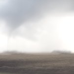
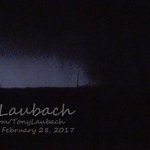

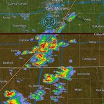


Omg


The most powerful weather app ever is now here! 🌦️📱
Aguacero’s iOS & Android apps are finally released! 🎉
🎨 Fully customizable
📡 Radar, satellite, models & more
🗺️ New: routes + navigation
iOS testers: delete the TestFlight version, then install 👇
🍎 apps.apple.com/us/app/aguace…
🤖 play.google.com/store/apps/d…
10
274


Very intresting day as well

November 7, 2011:
An outbreak of 10 tornadoes struck Oklahoma. The strongest was an EF4 (2011's 23rd violent tornado) that leveled an Oklahoma State University research building and mangled nearby trees. A mesonet station was also destroyed. No injuries occurred.
#wxhistory


11
322


Ive always hated this time of year up in the Midwest, usually all of the severe weather is done for the next 6 months and winter weather storms haven't really rolled around yet. Atleast there is still some fall foliage hanging around
3
176
❤️🩹

NOAA retired the NAM this week. We ported it to the GPU and it's back, better than ever: WOOF-NAM, open source.
- 12 km CONUS, all NAM physics, 24 h forecast in ~20 min on a single RTX 5090 (32 GB).
- 8 GPUs: 6 h in 92 s. Multi-card is bitwise to single card.
- 4 km CONUS, 24 h in under 9 min on 8 GPUs. 3 km nests anywhere on Earth (Europe, Japan, CONUS): 48 h in ~7 min on one card.
SStarts from the NAM analysis or GFS today, IFS open data in the next release. Beside the operational NAM from the same cycle it's hard to tell them apart (pics).
Today it needs one 32 GB card for the full 12 km CONUS; ~15 GB is the target, coming soon.
github.com/recastsystems/woo…


8
510
Anniversary of arguably the most intresting outbreak of the 2020's
November 4, 2022:
An outbreak of 30 tornadoes struck Texas, Oklahoma, Louisiana, and Arkansas. 11 twisters were significant (EF2+). EF4s near Paris and Clarksville, TX, became the state's first violent tornadoes since 2017. Two people were killed and 33 were injured.
#wxhistory


Looking back on June 11th is to tough for me. I vividly remember seeing little showers go up about 20 miles west of Peoria and still targeting the showers just drifting through the OWS further west near Macomb. Honestly its kinda a miracle Ipava even occured with all the outflow!


8
180

Long live the NAM3KM and this classic
#wxtwitter

4
183
August S retweeted

NEW:
The Storm Prediction Center, on or about November 16, 2026 will begin issuing afternoon Day 4-8 Severe Weather Outlooks, at 2130 UTC (4:30 PM CDT/3:30 PM CST).
The content and format of the outlooks will not change; only the addition of afternoon issuances.

I would be chasing today if the state xc meet wasn't this week, I gotta keep training. So enjoy this Mammatus sunset on June 13th in Kansas!
2
112


August S retweeted

It appears that @ChasingWConnor may have captured a view of the potentially significant Overgaard, Arizona tornado around 7:06 PM MST while it was still ongoing. The tornado would have been north of town at this point, and it was a big one!