

Meteorology Student | A.S. Degree | NCSU ‘28 | North Carolina Piedmont-Triad
Burlington, North Carolina
Joined October 2019
- Tweets919
- Following378
- Followers786
- Likes2.7K






George retweeted

Today's addition: simplified models of lower troposphere temperature profiles for winter precip types
George retweeted

I improved the radar cross section tool. It'll show you the heights now. And you can overlay stuff like I put the temperature lines and kdp contours. It'll continue to improve!
As an aside, anybody in Show Low seeing this? Looks like a beast with golf ball sized hail or larger.

George retweeted

Will this year's record-shattering El Niño event be the strongest in a millennium?
In a new piece over at The Climate Brink I review the paleoclimate literature from tree rings and corals and argue that may well turn out to be the case.
(link below)

George retweeted
As a direct appeal to WeatherBell users out there. Consider my website as an alternative. Why pay 30 a month when you can get the same or better for 2-5 a month?
Please help spread the word if you enjoy my work, I want to succeed but I need enough users to cover my costs!


George retweeted

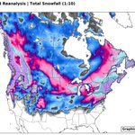
Once again, I decided to have a little fun in Python 🐍 today & created some Dec-Jan-Feb-Mar CONUS surface temp & 500mb height anomaly probability + mean composites for El Niños since 1855 using NOAA's 20th Century Reanalysis!
Unlike the previous set of composites I showed in early October, these composites include more El Niño events (53 in total).
Also, weights have been applied to account for El Niño strength (1x - moderate, 2x - strong-"Super"), a negative Pacific Decadal Oscillation (-PDO), Positive Indian Ocean Dipole (+IOD), Positive Atlantic Multidecadal Oscillation (+AMO, or a warm Atlantic), and appearance of a negative North Atlantic Oscillation (-NAO) in December
As you can imagine, these new composites are more favorable looking for snow lovers over the Eastern US
☃️❄️


George retweeted

I've been experimenting with creating various ERA5 climatologies recently. To make sure the results look as expected, I plotted the daily change in average 2m temperature, nicely showing the contrast between land & water, as well as the change in seasons and monsoon/ITCZ:
George retweeted
Decided to have a little fun in Python 🐍 today & created some Dec-Jan-Feb-Mar surface temp & 500mb height anomaly probability + mean composites for moderate-strong or east-based El Niños since 1870!
To provide a more apples-apples comparison for the near-150 years worth of El Niño events & account for climate change, I created a 30-year sliding base period in NOAA 20th Century Reanalysis Version 3 that lags significantly behind each year.
This is typically how today's climate anomalies are perceived & forecasted (relative to the most recent 30-year climate period (e.g. 1991-2020)).
#climate #ElNino


George retweeted
A lot of weenies don't wanna hear this, but next week's pattern doesn't support big snow on the coast
Nice deep trough over the OH Valley & -NAO yes, but there's no trough near Atlantic Canada & the ridge off the West Coast is too far west >> Interior NE US & Great Lakes favored


George retweeted

Decided to correlation DC snowfall with 500mb heights for December and January. Interestingly, high-latitude blocking (-AO, -NAO) heavily correlates to Dec snow, while a Western US ridge (+PNA) is much more important for Jan snow. Additionally, a +EPO is favored for both months.


George retweeted

On this day in 1959...thunderstorms in NW Kansas produced up to 18" of hail in Selden. Hail fell for 85 minutes, and the temperature dropped from near 80 to 38 degrees. Here in our neck of the woods...you can expect plenty of sunshine and seasonable temps this weekend.

George retweeted

I recently heard Weld County, CO touted as the most tornado prone county in the US. While it's true that Weld has had the most tornadoes, it's large size makes comparisons hard.
Evaluating counties using path length per county area yields a very different picture #USTornadoes

George retweeted

Thanks to ERA-5 reanalysis, we can take a detailed look back at this historic event.❄️
Arctic front pushed through early on 1-19-77, but most of the #snow in extreme S Florida was generated behind via ocean effect precip.
Simulated 850 hPa T down to -4C in #Miami is nuts! #FLwx

On this day in 1977, snow fell in #SoFla for the first time in recorded history, from West Palm Beach to Homestead, and even across the Gulf Stream on Grand Bahama Island! If you saw it, please share your story with us! weather.gov/media/mfl/news/S…

George retweeted
I always wondered what the @NHC_Atlantic's climatological Atlantic Hurricane Chart would look like if I replicated the visual, but instead for winter storms in North Carolina.
Well... I finally did it.
☃️❄️
#ncwx

George retweeted
71 years ago today, an anomalously strong & cold Tropopause Polar Vortex (TPV) came down from Canada into the Midwest, accompanied by sub-zero temperatures.
The strong synoptic forcing & baroclinicity set stage for a deep, long-lived cyclone that produced substantial impacts.
George retweeted
The pattern being shown on most medium-range NWP models for next week is one that signals an active monsoon here in New Mexico.
Notice the big ridge off the coast of British Columbia on the EPS >> should give us a nice feed of disturbances &/or backdoor fronts to work w/
#nmwx

