




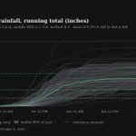


Halloween's 1.14 inches of rain set a record
Saturday's 1.14 inches of rain in New Orleans broke the Oct 31 record of 0.89 inches from 1979. Friday's weather models had centered near a tenth of an inch, so the gauge finished above 99% of th anecast.app/for/new-orleans-… #lawx

17.1 inches of snow fell around this date in 1974
Over Oct 30–Nov 1, 1974, Steamboat Springs picked up 17.1 inches of snow, 8.2 inches of it on this date — the biggest snow on Oct 31 on the record (records since 1909). This year's storm arr anecast.app/for/steamboat-sp… #cowx

Monday's high near 44°, with snow levels falling
Monday's forecast high is 44°, leaning cooler, with most of the models between 40° and 47°; a cold front sweeping through Sunday night drops snow levels to about 8,000 feet by morning and nea anecast.app/for/steamboat-sp… #cowx
Light Halloween rain, mostly after trick-or-treating
Saturday's high is headed for 63° as a trough digs into California and spins up a low off Southern California that sends moisture north. Drizzle may start during trick-or-treat hours, but anecast.app/for/san-francisc… #cawx

Denver still waits on its first measurable snow
Denver's first measurable snow usually arrives by Oct 19, and it still hasn't come; only 27 of 104 years went this long without one (records since 1921). Mountain snow above 8,500 feet looks l anecast.app/for/denver-co #cowx

4.30 inches of rain fell on this date in 1960
On this date in 1960, Austin got 4.30 inches of rain, the wettest Oct 29 on the books (records since 1948). This year the city carries a 24-day dry run into a soaking more modest than that. anecast.app/for/austin-tx #txwx

Wind Advisory through Tuesday, gusts near 35 mph
Gusts near 35 mph are expected around 10 AM today under a Wind Advisory that runs until 8 PM Tuesday, with the strongest weather models near 45 mph. A sprawling high from the Gulf to the Appa anecast.app/for/miami-fl #flwx

Highs stuck near 51° once the front passes
Behind Wednesday's front, Thursday's forecast high is 51° as an upper low deepens offshore and holds colder air over the region. Lows will likely slip into the 30s, with upper 20s possible in the u anecast.app/for/seattle-wa #wawx

Snow returns to the passes Tuesday night
A colder front sliding south from British Columbia drops snow levels to 2,500–3,500 feet Tuesday evening, enough for 4 to 6 inches of snow at the passes and 8 to 13 inches on the higher peaks by Wedn anecast.app/for/seattle-wa #wawx
Halloween high spans wide range across models
Next Saturday's forecast high is 67°, leaning cooler than Friday's 74°; most of the models put it between 59° and 70°. High pressure is expected to hold, but how fast cooler air returns after Fr anecast.app/for/new-york-ny #nywx

King tides could bring minor coastal flooding
The year's astronomically high tides could push localized minor coastal flooding into southern Nassau and southern Fairfield counties on the Tuesday and Wednesday morning high tides, even with h anecast.app/for/new-york-ny #nywx
Coastal flooding likely at high tide through Thursday
The Coastal Flood Advisory for Los Angeles runs until 1 p.m. Thursday, and today's sunshine and a high near 77° change nothing about it. The risk peaks around each high tide, when sea wa anecast.app/for/los-angeles-… #cawx

Monday's high leans cool at 60°
We've trimmed Monday's forecast high to 60°, below NWS's 63°; most of the models land between 56° and 61°, a split about twice as wide as usual for a day out. If the weak surface low tonight forms near Greele anecast.app/for/denver-co #cowx
Monday's high of 61° hinges on a surface low
Monday's forecast high is 61°, leaning warm; most of the models put it between 55° and 63°, an unusually wide split for a day out. Where a weak surface low forms overnight decides it: near Greele anecast.app/for/denver-co #cowx
Frost Advisory until 10 a.m., low near 37°
Ukiah's valley floor dips to about 37° near 6 a.m. under clear skies, cold enough that a Frost Advisory runs until 10 a.m. Sensitive outdoor plants left uncovered may be killed before the sun gets anecast.app/for/ukiah-ca #cawx

Dry spell reaches 14 days today
Today makes 14 straight days without measurable rain in Atlanta, and the rain chance stays at 0% through Tuesday as a low spinning off the Southeast coast keeps the dry northeast flow in place. The run looks anecast.app/for/atlanta-ga #gawx

Halloween weekend is trending cooler and wetter
Next Saturday, Halloween, is headed for a high near 69°, below the warm run of this week, as a broad trough settles over the West Coast. Thursday night and next Friday look mostly dry. Rain to anecast.app/for/san-diego-ca #cawx

Fort Collins nears its latest first freeze ever
Fort Collins has yet to drop to 32°, a mark it usually reaches by Oct 1; only 1 of 132 years waited this long, and the latest on record is Oct 25, 2024 (records since 1893). Tonight's forecast anecast.app/for/fort-collins… #cowx

Frost Advisory ends at 9 AM; another frosty night
Philadelphia's Frost Advisory runs until 9 AM, and sensitive plants left uncovered may be killed. With the strong high settling overhead and the wind going calm, the ground loses its heat fa anecast.app/for/philadelphia… #pawx

Anecast retweeted

Biggest snow on this date: 11.8 inches in 1997
On Oct 24–25 in 1997, Denver got 21.9 inches of snow over two days, 11.8 inches of it on this date (records since 1921). This year's first measurable snow is now overdue against the Oct 19 aver anecast.app/for/denver-co #cowx