




Bo Lu retweeted

We’re proud to announce an investment of $63.8M in the Flood Hazard Identification and Mapping Program to help Canadians better plan and prepare for future floods.
Learn more: ow.ly/2nm450Il4lC
#FloodMapping #FHIMP @Safety_Canada @environmentca

ALT aerial view of a river flanked by grassy fields with the text “Flood Hazard Identification and Mapping Program”
Bo Lu retweeted

Reminder of the pygeoapi presentations today at FOSS4G 2021, in Córdoba
- 17h UTC: project update (@tomkralidis, @francbartoli)
- 18h UTC: language support (@GeoSander)
Come join us! #foss4g #FOSS4G2021
Bo Lu retweeted

Have you watched the @osgeo annual general meeting video yet?
Video has chapters!
AGM part is first 5-10 mins
Leaving an hour or so of great community updates!
youtube.com/watch?v=daXH-fcv…
Bo Lu retweeted

#Developers from around the world are invited to develop and test #OGCAPI Records. This specification enables the discovery of geospatial resources by standardizing #metadata collections. Register Now: go.myogc.org/3wAW10g

Bo Lu retweeted

CIFFC -Canadian Interagency Forest Fire Centre has just gone to APL - Agency Protection Level 5 - the highest category. ciffc.net/en/ciffc/ext/publi…

Bo Lu retweeted
Multilingual support has landed in pygeoapi! Thank you/ευχαριστώ/grazie/dank u/merci to @geosander , @pvangenuchten and @geocat_bv for this valuable contribution! Read all about it at docs.pygeoapi.io/en/latest/l… #foss4g
Bo Lu retweeted

Paul Ramsey (@pwramsey): PostGIS at 20, The Beginning postgr.es/p/55b

Bo Lu retweeted
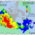
Wildfire in Manitoba, intense and growing. See GOES East mid-ir band - bright white indicates active fire. Also, attached is the fine fuel moisture code (ffmc) map- areas greater than 91 ( red areas) means that dead fuel moisture is 10% or less. Very dry fuels.


Bo Lu retweeted

#DYK @opengeospatial Common ‘building blocks’ will support next generation #3D #GeoVolumes, #Routes, #Styles, #Tiles, #Features, #Maps, and ChangeSets APIs. Nice! #modernization #standards See the OGC video on @YouTube at youtu.be/hNmZJ1itqfM

ALT Screenshot of Open Geospatial Consortium video on APIs. It has the words OGC APIs: The Building Blocks for Location.
Bo Lu retweeted
pygeoapi 0.10.0 has been released! OGC API - Records, OGC Environmental Data Retrieval API, OGC API - Processes asynchronous job management, and more! lists.osgeo.org/pipermail/py… @OSGeo @opengeospatial #foss4g
Bo Lu retweeted
This paper is open access at cdnsciencepub.com/doi/full/1…


Fifty years of wildland fire science in Canada.(Image from "Fifty years of wildland fire science in Canada") wildfiretoday.com/2021/03/13…
Bo Lu retweeted
The OGC Member Meeting is starting on March 17. The agenda is packed with special tracks for #health, #newspace, and #devs. See them all: mailchi.mp/ogc.org/oeol3zqkt…

Bo Lu retweeted

Today is #MandelaDay2019, when the legacy of Nelson Mandela is honoured through community service. The South African firefighters assisting #ABwildfire in High Level will be volunteering locally tonight after their work on the Chuckegg Cr wildfire. Thank you @wo_fire!
Bo Lu retweeted

Did you know that #CWFIS has a daily wind speed and direction map? Daily weather observations are required for the Canadian Forest Fire Weather Index (FWI) System calculations. Check out all of the other maps we have at cwfis.cfs.nrcan.gc.ca/maps! 🔥🇨🇦


Bo Lu retweeted

The smoke has been truly choking today in #yeg. Still easier here than for those evacuated and especially those who lost their homes in Paddle Prairie today.


Bo Lu retweeted
New thesis by Canada Wildfire student Ellen Whitman - Burn severity and fire history in the northwestern Canadian boreal forest: drivers and ecological outcomes. #forestfire #burnseverity #boreal #research canadawildfire.org/burn-seve…


Bo Lu retweeted
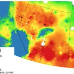
I don’t ever remember seeing a fire danger map like this before for Alberta. Climate change is truly frightening. Stay safe out there #abfire

Bo Lu retweeted
B.C. and Yukon could have highest risk of wildfires this season, federal forecasters predict. Via @Jantafrench @edmontonjournal @NRCan
edmontonjournal.com/news/loc…