

GIS Analyst, Map Enthusiast, Traveler, Explorer, Culture student, Hiker, Backpacker, Kayaker, Adventure seeker
Joined September 2012
- Tweets164
- Following91
- Followers35
- Likes365

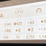




It begins and already my mind is blown! Excited for a week of learning, networking and fun at #esriuc #mapsfortheblind #maps #esriuc2023


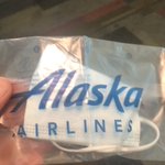
I still prefer to wear a mask in crowded places like airplanes, but found myself without one today in #smf and you can’t buy them here anymore! Thanks @AlaskaAir staff person who gave me one from their personal supply. 🙏😷✈️ #Grateful

1
Brad Findlay retweeted

It's the 109th anniversary of this article. And we still aren't doing enough to act on climate change.

Thanks @esri for letting us know where our Thanksgiving Harvest comes from. storymaps.arcgis.com/stories… #StoryMaps

2
Great visualization in case anyone needed clarification when looking at those mostly red maps and not understanding why their beloved candidate is loosing...#Election2020

Hopefully this tragic accident is a wake up call for other governments everywhere who might be storing “stuff” less than securely and with great caution. euronews.com/2020/08/06/befo…
Sad how these terms get incorporated in every day English language with the users understanding the original connotations. Now you know apple.news/AgREUzMotQwyx13yX…
Brad Findlay retweeted

This animation illustrates the geographic patterns of COVID-19's spread over time in the continental United States. Particularly striking how quickly things shift, and how many cities are fast growth now compared to the initial wave of growth. Made with #QGIS #Blender3d #RStats
Tracking The Pandemic: Are Coronavirus Cases Rising Or Falling In Your State? npr.org/sections/health-shot…
Just finished an awesome morning here at #EsriUC. Asset data health in #Salem Or, water mapping in #Santabarbara and #esri #vectortiles


Brad Findlay retweeted

From Cuff & Mattson, 1982. The sort of advice that never goes out of date #cartography

Brad Findlay retweeted

On #WorldOceansDay, explore what happens to the plastic that we throw out. nationalgeographic.com/magaz…

Brad Findlay retweeted

#Maps can help turn huge amounts of data into a gorgeous, simple image. But picking the right symbols isn't always as easy as you might think.
Unless, of course, you've already read this guide to choosing effective symbology 👉 p.ctx.ly/r/7fwb #cartography

Brad Findlay retweeted

SAVE the DATE: Sacramento GIS User Group - May 2, 2018 meetup.com/Sacramento-GIS-Us… … #Meetup #Sacramento via @Meetup

Just in time for Christmas. 10 Awesome Holiday Gifts for Map Lovers on.natgeo.com/2iBcjGh via @NatGeo
Here's a helpful map for some #perspective on the massive Larsen C iceberg that broke off projects.xocas.com/2017/how-… i.imgur.com/uVr3meu.png
Brad Findlay retweeted


An iceberg about the size of Delaware split off from Antarctica’s Larsen C ice shelf sometime between July 10-12: go.nasa.gov/2uiX09y