Graduated Texas A&M 1981 Meteorology B.S. Degree @FCN2go since 1982 AMS 1983 CBM 2005
Jacksonville Beach, FL
Joined July 2011
- Tweets23.8K
- Following1.7K
- Followers6.6K
- Likes63




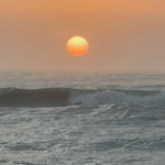


If you missed the rains of the last two days, hold on. Storms will be even more widespread today #Fcnstorm
Surfable swell out there. Overland the highest risk of storms will be east of highway 17 , 3-9 p #Fcnstorm
Looks like tstorms will not threaten Memorial Day activities until after 4 pm #Fcnstorm
Tim Deegan retweeted

Maintenance is scheduled for tonight beginning around midnight EDT, and may take several hours to complete.

The periodic downtime of tropicaltidbits.com this week has been due to a failing piece of hardware that I will be getting replaced ASAP. This will result in another chunk of downtime, hopefully during the night when traffic is low. I'll let you all know when that is scheduled. I apologize for the inconvenience.
In before everyone tells me I should be hosting in the cloud 😉 Unfortunately that is not always an economic option for every workload. But I am laying plans for a new architecture in the near future.
The ocean is clear and calm . The ocean and skies will remain like this thru Saturday. T-Storms will slowly increase Sunday-Thursday. #Fcnstorm
You can almost see the lower dew points , that will be with us thru Saturday #Fcnstorm

Some showers and isolated tstorms will blow in from the west between 2-6 pm. #Fcnstorm


Looks like this will be the hottest three day mid-May streak on record #Fcnstorm

Still some fun waves. Best wave of the morning caught by a dolphin. Overland, sunny and getting hotter thru Saturday. #Fcnstorm

Full moon rises at sunset. Tuesday will be drier and sunnier. The rest of the week , dry and becoming hotter. #Fcnstorm
Again today the highest risk of tstorms will be later in the afternoon. But Saturday-Monday rain with tstorms are possible anytime of the day. #Fcnstorm
Heaviest rains and strongest storms should be mostly afternoon and evening events thru Saturday but just as likely during the morning on Mother’s Day. #Fcnstorm
Today starts what looks to be at least 6 days of numerous showers and thunderstorms. Confidence continues to increase in the fcst of at least 2” for all of us and some may receive 6” #Fcnstorm.