

@FloodAlerts tweets flood alerts and warnings for England, Wales and Scotland with local accounts for each County. Find yours here: https://xitter.gq/t.co/B5SkbBuhd7 @Shoothill
United Kingdom
Joined February 2011
- Tweets14K
- Following202
- Followers11.6K
- Likes1.3K




FloodAlerts retweeted

Notice: Due to flooding, Quarry Play area is currently closed. Cleansing operations will take place once the water recedes.

FloodAlerts retweeted

First pitch inspection at Frys for Saturday not looking great. A bit of sun and you never know…


You can check the latest flood alerts and warnings for areas near you here: floodalerts.com/
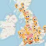
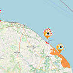
There are flood alerts issued across the UK, with areas of particular concern in the South of England. See how you might be impacted using this interactive map: floodalerts.com/


FloodAlerts retweeted

The team at Shoothill are devastated to hear about the passing of Queen Elizabeth II. We thought we'd share this again, a project that conveys itself much differently now.
One million images of The Queen, celebrating her life and service: bit.ly/3RLyTHc
FloodAlerts retweeted
The latest situation in central Shrewsbury...
The metal box is a river gauge - these are what the Environment Agency use to collect data relating to river levels. We display this information on @GaugeMap.
#StormFranklin – at Shrewsbury, England

FloodAlerts retweeted

Wharfage closed at Ironbridge - The river has now reached 6.2 m and it’s no longer safe to go behind the flood barriers. The Wharfage is now closed to vehicles and pedestrians. Please stay away from the area and stay safe everyone. More here > orlo.uk/upNNM

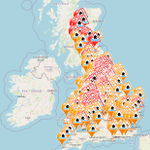
It is not very often the map at floodalerts.com looks like this. Stay safe everyone, and keep yourself up to date on local river revels with @GaugeMap (gaugemap.co.uk).
#StormFranklin

FloodAlerts retweeted

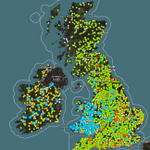
All the gauges marked 'flooding possible' as of 21st February in the UK.
If you are concerned about river levels near you, GaugeMap can help.
Take a look at the gauges closest to you here: gaugemap.co.uk
#StormFranklin

FloodAlerts retweeted

Water, water everywhere.. #floods 💦 #StormFranklin 💧but today level is dropping & the sun out #LakeDistrict #landscape #photo #StormHour 🐑


FloodAlerts retweeted

Aerial view of the valley below home with @BelperMCC cricket, football and hockey all affected by the Derwent flooding. Lots of road closures around #Belper this morning @UKweatherpics could be bad for a while today 😕 #Derbyshire #weather @FloodAlerts

FloodAlerts retweeted
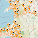
The state of Welsh River levels - visible only at gaugemap.co.uk.
Stay safe everyone.
#StormEunice

The state of Welsh River levels - visible only at gaugemap.co.uk.
Stay safe everyone.
#StormEunice
FloodAlerts retweeted

Thank you @FloodAlerts! Thankfully, none affecting Kent just yet. #StormEunice approaching.

FloodAlerts covers the whole of mainland UK and is the only place to do so. #StormEunice is coming, starting in the south-west on Friday morning, heading north-east throughout the day. Keep updated on flood warnings here: floodalerts.com
#StormEunice #StormDudley

FloodAlerts retweeted

See this innocuous bump in the cloud?
This is #StormEunice starting to form.
In 36 hours, it’ll travel 1,800 miles and slam into the UK with damaging and disruptive winds.
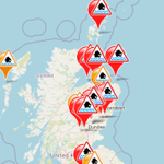
The bad weather over the weekend has impacted river levels across the UK. 2 flood warnings have been issued, one in Boroughbridge and another in the Lake District. There are 28 other flood alerts.
Check here: floodalerts.com/
#Flood #LakeDistrict #Boroughbridge
