

Maps and immersive visualisation at Monash University, Melbourne
Melbourne, Australia
Joined March 2018
- Tweets207
- Following224
- Followers1K
- Likes730




Bernie Jenny retweeted

Lire la carte du monde en nos langues: le Gouvernement s’y engage.
Un appel à candidatures lancé.
@DiplomatieTogo @MtnMapper @ProjectionWizz @mappingbernie @UN_Togo @AmbaTogoJapon

Bernie Jenny retweeted

The headlines you saw about the UN's recent vote on #maps and #Africa...were mostly wrong. 😬We dig into what actually happened in our new #geography #factcheck article:
polgeonow.com/2026/09/un-new…

Bernie Jenny retweeted

Eduard 1.4.18 released: cast shadow layer, Mapterhorn DEM download, support for macOS 27, and various bug fixes and improvements
eduard.earth

Bernie Jenny retweeted

Corriger la carte, ce n'est pas seulement rectifier une distorsion #géographique ; c'est corriger les perceptions qu'elle entretient…. Corriger la #carte, c'est corriger la carte du #monde au nom de la vérité #scientifique, au nom de la responsabilité face à #l'histoire, au nom de la justice et de l'équité, et au nom de la #réparation de distorsions cartographiques héritées du passé.
#CorrectTheMap
#UNGA81 #UNHA26 @MtnMapper @ProjectionWizz @mappingbernie
#EqualEarth
#MapAfricaRight #AfricaTrueSize
#FairMapFairWorld
#CartographyForEquality
#GeographyForEquality
#OneWorldFairMap
#AfricaOnTheMap


Bernie Jenny retweeted
#CorrectTheMap
Corriger la carte, c'est Corriger notre vision du monde!
En vérité, les cartes constituent un outil pédagogique, scientifique et culturel fondamental qui façonne la perception du monde et l’imaginaire collectif des peuples.
#EqualEarth @UN @_AfricanUnion @UNESCO @MtnMapper @ProjectionWizz @mappingbernie @DiplomatieTogo @AmbaTogoJapon

Hello Equal Earth: what the UN’s new world map will change nature.com/articles/d41586-0…

Bernie Jenny retweeted

Wow. When we (@ProjectionWizz
@mappingbernie) created the Equal Earth projection in 2018, we never imagined this: theguardian.com/world/2026/s…

Bernie Jenny retweeted
Bavaria's official maps now use shadings created with Eduard.
German: ldbv.bayern.de/aktuell/archi…
English: www-ldbv-bayern-de.translate…
#shadedWithEduard

Ring maps: simplified, egocentric, and topology-preserving views for augmented reality navigation tandfonline.com/doi/full/10.…

Bernie Jenny retweeted

Try it yourself, if you have @EduardShading
■ Eduard's bookmark: dropbox.com/scl/fi/3lmuaq48n…
■ GEDTM30 Chirchiq: dropbox.com/scl/fi/gtv8vcxpr…

Bernie Jenny retweeted

I created a map of my old classmate's birthplace — Chirchiq in Uzbekistan. Shaded relief using @EduardShading, draped with GEDTM30 bathymetry based mixed with Google Satellite imagery


Bernie Jenny retweeted
Eduard update 1.4.15 can replace void values with smooth feathering, export grids to small 16-bit GeoTIFF files with decimeter precision, and includes various improvements and bug fixes.
eduard.earth

Bernie Jenny retweeted
We are thrilled to introduce Eduard Cloud at cloud.eduard.earth
High-quality shaded relief for terrain maps can now be created on Windows, macOS, and Linux with any modern browser.

Bernie Jenny retweeted
Eduard 1.4.14 now supports macOS 26 Tahoe.
eduard.earth

ALT Eduard app icon for macOS 26, showing a snowy mountain peak.
Bernie Jenny retweeted

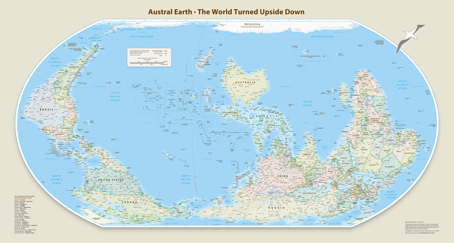
For my southern hemisphere friends: a south-at-top version of Equal Earth. The map even has an albatross on it. Get it here for free: shadedrelief.com/austral
Bernie Jenny retweeted
Mercator projection be gone: Africans in support of the Equal Earth projection.
aljazeera.com/features/2025/…

Bernie Jenny retweeted
Eduard 1.4.13 can now download the great new Global Ensemble Digital Terrain Model #GEDTM30 at various resolutions.
eduard.earth

Bernie Jenny retweeted

For beautiful and useful cartographic artifacts check out shadedreliefarchive.com/ , @MtnMapper and @mappingbernie preserved (and georeferenced!) airbrush/graphite terrain illustrations by artists of the 70s and 80s. Many of the originals were ~3x2 ft.
Here are a few by Ellen Kuzdro. "Much of this beautiful art deserves to be used by future mapmakers."