Exploring the geography and history of Ethiopia and the surrounding region through maps, data, and visuals.

Ethiopia
Joined December 2023
In case you want to see how the maps will look framed, and on your wall 😊
6
11
73
9,391
The most geologically stable area is in the western hinterland and, since nuclear power needs water, it's probably going to be along the Dabus River or near the Abay River, not far from GERD. Preferably covering both power plants with one AD battery
Where do you think the Nuclear power plant will be built? They are saying they have narrowed it down to few locations but have not decided yet since they need international institutions to weigh in on it first.
2
1
23
1,399
And convertible Midas too?
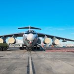
Confirmed: Ethiopia received 12 Su-35 Jets and will receive four S-400 AD batteries.
2
2
23
1,651
... እናት ኢትዮጽያ የደፈረሽ ይውደም
Our comprehensive efforts to sustainably ensure our country's peace and security have reached a new milestone today. The state of readiness being built within Ethiopia's defense forces is endowing the nation with the capability to preemptively deter aggression. In accordance with our prior agreement with the Russian government, we have today taken delivery of the first twelve Su-35 4++ Generation fighter jets. Additionally, Ethiopia will receive four S-400 air defense system batteries. I would like to express my gratitude to my friend, Russian President Vladimir Putin, for his dedication in ensuring we received these warplanes a year ahead of our agreed schedule. By equipping itself with these fighter jets, Ethiopia has taken the lead among Sub-Saharan African nations. This historic achievement further strengthens our nation's sovereignty, and it will serve as a massive capability boost that allows us to confidently continue our journey toward ensuring our collective security and regional stability in the future.
2
7
1
35
1,183
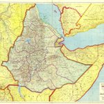
Ethiopia Prepared and Published by the Ethiopian Mapping Agency Addis Ababa, 1985
1
6
2
42
1,665
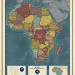
Africa By the National Geospatial Intelligence Agency Springfield, Virginia, 2024
1
2
8
563
Ethiopia: Road Map By the Ethiopian Transport Construction Authority (E.T.C.A.) Planning & Programming Division Printed by the Ethiopian Mapping Agency Addis Ababa, 1984
4
24
876
Ethiopia, Eritrea, and Somaliland: Cross-Country Movement Conditions for Tracked Vehicles By the Central Intelligence Agency Washington D.C., 1960
7
10
1
80
8,742
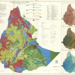
Hydrogeological Map of Ethiopia By Tesfaye Cherinet, Teshome Kumbi, and Belete Habteselassie Published by the Ethiopian Institute of Geological Surveys Printed by the Ethiopian Mapping Authority Addis Ababa, Ethiopia, 1993
9
22
1
157
11,636
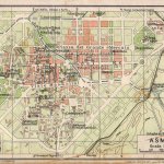
Map of Asmara By the Touring Club Italiano Published by Vallardi 1929, Milan
1
17
500
Maps of Ethiopia retweeted
Interesting to note the extent of Abyssinia from the Red Sea to Blue Nile. Meaning Ethiopia has a historical claim to the sea. And that Oromia was largely existed outside the territorial limits of the Abyssinian empire. Fascinating to see such contested claims on a map
Map of the Course of the Nile, Comprising Egypt, Nubia, Abyssinia, and the Red Sea By J. Andriveau-Goujon Paris, 1858
1
1
4
226
Map of the Course of the Nile, Comprising Egypt, Nubia, Abyssinia, and the Red Sea By J. Andriveau-Goujon Paris, 1858
1
1
1
13
798
Road Map of Addis Ababa By A. Anderson Bell Published by Addis Ababa City Planning Department Addis Ababa, September 1955 This map is one of my favorites, and thanks to @abbasshash for explaining the story of "Casa Inces" last time I posted it
13
441
European territorial claims on the coasts of the Red Sea By Rawson William, Weller, Edward Published by Edward Stanford, Proceedings of the Royal Geographical Society London, 1885 Inset: Gulf of Tajura, Obock, Assab Bay, Sheikh Syed and Perim Island
1
1
6
372
As the saying goes, a drowning man will clutch at a straw When you lose the battlefield, you freeze the frame, zoom in on the pupil, enhance it, and make up some batshit nonsense
We could say a lot about the 27-minute so-called interview that the great pretender, Abiy Ahmed, gave to his own megaphone television yesterday. Study the camera shots carefully. This time, they spend very little time on his face and much more time on wide shots and the interviewer. Why? Because he is constantly reading from a screen, reciting words prepared for him by either Getachew or Tsadkan. Yet, despite the producer’s and editor’s best efforts to conceal this, look what I found! You can actually see him reading from a screen strategically positioned behind the interviewer, creating the illusion that he is speaking freely to the interviewer or the camera. But I froze the footage, zoomed in on his pupils, and guess what? Hehehehe! He is reading and repeating words from a big-screen like a parrot! Abiy is as fake as they come: a pretender, a coward and a bigmouth. Behind the carefully staged performance and bluster, we all know he is terrified. #Eritrea #Ethiopia @TomGardner18 @TheEconomist @NewYorker @DailyNewsEgypt
7
8
1
113
4,300
Asia: Southwestern Sheet By Colton G. Woolworth (George Woolworth) Published by J.H. Colton & Company New York City , 1858
9
497
Maps of Ethiopia retweeted
The Trans Nzoia plateau and Nzoia valley from 40000 ft. Three of Kenya's five highest places are visible in this image. Mt. Elgon (2nd), Cherangany Hills (4th) and Mt. Mtelo (5th). River Nzoia drains Elgon and Cherangany before draining into Lake Victoria Happy Mashujaa Day 🇰🇪
4
34
1
114
3,405
Map of Abyssinia By The Bombay Gazette Published on October 26, 1867, as a supplement map for the gazette Mumbai, India
1
9
2
69
5,473
Northeastern Africa By F. Handtke and Karl Sohr Published by Carl Flemming Glogau Leipzig, 1846
11
383
Central and North Africa and Arabia By Adolf Stieler, Heinrich Karl Wilhelm Berghaus Published by Justus Perthes Gotha, 1836 Inset: Ethiopia
14
437