




Pinned Tweet
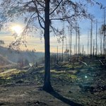
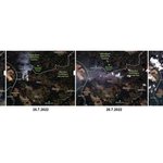
Bohemian Switzerland fire spread visible in satellite imagery (unfortunately). The view is from our research area access to Planet Labs PBC.

Peter Surový retweeted

I am very proud of our new article describing a newly developed R package for #forest dynamic simulation based on #NFI data! Great work, @jernejjevsenak !
Machine Learning Forest Simulator (MLFS): R package for data-driven as... sciencedirect.com/science/ar…
First results of Tereza's mapping of the invisible world of smells. Great thanks to our Gottingen colleagues for help. doi.org/10.3390/s23042001 ... and more to come soon 🤓🌳🌹
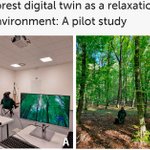
If you ever wondered how to make different use of your lidar scanned data (for people who cannot visit forest), here is a suggestion: frontiersin.org/articles/10.…
Proud of this team of pioneering guys from different research areas (3xH 🤓)
#lidar #VirtualReality #DigitalTwins

ALT Frontiers in Virtual Reality


After firemen leave, the forest services are required to monitor the burned area. Aviation causes dangerous air movement; walking is nearly impossible at this extent. Drones are most likely the only solution(forestry education should take it to account)🌳🛩️ceskenoviny.cz/zpravy/hasici…

Once again, after 7 days, more than 1000 ha burned (13% of the park), most of it within first 4 days. (credit: Planet Labs PBC, research access)

📢New App Announcement 🥳
#iScanForest
We are happy to announce the LiDAR-based app for #iPhone and #iPAd for tree mensuration (DBH accuracy under 2cm, positional error 1m/100m).
More info at iScanForest.fld.czu.cz
Soon on AppStore
#forest #lidar #ScienceToPractice @Apple
Even the longest journey starts with the first step. And if you want to know how to make the second, third and all the other steps during the optimal trajectory for photogrammetry in forest stand, read this 🙂😎:
sciencedirect.com/science/ar…

Surprising discovery of Martin: dead trees move! (and we can measure it by laser UAV). mdpi.com/2072-4292/12/22/382…
Feeling like supervising dr. Fleming 😀🤓

13 is bad luck in some countries, 4 in another ones. :) Karel managed to get the new paper published on 13.4. This must bring luck🤓
How you can automatically measure trees in high density laser scans (from UAV):
mdpi.com/2072-4292/12/8/1236
#UAV #laser #pointclouds
Peter Surový retweeted

Looking for something to cite in your first research using #GEDI data? The mission paper is out! Happy reading. sciencedirect.com/science/ar…
Test of the new terrestrial laser scanner from Trimble during visit of Forest school enterprise in Zvolen, Slovakia . (2.5.2019)


How can a forest enterprise profit from remote sensing as of the end of 2018? Check our recently accepted review paper; and BIG thanks to all the reviewers 🙂
mdpi.com/1999-4907/10/3/273 . #forestry #remotesensing #satellites #airplanes #drones
