
Storm chaser and weather nerd
Pittsburg, KS
Joined April 2009
- Tweets1.1K
- Following795
- Followers636
- Likes137





Tyler Costantini retweeted

Dom4 getting a saltwater bath @ReedTimmerAccu #HurricaneIan


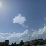
3 miles NW of Opolis, KS on 126hwy in Barton county, MO looking east 10:17am @NWSSpringfield #mowx

Tyler Costantini retweeted

NEW PRELIMINARY pressure data from tornadogenesis north of Petrey, AL with three sensors mounted to poles using @GetFlexSeal. #6 recorded a >5 mb pressure drop as destructive inflow jet caused damage to church, snapping trees next to sensor. TDS appears minutes later @ChasinSpin


Tyler Costantini retweeted

Did you receive a call or text about a boil water notice? This is an official activation of the Warn Central Texas emergency alert system. ALL Austin Water Customers MUST boil water for 2 full minutes before using it for eating or drinking. More info: austintexas.gov/alerts

Tyler Costantini retweeted

Scary video of Boulder windstorm and fire. Evidence of hydraulic jump and downstream rotor.


Tyler Costantini retweeted

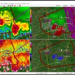
Another nocturnal December tornado, this time S of the Birmingham metro. Given a peak Vrot near 60 kt and a TDS above 12,000 feet, this was likely a significant (EF2) tornado.


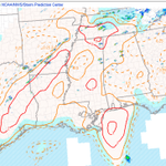
Extreme NE MS and Southern TN currently has the best tornado environment that will likely shift back in to AR with time

Tyler Costantini retweeted
Drone view of tornado warned supercell with circulation wrapped in rain. Immense lightning frequency @RadarOmega_WX @NWSNashville


Flooding south of Pittsburg, KS 37.3673, -94.6769 over 520th ave, second pic cow creek out of banks. 37.3670, -94.6891 #kswx @NWSSpringfield


