

Weather, alerts & local news for NE Tennessee & SW Virginia since 2013.
Tri-Cities NE TN / SW VA
Joined March 2012
- Tweets22K
- Following93
- Followers2K
- Likes2.2K
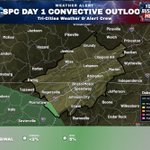




2:44 PM ET 11/4/26: SPC Day 1: Marginal Risk in Greene County today. Isolated severe storms are possible. Marginal: tornado less than 2% and damaging wind 5%.

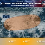
1:00 PM ET 11/4/26: A non-tropical low a few hundred miles south of Bermuda has a 30% chance to develop in 48 hours and 50% in 7 days, with subtropical characteristics possible this weekend. Conditions turn unfavorable by early next week.

11:15 AM ET 11/4/26: SPC Day 1: Marginal Risk in Greene County today. Isolated severe storms are possible. Tornado less than 2% and damaging wind 5% within the Marginal Risk.

7:57 AM ET 11/4/26: SPC Day 1: Marginal Risk extends from Hancock County eastward to Greene County today. Isolated severe storms are possible. Marginal: tornado less than 2%, damaging wind 5%.

7:00 AM ET 11/4/26: Low pressure is forming along a remnant frontal boundary a few hundred miles south of Bermuda, with a 30% chance of development in 48 hours and 50% in 7 days.

12:34 AM ET 11/4/26: SPC Day 1: Marginal Risk in Greene County today. Isolated severe storms are possible. Marginal: tornado up to 2% and damaging wind up to 5%. Nearly all other areas: tornado up to 2% and damaging wind up to 5%.

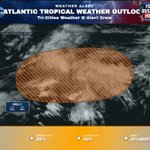
1:00 AM ET 11/4/26: Low pressure may form in 1–2 days a few hundred miles south of Bermuda along a weakening front, with a 20% chance of development in 48 hours and 40% in 7 days.

7:00 PM ET 11/2/26: Low pressure may form within a day or so a few hundred miles south of Bermuda, then could gain some subtropical traits late this week or this weekend. Formation chances: 20% in 48 hours, 40% in 7 days. Conditions turn unfavorable by early next week.

1:00 PM ET 11/3/26: Low pressure is expected to form along a weakening front a few hundred miles south of Bermuda within a day or so, with a 20% chance of development in 48 hours and 40% in 7 days.

7:38 AM ET 11/3/26: Wind Advisory is in effect for Johnson, Cocke Smoky Mountains, Sevier Smoky Mountains & Others from 4 PM this afternoon to 7 PM EST Wed. SE winds 15–25 mph with gusts up to 55 mph; isolated gusts above 60 mph. Secure loose items.

7:00 AM ET 11/3/26: Low pressure may form a few hundred miles south of Bermuda along a weakening front, with subtropical characteristics possible late this week. Subtropical development chances: 10% in 48 hours, 30% in 7 days.

1:00 AM ET 11/3/26: Low pressure is expected to form along a weakening frontal boundary a few hundred miles northeast of the Bahamas in a day or so, with a 10% chance of subtropical development in 48 hours and 30% in 7 days.

7:00 PM ET 11/1/26: Low pressure is expected to form along a weakening frontal boundary a few hundred miles northeast of the Bahamas in a day or so, with a 30% chance of subtropical development over 7 days. Any development is unlikely through 48 hours.

1:00 PM ET 11/2/26: Low pressure may form along a weakening frontal boundary a few hundred miles northeast of the Bahamas in a couple of days, with a 30% chance of subtropical development over 7 days.

7:00 AM ET 11/2/26: Low pressure is likely to form along a weakening frontal boundary a few hundred miles northeast of the Bahamas in a couple of days, with a 20% chance of subtropical development over 7 days.

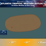
2:00 AM ET 10/23/26: Atlantic Tropical Weather Outlook for Atlantic from 2 AM EDT Friday through 9:37 AM EDT Friday. #1 48h 0% / 7d 0%.

8:00 PM ET 10/21/26: A trough east-southeast of Bermuda is producing disorganized showers and thunderstorms, with slight development possible through Friday (10% through 48 hours, 10% through 7 days). Upper-level winds should limit further development by the weekend.

5:00 PM ET 10/22/26: Post-Tropical Cyclone Josephine is about 235 miles east-southeast of Nantucket Massachusetts. Winds 65 mph. Josephine becomes a powerful extratropical low. A gradual turn toward the east is forecast on Friday and into the weekend.

2:00 PM ET 10/22/26: Subtropical Storm Josephine is producing unsettled weather near the western North Atlantic. A trough east-southeast of Bermuda has a 10% chance to develop through 48 hours and 10% through 7 days, with some development possible through Friday.

