

Meteorologist/Manager at the Canadian Hurricane Centre @ECCC_CHC | Tropical cyclone (hurricane) and many weather related topics | postings are own not employer
Dartmouth, NS, Canada
Joined January 2024
- Tweets1.6K
- Following151
- Followers644
- Likes589
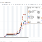




Friday and Saturday likely to be the wettest days this week - here is the time series for Halifax #nswx meteologix.com/ca/forecast/6…

Weather outlook for rest of week and the weekend. The mild pattern continues with spells of showers/rain more likely as the week goes on. Particularly mild at night. Parts of NS will likely see upper teen temperatures (60sF). #nswx Halifax:

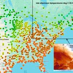
Fantastic weather this afternoon around the GTA and also in Maritime provinces. #onwx degrees C in map (66-73F so far)

Chris Fogarty, PhD retweeted

A colleague and I walked across from AOML to RSMAS to see where the water was relative to these high water marks. Just a little bit below Irma from a non-tropical event. Of course, if Irma had taken the original track up Biscayne Bay, it would have blown all of these away.


Clear this afternoon - high-resolution Sentinel satellite view over Parrsboro NS with blueberry fields showing up in shades of maroon and crimson. #nswx

Chris Fogarty, PhD retweeted

TC Info Statement from CHC on Subtropical Storm Josephine: weather.gc.ca/hurricane/stat….
Mainly a marine hazard, with hurricane-force winds likely on its backside as it transitions to post-tropical. Will also help fuel a feed of moisture and gusty conditions into parts of Nfld. #nlwx


Chris Fogarty, PhD retweeted

🌀Hurricane Isaias Damage Analysis (1/4)
NWS Mobile continues to investigate an extreme corridor of damaging winds WEST of Isaias' center. This radar/velocity loop shows intense winds, with deeper blues/greens indicating higher wind speeds, possibly associated with a "sting jet"
Chris Fogarty, PhD retweeted

We really don't often get to see the inner dynamics of pinhole eyes on radar, especially in the Western Pacific basin, so it's remarkable to watch the eye pass just to the south of #Guam and see the various eyewall mesovortices and other features.
On this date...25 years ago our second Canadian research flight into Tropical Storm Karen (first was Michael in 2000) as it approached western Nova Scotia. Here is the report from the storm and flight data. novaweather.net/Hurricane_Ka… report and data: novaweather.net/Hurricane_Ka… #nswx


The sting jet from Hurricane Isaias showed up in striking detail as seen by Sentinel SAR instruments: #Isaias

Chris Fogarty, PhD retweeted

Here's a preliminary look at peak wind gusts observed in association with the landfall of Hurricane #Isaias on Friday night. Multiple gusts topping 100 mph were recorded from Santa Rosa Island through the Pensacola area and northward.
You might note that the strongest winds were on the west side of the track -- not what we typically expect. This appears to be associated with the formation of something meteorologists refer to as a 'sting jet.' Isaias was in the process of transitioning from a tropical low to an extratropical low at landfall, and these sting jets are often associated with extratropical systems.
If you rode the storm out in the Panhandle and have any updates and/or pictures, please share them here. Wishing the best for everyone over there as the recovery process gets underway. @WAFB

Chris Fogarty, PhD retweeted

16 hours and counting of continuous coverage of Hurricane Isaias from hurricane hunters.
4 flights (2 NOAA, 2 US Air Force) provided frequent data on the storm’s structure to help forecasters predict the expected hazards tonight & tomorrow.

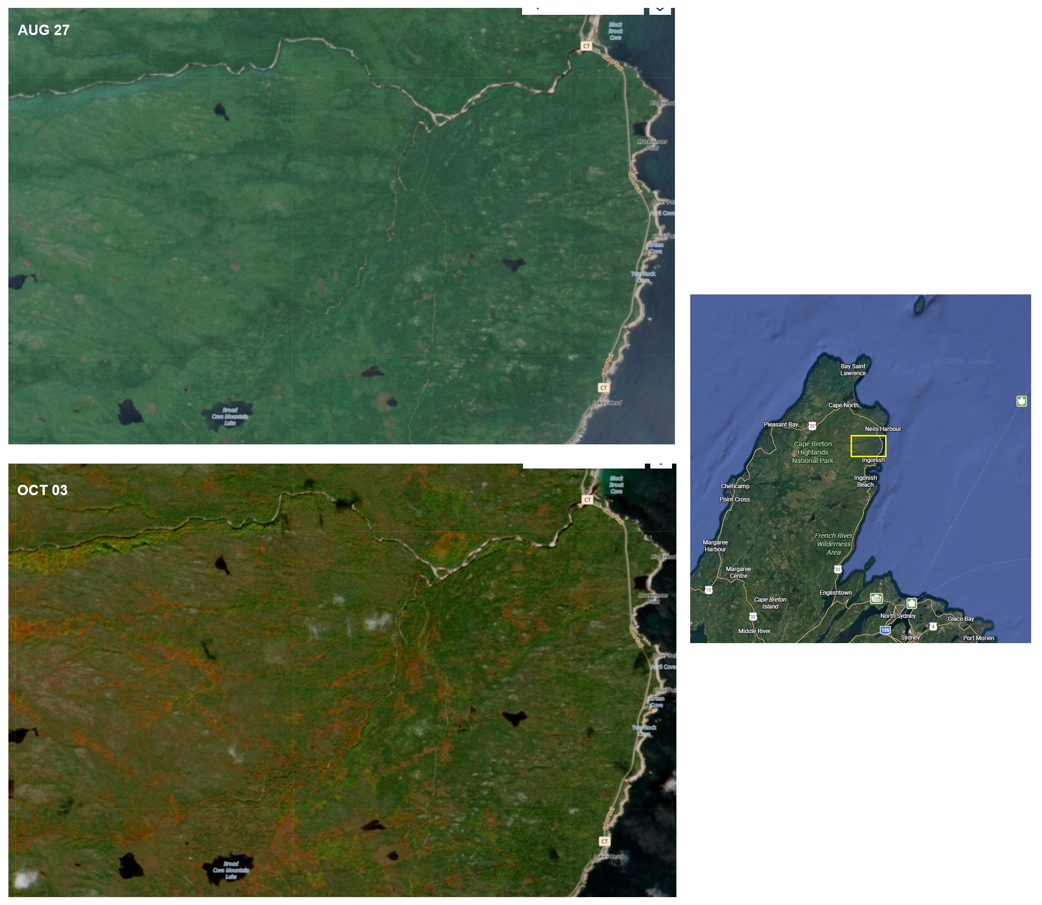
Foliage change from high-resolution Sentinel satellite over northern Cape Breton comparing Aug 27 to today Oct 3. #nswx novaweather.net/Photos/folia…


Chris Fogarty, PhD retweeted
Starting to see the signal for Gulf development wane a little bit. Down to 30% on Google DeepMind (was 40% a day or so ago). If shear proves to be too much for this system, I think that probably closes the book on the 2026 Atlantic hurricane season (that never really got started to be honest).
