
Putting the World on the Map: History - Political Geography - Borders - Lands - Maps
Montreal, Canada
Joined February 2015
- Tweets2.6K
- Following315
- Followers3.4K
- Likes1.1K




The Economist reported that the US has proposed changing Ukraine's regional borders so that Russia could declare full control over the Donbas. Under this proposal, Ukraine would retain control over the cities it currently holds.
But, according to the Russian official map of Ukraine, Donbas is already a Russian territory... (And Crimea, and Kherson, and Zaporizhzhia/Zaporozhye, and Melitopol...)
#map #borders #control #Putin #Trump #Zelenskyy #Ukraine #Russia #Donbas

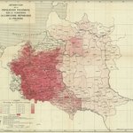
History, maps and national territory: Poland and the Neighbouring Countries in 1918 (T. Szumanski, La Pologne et les pays limitrophes, Paris, 1918)
Published at the pivotal close of the First World War, "La Pologne et les pays limitrophes" by T. Szumanski stands as a remarkable cartographic document of a continent in flux. Released in 1918, the exact year Poland re-emerged on the map of Europe after more than a century of foreign partitions, this map captured the complex geopolitical anxieties, territorial aspirations, and shifting boundaries of Central and Eastern Europe.
At its core, the map addresses the urgent "Polish Question" as the Austro-Hungarian, German, and Russian empires collapsed. Published in Paris, the intellectual and diplomatic hub for the resurrection of the Polish state, the document served both strategic and propaganda purposes. It visually argued for Poland’s rightful place among sovereign nations by meticulously delineating historical regions and weighing them against contemporary demographic and linguistic realities.
The cartography highlights not only the core Polish lands but also the intricate web of neighboring territories, spanning the Baltic lands, Ukraine, Silesia, and parts of East Central Europe. By framing Poland within its wider borderlands ("les pays limitrophes"), Szumanski underscored how deeply intertwined Polish self-determination was with the stability and self-rule of its neighbors. The map details regional borders, key transit arteries, and urban centers that were vital to defining the economic and defensive framework of the nascent Second Polish Republic.
Today, Szumanski’s 1918 map is treasured by historians and cartographers alike. It offers a rare, frozen-in-time snapshot of a continent transitioning from imperial subjugation to national sovereignty, reflecting the precise geographical lines upon which modern Europe was redrawn.
(Better version and more maps: historicalmaps.edmaps.com/po…)
#history #historical #map #Poland #1918 #Germany #Ukraine #Russia #Lithuania #Austria #Czechia #Sloakia #Romania #Hungary #war #WWI #peace #ethnographic #borders #Warsaw #nationalism

History, maps, ethnicities, and territorial claims: "Ethnographical Map of the Polish Population" (published by the Polish Information Committee, London, 1916)
Published in London during the turbulence of the First World War by the Polish Information Committee, the "Ethnographical Map of the Polish Population" served as a powerful visual weapon of wartime diplomacy. At a time when the map of Europe was being violently redrawn, this cartographic artifact was meticulously crafted to champion a singular cause: the resurgence of a sovereign, independent Polish state.
By mapping the distribution of Polish-speakers within the historical boundaries of the former Polish-Lithuanian Commonwealth (as it stood before the partitions of the late 18th century), the map directly challenged the imperial status quo. It visually refuted the narrative pushed by partitioning powers (particularly the Russian Empire and Austria/Habsburg Empire) that these lands were irreversibly assimilated or naturally belonging to their respective empires. Instead, the cartographers utilized modern ethnographic surveying to demonstrate that despite over a century of foreign rule, a cohesive Polish demographic majority persisted across a vast contiguous territory bridging Central and Eastern Europe.
The map's strategic utility in London, the heart of Allied diplomacy, cannot be overstated. It was designed to influence British statesmen, international journalists, and policymakers by translating complex demographic realities into an undeniable geopolitical argument. By anchoring its territorial claims in the principle of nationality and historical continuity rather than mere military conquest, the Polish Information Committee framed the reborn Polish state not as a revolutionary disruption, but as a long-overdue restoration of historical and ethnic justice.
Ultimately, the Ethnographical Map of the Polish Population exemplifies how cartography during WWI transcended mere geography. It functioned as a blueprint for self-determination, offering a persuasive preview of the territorial ambitions that would eventually shape the rebirth of Poland at the 1919 Paris Peace Conference.
(A larger version and more maps: historicalmaps.edmaps.com/po…)
#history #historical #ethnic #ethnographic #map #Poland #Polish #Lithuania #Ukraine #Russia #Byelorussia #Belarus #Prussia #Germany #Austria #Galicia #Warsaw #Kyiv #Kiev #Romania #Hungary #war #peace #broder #nationalism #territory #WWI #Paris #London #France #Britain

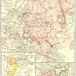
Let's come back to history & maps, sine ira et studio: A map of the Grand Principality of Moscow ("The Muscovite State"), 1598-1682 (from "Educational Atlas of Russian History," 8th edition, published by Baron N. N. Tornau, St-Peterburg, 1910, in Russian).
This historical map captures a transformative era of territorial consolidation, geopolitical conflict, and westward expansion for Russia spanning from the ascension of Boris Godunov to the early reign of Peter the Great.
The map's legend outlines four critical chronological and political layers:
1) "The Muscovite State, 1598": Marks the baseline territory at the close of the Rurik dynasty, on the eve of the destabilizing Time of Troubles.
2) "The Russo-Polish border of 1634": Delineates the frontier established by the Treaty of Polyanovka following the Smolensk War, reflecting post-Time of Troubles stabilization.
3) "Town occupied by Russians in 1655": Highlights strategic military penetrations during the Russo-Polish War (1654–1667), illustrating the dynamic shifts of frontier fortresses.
4) "The border of the Muscovite state in 1682": Shows the expanded realm at the end of the period, incorporating significant territorial gains including Left-Bank Ukraine and Kiev following the Treaty of Andrusovo and subsequent agreements.
A notable cartographic feature of this 1910 educational edition is its regional labeling. While tracking the institutional growth of the centralized Muscovite state (Московское государство), the map explicitly displays the geographic descriptor Ukraine (Украина) around Kiev/Kyiv (Кieвъ), alongside the Slobodnaja Ukraina (Слободская Украина), within the southern borderlands administered by Moscow. In late-Imperial Russian cartography, these terms served dual geographic and historical functions: identifying the distinct semi-autonomous Cossack territories (the Hetmanate and the Sloboda regiments) incorporated into the Tsardom, while simultaneously contextualizing them within an overarching imperial narrative of "gathering Russian lands."
#history #historical #map #educational #school #Atlas #Ukraine #Russia #Ukrainian #Russian #Moscow #Principality #Muscovite #State #Kiev #Kyiv

2
327
History, maps and East Slavic peoples (Russians, Ukrainians and Byelorussians/Belarusians): "The modern division of East Slavs by language" (from K. V. Kudryashov, The Russian Historical Atlas, Moscow-Leningrad, State Publishing House, 1928)
Sine ira et studio: An early Soviet linguistic map of the major East Slavic areas, published in Russian - "Современное деление восточных славян на языки".
#history #historical #linguistic #map #atlas #Slavs #Slavic #Russia #Ukraine #Byelorussia #Belarus #Europe #Putin #Zelenskyy

History, maps and ethnicities: "Ethnographical Map of the Ukrainian SSR, 1959" (Ukraine: A Concise Encyclopaedia, University of Toronto Press, 1988)

History, maps and ethnicities: "Carte ethnographique des régions habitées par les Roumains et des colonies étrangères qui s'y trouvent": An Ethnographic Map of Romania, 1919 (made by S. Demetresco & al., Paris, 1919)
Published in Paris at the height of the 1919 Peace Conference, the map served a vital political and diplomatic purpose. At a critical juncture when the borders of post-World War I Europe were being redrawn, it functioned as scientific advocacy for the creation of "Greater Romania" (România Mare).
Using distinct color-coding, the authors visually documented the spatial distribution of the Romanian-speaking population across Transylvania, Bessarabia, Bukovina, and the Old Kingdom, alongside various minority "foreign colonies" (such as Hungarians and Germans).
By translating demographic data into a compelling visual language, the map aimed to convince Allied decision-makers in Paris that territorial unification aligned directly with the principle of national self-determination.
(A larger version and more maps: historicalmaps.edmaps.com/ro…)
#history #historical #ethnographic #ethnicities #map #maps #carte #ethnographique #Romania #Roumanie #Romanians #Roumains #WWI #union #Transylvania #Moldavia #Moldova #Bessarabia #Bukovina #Banat #Dobruja #Austria #Hungary #Russia #Ukraine #Poland #Bulgaria #Serbia #USA #America #France #Germany

1
11
575
History, maps and borders: "Ukraine and its historical limits" - A French View, 1941 (from Jacques Benoist-Méchin, L'Ukraine des origines à Staline, Paris, Albin Michel, 1941)
The territorial schema reproduced by Jacques Benoist‑Méchin in "L’Ukraine des origines à Staline" (Paris, Albin Michel, 1941) reflects a markedly different cartographic imagination from the administrative boundaries asserted by Ukrainian political actors during the revolutionary years. Rather than depicting a functioning state or a legally grounded claim, the map presents a synthetic vision of the Ukrainian nation as conceived within interwar nationalist discourse, shaped by ethnographic arguments, historical retrospection, and the geopolitical anxieties of the late 1930s.
Benoist‑Méchin’s outline encompasses a broad arc of territory stretching from the Carpathians to the Don basin, integrating regions that had never formed a single political unit but were understood by nationalist writers as belonging to a continuous Ukrainian ethnolinguistic zone. Galicia, Bukovina, and Transcarpathia appear alongside the core lands of the former Russian guberniyas, while the steppe districts of the Black Sea littoral and the approaches to the Caucasus are included as extensions of a historical frontier shaped by Cossack settlement and imperial contestation. The resulting configuration is less a political boundary than a cultural‑historical construct, projecting a unified national space across multiple imperial legacies.
The map’s outer limits thus exceed any contemporary administrative reality, enclosing territories under Polish, Romanian, Soviet, and even nominally autonomous control. By plotting this maximalist perimeter, Benoist‑Méchin translates an ideological claim into cartographic form, presenting the Ukrainian nation as a trans‑imperial continuum whose fragmentation is attributed to external domination rather than internal diversity. For readers in 1941, this juxtaposition of present borders and imagined national extent visually stages the unresolved question of Ukrainian unity, framing territorial loss and partition as the central drama of the country’s modern history.
Read in context, the map functions less as a record of political fact than as a window onto the nationalist narratives circulating in Europe on the eve of the Second World War: expansive, retrospective, and designed to assert a coherent national geography where none yet existed.
(For a larger version: ukraine.edmaps.com/ukraine-n…
For more historical maps of Ukraine: historicalmaps.edmaps.com/uk…)
#history #historical #map #war #Ukraine #Russia #Germany #Poland #Hungary #Romania #Moldova #Slovakia #Belarus

1
4
387

History, geography and school maps: Empire of Japan, 1943 (from Goode's School Atlas, Chicago, Rand McNally and Co., 1943)
#history #historical #geography #geographical #map #atlas #Japan #China #Korea #Russia #USA

8
307
A very interesting map of the Falkland Islands / Islas Malvinas detailing the administrative division under Don Luis Vernet, "Comandante Político y Militar de las Islas Malvinas" (1829-1831).
#history #historical #map #Argentina #Britain #Malvinas #Falkland

🗺️🇦🇷La Comandancia Política y Militar de las Islas Malvinas (1829-1833) fue el régimen político que bajo Luis Vernet hizo posesión efectiva de las Islas, siguiendo a la antigua Comandancia Militar. Las Islas Malvinas se encontraban bajo dominio hispánico desde el año 1767+

1
227
History, maps and religion: The Eastern Patriarchates, c. 750 (from R. Lane Poole, Historical Atlas of modern Europe from the Decline of the Roman Empire, Oxford, Clarendon Press, 1902)
By 750 CE, the geopolitical landscape of the Eastern Mediterranean had fundamentally fractured, shattering the ancient Roman oikoumene. This map illustrates the starkly divided realities of the four Eastern Patriarchates following the lightning expansions of the Rashidun Caliphate and the subsequent rise of the Umayyad Caliphate (which fell to the Abbasids in this pivotal year).
Only Constantinople remained within the borders of the heavily militarized Byzantine Empire. It served as the Ecumenical Patriarchate, tightly bound to the imperial court and protected by the newly established themata (military-administrative units) across Anatolia and the Balkans.
In contrast, the other three ancient sees were fully incorporated into the administrative machinery of the Caliphate. Antioch (conquered by Khalid ibn al-Walid in 637 CE), Jerusalem (surrendered to Caliph Umar in 638 CE), and Alexandria (permanently secured by Amr ibn al-A'as in 646 CE) operated as dhimmi communities within Islamic provinces—such as Jund Filastin and Jund Qinnasrin. Despite their political isolation from Constantinople and the physical barriers of the Thughur (the fortified frontier zone), these three Melkite sees maintained their theological ties to the Chalcedonian world, enduring across hostile imperial borders.
#history #historical #map #religion #Greek #Christian #Patriarchate #Constantinople #Alexandria #Jerusalem #Antioch #Byzance #Byzantine #Empire #Balkan #Anatolia #MiddleEast #Palestine #Egypt #Syria

3
258
History, maps and nationalism: Ethnographic map(s) of Macedonia, 1914 - Serbian view vs. Bulgarian view (from Carnegie Endowment for International Peace, Report of the International Commission To Inquire into the Causes and Conduct of the Balkan Wars. #Washington: The Carnegie Endowment, 1914)
These two ethnographic maps of Macedonia reflect how cartography became a tool for advancing competing national narratives. Although produced within the same geopolitical moment, the Serbian and Bulgarian maps present sharply divergent readings of the region’s demographic landscape. Each relies on distinct ethnographic categories and visual conventions to assert historical rights and cultural continuity.
The Serbian interpretation foregrounds a predominantly “Serbian” or “Old Serbian” population, reinforcing Belgrade’s claim that Macedonia formed an integral part of the Serbian national space. The Bulgarian map, by contrast, highlights extensive “Bulgarian” settlement zones, supporting Sofia’s position that Macedonian Slavs were fundamentally Bulgarian in origin. These differences were not merely scholarly disputes: they were embedded in broader territorial ambitions following the Balkan Wars.
Within Serbian and Bulgarian societies, such maps circulated widely in newspapers, pamphlets, and educational materials, shaping public opinion and legitimizing political claims. By presenting ethnography as objective fact, they helped mobilize national sentiment and provided visual evidence for competing state projects. Viewed today, they reveal how cartography functioned as a persuasive instrument, an essential component of early twentieth‑century propaganda surrounding the Macedonian question.
#history #historical #ethnic #ethnographic #map #wars #carte #ethnographique #Balkan #Macedonia #Macédoine #Bulgaria #Serbia #Greece #Albania #Turkey #Romania #Montenegro #Russia #USA


6
297
History, maps and ethnicities: "Map of the South Slavonic Countries" (1877), an ethnographic map of the Balkans produced during the Russo-Romanian-Turkish War by Georgina Mary Muir Mackenzie and Adelina Paulina Irby for "Travels in the Slavonic Provinces of Turkey‑in‑Europe".
Emerging amid the Eastern Crisis and intensifying debates over Ottoman governance, the map reflects a distinctly British liberal‑philhellenic and pro‑Slavonic interpretive framework and organizes the South Slavonic lands (Serbia, Montenegro, Bosnia, Herzegovina, Bulgaria, and adjacent regions) into a coherent ethnographic and territorial schema that foregrounds Slavic demographic presence and historical claims.
Its cartographic choices, including the delineation of provincial borders and the emphasis on key urban centres, participate in contemporary efforts to render the Balkans legible to Western publics and policymakers.
As such, the map is not merely descriptive: it is an intervention shaped by humanitarian activism, political advocacy, and evolving nineteenth‑century ethnographic conventions. It offers insight into how external observers conceptualized the region’s populations, imperial structures, and emerging national movements.
#history #historical #ethnographic #maps #war #ethnicities #Balkan #Bulgaria #Serbia #Greece #Albania #Macedonia #Bosnia #Croatia #Montenegro #Turkey #Romania #Russia #Hungary #Austria

2
4
319
History, maps and Irishmen: A school map of Ireland since 1500 (from Charles Andrews, A Short History of England, Boston-New York, Allyn & Bacon, 1921)
This map traces the shifting contours of English authority in Ireland from the early sixteenth century onward, with particular attention to the Pale under Henry VIII and during the Stuart monarchy.
In Henry VIII’s reign, the Pale constituted a confined zone centred on Dublin, where English law, administration, and cultural norms were actively maintained. Beyond its limits, Gaelic lordships and autonomous Anglo‑Irish jurisdictions preserved distinct political traditions.
Under the Stuarts, the Crown pursued a more assertive programme of territorial consolidation, marked by plantations, institutional reforms, and sustained military intervention. These measures gradually diminished the Pale’s administrative distinctiveness as English governance extended across the island.
By juxtaposing both periods, the map underscores the transformation of Ireland’s political landscape and the complex interplay between local authority, colonial policy, and evolving territorial control in the early modern era.
#history #historical #maps #school #classroom #textbook #Irish #Ireland #English #England #British #Britain #Europe

134

History, maps and territories: "The Euphrates Valley, Syria, Kurdistan & c." (from Stanford's London atlas of universal geography..., London, Stanford's Geographical Establishment, 1904)
A British view of the Levant under Ottoman rule, early 20th century.
#history #historical #map #borders #territories #Levant #MiddleEast #Ottoman #Turkey #Turkish #Arab #Syria #Kurdistan #Lebanon #Iran #Persia #Palestine #Jerusalem #Damascus #Baghdad #Beirut #Aleppo #Tehran

3
272
History, maps and ethnicities: Ethnographic Map of Central Europe, 1915 (From B. V. Darbishire, War Atlas, London, Oxford University Press, 1915)
A British view of the ethnographic puzzle of the Central Europe before WWI.
#history #historical #ethnographic #ethnic #linguistic #ethnolinguistic #map #borders #territories #Central #Europe #Germany #Austria #Switzerland #France #Britain #Russia #Ukraine #Italy #Poland #Czechia #Slovakia #Hungary #Romania #Belgium #Netherlands #Denmark

3
239
History, maps and postcards: "Heimkehr in das Altreich" - Return to the Old Reich (German nationalistic propaganda postcard, December 1938)
#history #historical #propaganda #postcard #map #nationalism #WWII #Germany #Austria

2
245
History, maps and languages: Ethnolinguistic map of Germany, 1938 (compiled and drawn in the Branch of Research and Analysis, U.S. Office of Strategic Services, Washington, November 1943)
A very simplistic ethnolinguistic map of Germany after the Anschluss made by the U.S. Office of Strategic Services. (Use of super intelligence: not involved.)
#history #historical #ethnographic #ethnic #linguistic #ethnolinguistic #map #Germany #Austria #Switzerland #borders #territories #Central #Europe #USA #France #Britain #Russia #Ukraine #Italy #Poland #Czechia #Slovakia #Hungary #Romania #Belgium #Netherlands #Denmark

8
473