
Putting the World on the Map: History - Political Geography - Borders - Lands - Maps
Montreal, Canada
Joined February 2015
- Tweets2.6K
- Following315
- Followers3.4K
- Likes1.1K




The history is complicated for the U.N., but is very simple for Russia: The Russian parliament (both the State Duma and the Federation Council) formally ratified the annexation of four Ukrainian regions (Donetsk, Luhansk, Kherson, and Zaporizhzhia) in October 2022, following similarly illegal annexations of Crimea in 2014.

1
104
What can I say? Technically, according to the Russian Govt., the Zaporozhye/Zaporizhzhia region is a Russian territory, but Kupiansk is an Ukrainian territory.

500
Yes, that's a map of Ukraine and its borders, recognised by the U.N. (and the Russian Federation, 1991-2014), but the history is more complicated in 2026:


3
9
1,995
That's a Russian official map. You have to know it if you want to understand the context (and the article from The Economist, the U.S. position, etc. - n.b.).
1
4
1,308
Yes, you're right, but the history is complicated. Your citations come from a tertiary source (Simha Flapan), a source that uses a secondary source (Zeev Tzur), and, well, Flapan was a "new historian"... As concerns Ben Gurion's aspirations, he was de facto trapped between two maximalist territorial projects (with Jordan/Transjordan included): Jabotinski's and King Abdullah's.


12
The Economist reported that the US has proposed changing Ukraine's regional borders so that Russia could declare full control over the Donbas. Under this proposal, Ukraine would retain control over the cities it currently holds.
But, according to the Russian official map of Ukraine, Donbas is already a Russian territory... (And Crimea, and Kherson, and Zaporizhzhia/Zaporozhye, and Melitopol...)
#map #borders #control #Putin #Trump #Zelenskyy #Ukraine #Russia #Donbas

Just to be fair, historically speaking, the map is wrong. The map below shows the real size of the British Mandate for Palestine, 1920-1922:

3
10
1,269
Yes, following WWI, Germany and the reborn Polish state engaged in a fierce 'war of the maps' to legitimize their territorial claims.
1
19
Yes, the map is contestable, but it is a real historical artifact that needs to be put back into context. Following WWI, maps like this were actively used as instruments of political propaganda to promote territorial claims and reshape national borders.
1
19
Well, the map is contestable, but it is a real historical artifact that needs to be put back into context. Maps like this were actively used as instruments of political propaganda to promote territorial claims and reshape national borders.
1
15
Yes, the map is contestable, but it is a real historical artifact that needs to be put back into context. Following WWI, maps like this were actively used as instruments of political propaganda to promote territorial claims and reshape national borders.
1
65

Well, that's was a smart idea: Kostrzewski used the 1910 Prussian census (the German Empire's own official data - n.b.) and the Polish delegation at the Paris peace conference presented the map in order to counter German territorial claims to the "Polish corridor".
1
19
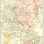
History, maps and national territory: Poland and the Neighbouring Countries in 1918 (T. Szumanski, La Pologne et les pays limitrophes, Paris, 1918)
Published at the pivotal close of the First World War, "La Pologne et les pays limitrophes" by T. Szumanski stands as a remarkable cartographic document of a continent in flux. Released in 1918, the exact year Poland re-emerged on the map of Europe after more than a century of foreign partitions, this map captured the complex geopolitical anxieties, territorial aspirations, and shifting boundaries of Central and Eastern Europe.
At its core, the map addresses the urgent "Polish Question" as the Austro-Hungarian, German, and Russian empires collapsed. Published in Paris, the intellectual and diplomatic hub for the resurrection of the Polish state, the document served both strategic and propaganda purposes. It visually argued for Poland’s rightful place among sovereign nations by meticulously delineating historical regions and weighing them against contemporary demographic and linguistic realities.
The cartography highlights not only the core Polish lands but also the intricate web of neighboring territories, spanning the Baltic lands, Ukraine, Silesia, and parts of East Central Europe. By framing Poland within its wider borderlands ("les pays limitrophes"), Szumanski underscored how deeply intertwined Polish self-determination was with the stability and self-rule of its neighbors. The map details regional borders, key transit arteries, and urban centers that were vital to defining the economic and defensive framework of the nascent Second Polish Republic.
Today, Szumanski’s 1918 map is treasured by historians and cartographers alike. It offers a rare, frozen-in-time snapshot of a continent transitioning from imperial subjugation to national sovereignty, reflecting the precise geographical lines upon which modern Europe was redrawn.
(Better version and more maps: historicalmaps.edmaps.com/po…)
#history #historical #map #Poland #1918 #Germany #Ukraine #Russia #Lithuania #Austria #Czechia #Sloakia #Romania #Hungary #war #WWI #peace #ethnographic #borders #Warsaw #nationalism

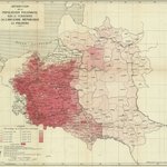
History, maps, ethnicities, and territorial claims: "Ethnographical Map of the Polish Population" (published by the Polish Information Committee, London, 1916)
Published in London during the turbulence of the First World War by the Polish Information Committee, the "Ethnographical Map of the Polish Population" served as a powerful visual weapon of wartime diplomacy. At a time when the map of Europe was being violently redrawn, this cartographic artifact was meticulously crafted to champion a singular cause: the resurgence of a sovereign, independent Polish state.
By mapping the distribution of Polish-speakers within the historical boundaries of the former Polish-Lithuanian Commonwealth (as it stood before the partitions of the late 18th century), the map directly challenged the imperial status quo. It visually refuted the narrative pushed by partitioning powers (particularly the Russian Empire and Austria/Habsburg Empire) that these lands were irreversibly assimilated or naturally belonging to their respective empires. Instead, the cartographers utilized modern ethnographic surveying to demonstrate that despite over a century of foreign rule, a cohesive Polish demographic majority persisted across a vast contiguous territory bridging Central and Eastern Europe.
The map's strategic utility in London, the heart of Allied diplomacy, cannot be overstated. It was designed to influence British statesmen, international journalists, and policymakers by translating complex demographic realities into an undeniable geopolitical argument. By anchoring its territorial claims in the principle of nationality and historical continuity rather than mere military conquest, the Polish Information Committee framed the reborn Polish state not as a revolutionary disruption, but as a long-overdue restoration of historical and ethnic justice.
Ultimately, the Ethnographical Map of the Polish Population exemplifies how cartography during WWI transcended mere geography. It functioned as a blueprint for self-determination, offering a persuasive preview of the territorial ambitions that would eventually shape the rebirth of Poland at the 1919 Paris Peace Conference.
(A larger version and more maps: historicalmaps.edmaps.com/po…)
#history #historical #ethnic #ethnographic #map #Poland #Polish #Lithuania #Ukraine #Russia #Byelorussia #Belarus #Prussia #Germany #Austria #Galicia #Warsaw #Kyiv #Kiev #Romania #Hungary #war #peace #broder #nationalism #territory #WWI #Paris #London #France #Britain
