

j'explore avec passion ce qui se trouve entre la cartographie, la géographie, l'art et l'environnement 🧭 - Cartographe indépendant
📍 48° 3' N, -1° 9' W
Joined January 2020
- Tweets692
- Following173
- Followers3.1K
- Likes383


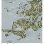



Perrin Remonté retweeted

Salinity of the World’s Oceans at Surface Level, Grams per Liter
credit: @PerrinRemonte
brilliantmaps.com/ocean-sali…

Perrin Remonté retweeted

Portrait de @PerrinRemonte, jeune cartographe-poète français, et présentation de ses travaux 👍

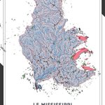
Quand les fleuves sont représentés sous forme d'arbres, découvrez les "cartes qui touchent les gens" de Perrin Remonté
(Cc @PerrinRemonte, @RaisonPablo, @claradealberto, @JulesGrandin)
#Passion #Cartes #Carto #Cartographie
> france3-regions.franceinfo.f…

Perrin Remonté retweeted

Quand les fleuves sont représentés sous forme d'arbres, découvrez les "cartes qui touchent les gens" de Perrin Remonté
(Cc @PerrinRemonte, @RaisonPablo, @claradealberto, @JulesGrandin)
#Passion #Cartes #Carto #Cartographie
> france3-regions.franceinfo.f…
Perrin Remonté retweeted

🍾🎉 Venez découvrir le dernier numéro de #Mercator et rencontrer plusieurs de ses contributeurs.rices, jeudi 25 septembre prochain à partir de 19h, dans le bar-restaurant le ZANGO, 15 rue du Cygne à Paris 🥰
👉Pour vous inscrire gratuitement, c'est ici : my.weezevent.com/inscription…

Perrin Remonté retweeted

Let’s wind the clock back 20,000 years to Europe’s last Ice Age. Only small human populations could theoretically be maintained in such an environment. Great map by @PerrinRemonte

Perrin Remonté retweeted

Après la France sous l’eau, la France de l’eau 😉.
Un peu déçu pour mes amis Bretons qui se fassent dépasser par les basques au niveau de la pluviométrie …
@kartographjs @Maxime_Blondeau @PerrinRemonte
#meteo #climat #pluie #immobilier

Perrin Remonté retweeted
Map Of The World During The Last Ice Age
Credit: @PerrinRemonte
More about the last Ice Age: brilliantmaps.com/ice-age-ma…

Perrin Remonté retweeted

A map of Comancheria that I designed as lead map and infographics designer for a nationwide US history platform being rolled out in middle and high schools across the country right now.

Perrin Remonté retweeted

#jeudilecture
Il est paru hier !
Il est génial. On s'instruit avec les textes réunis par @MGarrigou. On s'amuse aussi avec les dessins de @SavoirsEnBulles.
On fait de la géographie, quoi !
Et ça c'est bien.
Bref, allez en librairie pour vous procurer ce [Cabinet de curiosités] !


Perrin Remonté retweeted
The American effort to shift the Centre of the global economy away from China towards the US can be taken literally. This map by @PerrinRemonte visualizes the center of the global economy over time. Fun exercise. So far the eastward shift continues.

Perrin Remonté retweeted
Land vs Water Hemispheres of The Earth
credit: @PerrinRemonte
brilliantmaps.com/land-vs-wa…

Perrin Remonté retweeted
Salinity of the World’s Oceans at Surface Level, Grams per Liter
credit: @PerrinRemonte
brilliantmaps.com/ocean-sali…

Perrin Remonté retweeted
Spilhaus World Ocean Map Projection With Sea Surface Temperature
credit: @PerrinRemonte
brilliantmaps.com/spilhaus-w…

Perrin Remonté retweeted

Pour cette première carte de l'année, rêvons un peu ! Depuis tout petit, j’ai toujours aimé lever les yeux au ciel et observer les étoiles. Cette fois, prenons de la hauteur, contemplons la population terrestre et imaginons ces véritables constellations humaines se dessiner.

Perrin Remonté retweeted

Le cyclone #Chido, classé en catégorie 4, a dévasté l’archipel de Mayotte le 14 décembre 2024, avec des vents soufflants à plus de 220 km/h. C’est le cyclone le plus important depuis 1934. Le dernier cyclone majeur datait de 1984.
Un 🧵 [1/24]
👇

Perrin Remonté retweeted

2024: A year of challenges and deep gratitude for the incredible support from friends and teams.
In 2025, the International Year for Glaciers' Preservation will decide the future of our mountain glaciers. Let’s highlight their importance, and inspire the bold climate action❄️🌍
Perrin Remonté retweeted

moi quand je joue à the legend of zelda phantom hourglass

Je suis parti cartographier une île bretonne à partir de ZERO.
Je vous partage enfin la vidéo de l'aventure sur ma nouvelle chaîne youtube ! youtube.com/watch?v=0t4hSnIG…


Perrin Remonté retweeted
What’s your favorite type of power line? Follow me for more tips on great questions to ask on first dates.


