

Southern Oregon and Northern California weather updates. My website links to weather data live from Medford, Oregon. Hourly weather updates 24/7/365.
- Tweets143K
- Following132
- Followers2.3K
- Likes1.3K






ALT Utqiaġvik (Barrow) will officially enter Polar Night once the sun sets later today at 1:42 PM. The sun will not rise again until January 23, 2027. While the sun will remain below the horizon for the next 65 days, they will still see a few hours of civil twilight each day. #akwx


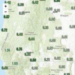
ALT A graphic showing the total rainfall amounts expected through Tuesday, November 17th. The highest amounts expected along the northern CA and Oregon coasts, as well as the intermountain west.

ALT A graphic of the total snowfall expected across the intermountain west through Tuesday, November 17th. Highest snowfall amounts are expected in the higher elevations with max amounts of 8-10 inches in the northern Rockies.


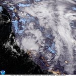
ALT Potential atmospheric river activity could bring enhanced moisture to much of the West Coast during mid-November. There is increased uncertainty regarding the potential for heavy precipitation. Strong surface low pressure north of the region will also likely drive high winds along the immediate coastline. Moderate risk (40 to 60%) of heavy precipitation shown for Nov 13 to 15 across parts of the Pacific Northwest and northern/central California, with slight risk (20 to 40%) extends to Nov 17 across the West Coast into the Desert Southwest, Great Basin, and Southern Rockies. High winds are possible across much of the West, including a moderate risk along the immediate West Coast Nov 13 to 15 and broader slight risk to Nov 17. Moderate risk of heavy snow across the higher elevations of the Klamath and Sierra Nevada Nov 13 to 15. Slight risks of heavy snow extend to Nov 17 for these areas as well as the Northern Intermountain, Great Basin, and Central and Northern Rockies.

ALT Heavy Precipitation, High Wind, and Flooding risks for the western United States, valid November 10-16. There is a high risk (over 60 percent) of heavy precipitation across the West Coast states from northern California through the Northwest November 10-12, accompanied by the potential for flooding in lower elevations. A moderate risk (40 to 60 percent) extends through November 14 and includes central California. A moderate risk (40 to 60 percent) of high winds extends along coastal portions of the West Coast November 10-14. Slight risks of heavy precipitation and high winds cover large parts of the West through November 16. Heavy Snowfall risks for the western United States, valid November 10-16. A high risk (over 60 percent) of heavy snow is indicated across the Washington Cascades 10-12, with a moderate risk (40 to 60 percent) extending farther south to include the southern Cascades, Klamath, and Sierra Nevada ranges through November 14. A slight risk continues through November 16


ALT The Climate Prediction Center 8-14 Day Hazards Outlook released October 26, 2026 for the period of November 3 to 9, 2026 indicates a moderate risk (40 to 60 percent chance) of heavy precipitation for portions of southwestern Oregon and northwestern California November 6 to 8, and a moderate risk of heavy snow for portions of the northern Sierra Nevada and southern Cascades Nov 6 to 8. Slight risk (20 to 40 percent chance) of heavy precipitation is posted for portions of the Pacific Northwest and Northern California Nov 5 to 9, along with slight risks of heavy snow for the Cascades, Klamath and northern Sierra Nevada ranges Nov 5 to 9.


ALT An image of a Summer Lake next to text describing the forecast for northern California and southern Oregon.








ALT A Climate Prediction Center key message has been issued for the period November 22 - December 12, 2025 for a significant pattern change, including a colder pattern across much of the western and northern U.S.. The key message includes the CPC 8 to 14 Day Temperature Outlook, which favors below normal temperatures across the West and above normal temperatures in the East, as well as the CPC Week 3 to 4 Temperature Outlook, which favors enhanced odds for below normal temperatures for much of the northern U.S., especially the Northern Plains.