

Writer, Editor, Analyst. Enjoyer of computer things.
Australia
Joined June 2019
- Tweets335
- Following210
- Followers349
- Likes1.9K



The Minimaps app is now out and available!
This public version should be easy to use and is also compliant. I'll include a link to the app as well as the repo so you can build it yourself in the comment below.
#minimaps #threejs #Esri #OpenTopography #OSM
Mike Jenkin retweeted

STEAM FRAME UPDATE
Valve has broken their silence and spoken up about Steam Frame reservations. You can now see your expected reservation time if you view the Steam Frame product page. Those in the reservation pool will either have their order emails by December, or sometime in 2027. Those who will be getting it next year will receive further updates when the time comes.
Valve has also released the CAD files for Steam Frame, available publicly so people can use them as they wish non-commercially.


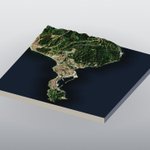
Minimaps
Ceuta, Spain
35.89666°N, 5.33117°W
Melilla, Melilla, Spain
35.28997°N, 2.95122°W
#minimaps #threejs #esri @OpenTopography


Interesting to see how the Spain's Ceuta crisis is being covered by different European agencies.
You might catch a glimpse of it on my European channel surfing app. A 'news-exclusive' mode has been made available for now as well.
esbes.mikejenkin.com/


86
Minimaps
Finhaut, Valais/Wallis, Switzerland
46.07621°N, 6.96224°E
Zion National Park, Washington County, Utah, United States
37.21160°N, 112.98409°W
Musau, Tyrol, Austria
47.50594°N, 10.61169°E
Milford Sound, Southland, New Zealand
44.63327°S, 167.89738°E
#minimaps #threejs #Esri #OpenTopography #OSM


Mike Jenkin retweeted

I built a Cloud Optimized Geotiff explorer: Take any local COG, it breaks down visually the size, shape & resolution of each overview & tile
I'm exploring Fable to make better technical visuals that I wish I had when learning all this

Mike Jenkin retweeted

👋 Farewell, Sentinel-1A!
After more than 12 years in orbit, the pioneering #CopernicusEU satellite has concluded its mission.
Originally designed for 7 years, it delivered over a decade of radar observations.
🌍 Learn more: link.europa.eu/VygWgP

Canal 33 Madrid appear to be having a big Tina Turner marathon. See if you can find it on esbes.mikejenkin.com/


77
Very cool. I love that there are so many interesting projects all exploring the Earth.
xitter.gq/StriderMJ/status/20698…

The Minimaps app is now out and available!
This public version should be easy to use and is also compliant. I'll include a link to the app as well as the repo so you can build it yourself in the comment below.
#minimaps #threejs #Esri #OpenTopography #OSM
1
1
30
Strange. It's been updated. If you are using the live site: hard refresh. If running locally make sure to git pull and restart the server. DM me if issue persists
1
10
Minimaps are pretty cool, and you can make them too.
Ord River, Western Australia, Australia
15.95803°S, 128.65986°E
Faial, Portugal
38.57909°N, 28.70995°W
Quelloúno, Cusco, Peru
12.59099°S, 72.65914°W
Cerro Torre, Santa Cruz, Argentina
49.30784°S, 73.02523°W
#ESRI, Maxar, #Opentopography
#OSM #threejs


Made new background art for my European channel surfing app using Blender.
esbes.mikejenkin.com

1
96
Hey John thank you. You can export in STL, but you would have to carefully capture each neighbouring puck manually to build a mosaic.
60
Make Minimaps!
Thanks to those who have liked and shared my minimaps app.
Have updated today with some small things including an ocean shader, which can help mask blotchy coastal images.
If you try the app I'd love to see your maps. Links in the comment below.
Le Lavandou, Provence-Alpes-Côte d'Azur, France
43.16383°N, 6.42936°E
Unorganized Borough, Alaska, United States
60.88078°N, 147.94131°W
Aia, Autonomous Community of the Basque Country, Spain
43.26739°N, 2.13119°W
Bermeo, Autonomous Community of the Basque Country, Spain
43.414998°N, -2.723151°W


