

Northeast Tennessee coverage on short and long range weather, 7-Day forecasts for the Tri-Cities, model discussion, etc. Snow is the best kind of weather.
Joined December 2020
- Tweets29K
- Following934
- Followers4.9K
- Likes20.9K






StormTrackerSacher retweeted

❄️❄️❄️ Is back, back again!
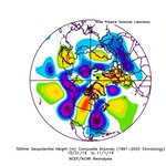
It's looking more and more likely that our first flakes could fall in the valleys next weekend...ensemble runs below:
I will say the potential is there for this system to do something funky. For now, however, I'll just say that at very least, some snow flakes will return to WNC next weekend, along with the coldest air of the season so far! Stay tuned...


Thank God someone said it. Ive literally been so ticked off by all that crap today
How can any of you make any assumptions about the long range? Like all this talk on "A cooldown is coming but it'll be brief then it'll warm up again"
Wow! Very creative! I mean that is so easy to say. The timeframe coming up that is bringing a shot of cold air with Winter weather chances was showing above average temperatures on the EPS last Saturday. Now we have the coldest air of the season on the way.
Let's just keep things out in front of us. No reason to just pencil off huge timeframes way out of ahead of us. Like you got people saying December is toast... How do you know? You got a time machine?

TRI-CITIES: Taste of winter showing up for next weekend! Highs may drop into the low 40s and lows will be in the 20s! Could easily be talking snow in the mountains with first flakes not off the table in the Tri-Cities!

StormTrackerSacher retweeted

Model guidance keeps trending colder & colder for next weekend.
Mise well put up your Christmas tree. Don't pretend like you don't want too.. Come on now!


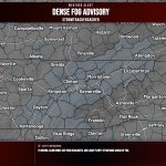
Dense Fog Advisory has been issued for Cherokee, Clay, Scott +44 more | Visibility: 1/4 MI | Expires Friday, 11/6/26 at 9 AM.


November 2023 run of the Euro seasonal for DJF ahead of the last strong El Niño versus this November’s run. Just food for thought.


