

Northeast Tennessee coverage on short and long range weather, 7-Day forecasts for the Tri-Cities, model discussion, etc. Snow is the best kind of weather.
Joined December 2020
- Tweets29K
- Following934
- Followers4.9K
- Likes20.9K






StormTrackerSacher retweeted

❄️❄️❄️ Is back, back again!
It's looking more and more likely that our first flakes could fall in the valleys next weekend...ensemble runs below:
I will say the potential is there for this system to do something funky. For now, however, I'll just say that at very least, some snow flakes will return to WNC next weekend, along with the coldest air of the season so far! Stay tuned...


StormTrackerSacher retweeted

Model guidance keeps trending colder & colder for next weekend.
Mise well put up your Christmas tree. Don't pretend like you don't want too.. Come on now!
StormTrackerSacher retweeted

.@FirstLadyMaria and I ask Tennesseans to join us in praying for families in Polk County impacted by flooding. @TennesseeEMA is coordinating a whole-of-government rescue and response effort, and we are in close contact with our partners in Georgia.

(November 5, 2026 | 8:25 a.m. CT): The Tennessee State Emergency Operations Center has been activated to a Level 4 due to the flooding that has occurred in Polk County.
At this time, the flooding is expected to remain through this evening. Please avoid flooded roads and follow all local official guidance.
StormTrackerSacher retweeted

(November 5, 2026 | 8:25 a.m. CT): The Tennessee State Emergency Operations Center has been activated to a Level 4 due to the flooding that has occurred in Polk County.
At this time, the flooding is expected to remain through this evening. Please avoid flooded roads and follow all local official guidance.
StormTrackerSacher retweeted

We made a small error with the rain scale on the graphic. Here's the corrected graphic:

ALT Heavy rainfall up to 10" fell across northern Georgia last night. This runoff has led to the Ocoee River cresting at major flood. Major flooding is expected to last through sunset. No rain is expected over the next several days.
StormTrackerSacher retweeted

Copperhill, Tennessee, this is catastrophic and it's happening right now. The Ocoee River just hit major flood stage, only 3 feet from its all time peak, with homes and businesses underwater and being evacuated. If you're anywhere near that river, get to higher ground immediately and do not drive into water.
StormTrackerSacher retweeted

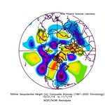
Hearing lots of chatter about widespread cold coming mid-month... Just dove into some teleconnections and wanted to share my thoughts:
There is lots of conflicting long-term data, and I don't think any model data has a great handle on anything beyond 10 days right now.
Looking at the MJO it is expected to go into phase 2/3 over the next couple of weeks. This is traditionally a colder MJO phase for the central/east US in November.
One of the strongest connections leading to some confidence in colder temperatures mid-month is the PNA soaring positive through the next week. This traditionally allows for colder air to spill down from Canada.
However this does not mean that cold air is 100% going to spill down to the U.S. (especially central US). We also have a positive EPO which typically leads to more of a zonal and warmer flow in the U.S.
One last thing we need to watch mid-month is the good old Polar Vortex! Nearly all model data is showing a SSW (displacement of the polar vortex) as we get into mid-November. This does not guarantee cold in the central US and I would argue (due to El Nino) this might be a Europe based SSW. This is an anomaly event as we don't normally get a visit from the polar vortex this early in the year (especially not in an super El Nino). The last time we had a polar vortex event in November was 1968. This is why I think models will struggle and potentially flip multiple times over the next few days!
LOTS to track in the next few weeks as we kick off Fall. Going to be a battle of the polar vortex vs El Nino the next couple of weeks and I am PUMPED to see how it turns out!


StormTrackerSacher retweeted

GOOD NEWS: National Weather Service morning balloon launches have officially returned to normal levels while offices across the US have filled various vacancies. It seems like after an incredibly stressful and tumultuous 20 months in our industry, things are moving back to normal.
It’s important to remember though that the fight must continue. The United States of America has long been the global leader in weather infrastructure. We must do everything to ensure NOAA, and by extension the NWS, is fully and properly funded to maintain this status and continue to innovate. Accurate and timely forecasts save lives and keep money in your pockets.


StormTrackerSacher retweeted

The big 3 all got colder today as they realize a change up in the North Pacific looms and a connection to cold tap is readily available with long advertised Nov 10-12th golf front.


StormTrackerSacher retweeted
Strong and gusty southeast winds are expected across the east TN mountains and foothills this afternoon through Wednesday. A Wind Advisory has been issued.

ALT Strong and gusty southeast winds are expected across the east TN mountains and foothills this afternoon through Wednesday. A Wind Advisory has been issued.
StormTrackerSacher retweeted

As we go to bed tonight, we hold a moment of silence for the NAM model, which will be retired tomorrow. No more fantasy 30 inches of snow... you will be missed, NAM.
The new guy, the RRFS, tends to be a little stupid, but we'll give him a grace period before final review.
StormTrackerSacher retweeted

NOAA is pulling the plug on the NAM, NAM MOS, SREF, HREF, and HiresW tomorrow. RRFS and REFS take over. Love it or hate it, the CAM landscape we’ve used for years is about to change forever...

StormTrackerSacher retweeted

Can we please bring back Heelys?
I’m sick and tired of walking everywhere, I want to glide.
StormTrackerSacher retweeted

A reminder that today is the final day for the NAM, SREF, HREF, HiresW models and NAM MOS. Tomorrow they are retired with the RRFS and REFS becoming the NCEP flagship mesoscale models.

StormTrackerSacher retweeted
Some morning drizzle or sprinkles will be possible Monday morning. The best chance for measurable rain will be Wednesday into Thursday.

StormTrackerSacher retweeted

Knock-your-socks-off foliage in one of Helene's most severe blowdowns today. WNC is healing.
📍 Mountains to Sea Trail, NC


